Check Out Our Holiday Auction!

Forecast for the Ogden Area Mountains

Nikki Champion
Issued by Nikki Champion on
Tuesday morning, December 9, 2025

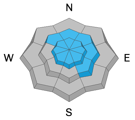
Today, mid and upper-elevation steep slopes facing west through north and east have a MODERATE avalanche danger. Here, it will be possible to trigger an avalanche on the weak October and November facets, now buried 1 foot deep.

Across all upper elevations, there is also a MODERATE avalanche danger due to wind-drifted snow. Slopes that have recently been wind-loaded are the most suspect today, and extra caution is advised, as these drifts could step down deeper in the snowpack and trigger larger avalanches.

With warm temperatures and a chance of rain today, watch the snow surface. If it becomes unsupportable or you see widespread rollerballs or pinwheels, consider changing aspects.

Low
Moderate
Considerable
High
Extreme
Learn how to read the forecast here
Weather and Snow

This morning, skies are mostly broken, and temperatures range from the mid to upper-30s F. Northwest winds are still elevated at 10 to 20 mph, with gusts in the 30s across most mid-elevation sites. At the highest elevation wind sites, gusts are pushing close to 50 mph.

Today, skies will be partly sunny with a very small chance of snow as a system passes just north of us. We could see a trace of precipitation. Winds will hold steady from the west northwest, averaging 10 to 20 mph with gusts up to 25 mph across mid to upper-elevation sites. The highest elevations may continue to gust up to 45 mph. Mountain temperatures will remain in the mid-to upper 30s F.

Looking ahead, it stays dry Thursday through the weekend. A relatively weak trough may move in next Tuesday.

Recent Avalanches

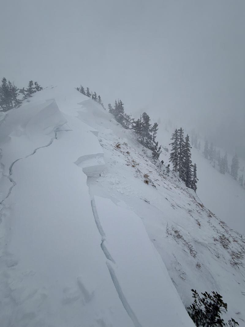
No new avalanches were reported from the backcountry yesterday. In the Ogden area, dozens of avalanches were observed along the Ben Lomond Ridgeline, ranging up to D2 in size. Most appeared to be natural and likely occurred Friday-Saturday during peak instability.

Example of the avalanches seen along the Ben Lomond Ridgeline (Photo: H. Jeremias)

Avalanche Problem #1
Persistent Weak Layer
Type
Location
Likelihood
Size
Description

A persistent weak layer of October and November facets makes up the base of the snowpack on north-facing slopes at mid and upper elevations. In these areas, it is still possible to trigger an avalanche up to about 1 foot deep and over 100 feet wide.

This setup was obvious over the weekend, with widespread avalanche activity and plenty of red flags. As we move farther from the loading event, those signs may be less obvious, but the structure has not changed. Sensitivity and overall likelihood are slowly dropping, but the consequences remain high.

This problem extends across both mid and upper elevations, and both deserve caution. Upper elevation slopes remain the most suspect because they received the most snow and have the most connected weak layer.

Avalanche Problem #2
Wind Drifted Snow
Type
Location
Likelihood
Size
Description

Northwest winds have been cranking for days. In some places they have scoured the surface, but in others they are drifting snow and building both fresh soft and hard slabs. Watch for slopes that are loading or have that rounded, pillow look. Cracking under your feet, a hollow feel, or stiff chalky snow are all signs of new wind drifts to avoid.

The longer the winds blow, the more supportive these slabs become, which means you can get farther out onto the slope before they break.

Where these drifts sit on top of a weak layer of facets, it does not take much to overload the structure. Even a small drift can step down into the weak faceted snow, triggering a much deeper and more dangerous avalanche.

General Announcements

This information does not apply to developed ski areas or highways where avalanche control is normally done. This forecast is from the U.S.D.A. Forest Service, which is solely responsible for its content. This forecast describes general avalanche conditions and local variations always occur.