Geyser Pass Road: The road is open. Surface is snowpacked and soft near the top. Warm temps today will make it a sloppy mess on the lower end. 4x4 recommended.
Grooming: The Forest Service groomed into Gold Basin on Saturday but traffic over the weekend has roughened up the surface considerably.
6:00 a.m. Snow and Weather Data
24 Hour Snow 0" 72 Hour Snow 0" Season Total Snow 301" Base Depth at Gold Basin 100"
Temp 31° F Winds on Pre-Laurel Peak: S 25-35 G 42
Weather
If it's deep snow you want, head north. Down south here it's going to be all about the wind as a strong low pressure system moves into the region. Today, look for increasing clouds and strong SW winds blowing in the 35-45 mph range with gusts possibly as high as 70 mph. As the cold front moves through tonight, temps will crater into the single digits. We should see some snow tonight though amounts look a bit lean. I'd say 3"-5" are possible. Snow lingers into tomorrow with mostly cloudy and cold conditions, but at least the wind is going to back off a bit. Look for partly sunny skies on Wednesday with a dry and gradual warming trend toward the end of the week.
General Conditions
The effects of wind and sun have taken a toll on most snow surfaces and you'll have to seek out the most sheltered, northerly aspects to find soft conditions. Or, you could clean out the garage. Continuous winds over the past several days have blasted the high country scouring surfaces, exposing rocks, and building spotty, stiff slabs of drifted snow on northerly aspects. This trend will continue today, with slab building ramping up tonight with the addition of more snow. If you venture into high, alpine terrain, be sure you know how to identify and avoid potentially unstable slabs of wind drifted snow. Even a small avalanche could have serious consequences in areas of more extreme terrain.
Loose, wet instability has been minimal and this concern has largely waned. Nevertheless, it is April, and as the day heats up you'll want to remain mindful. Signs of instability include rollerballs, pinwheels, and sloppy wet snow. Stay off of, and out from under steep slopes where these signs are present.
And finally, cornices have grown huge in some areas. Give them a wide berth and stay out from under them.
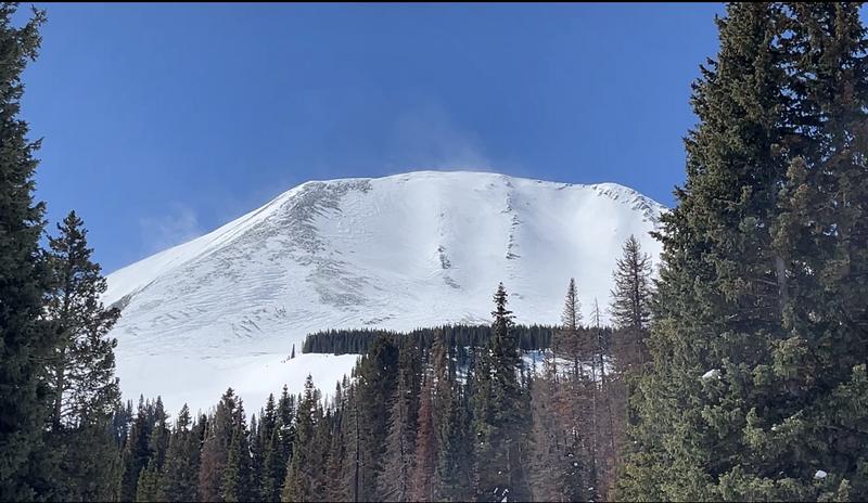
Always a wind magnet, the north face of Mount Melenethin has taken a hit with alternating scoured and drifted areas. Note the plumes of wind transported snow blowing off the summit.
Snowpack and Weather Data