Today is our last regularly scheduled forecast.
The Geyser Pass Road is melted down to the dirt up to the parking lot.
The Lower Utah Nordic Alliance is through grooming for the season.
Overnight freezes and daytime high temps mean everything right now. Get current and past 24-hour readings from these real-time weather links.
Snowpack Discussion
Successive nights with below-freezing temps have helped to lock up the snowpack and we've moved into a decent corn cycle on SE-W aspects. South facing lines are melting out fast, however. The extreme heat last weekend lumped up the surface a bit and it's not as smooth as it was but we found decent corn skiing Thursday between about 11,700' and 10,200'. Look for things to soften between 10:00 and 1:00 depending on the aspect. Once the crust becomes unsupportable and the snow starts to get sloppy, it's time to call it a day as the danger for loose wet, or even wet slab avalanches will start to develop.
North aspects remain in transition and conditions are variable ranging from hard, wind-packed, and frozen boilerplate, to crusted over with occasional pockets of dry powder-like snow. Weak, sugary, faceted snow still exists near the ground, especially at higher elevations and it may still be possible to trigger an avalanche on this weak layer. Slopes with steep convexities and rocky, more radical terrain are where you are most likely to trigger an avalanche failing on this weak, faceted snow.
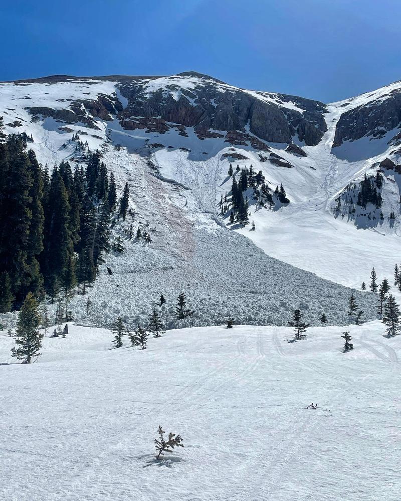
This large
wet slab avalanche occurred high in Gold Basin last Sunday. It failed on weak faceted snow near the ground as a result of percolating melt-water. Extreme heat and a lack of overnight re-freezes contributed to the failure. Freezing temperatures at night this week have helped to lock up the snowpack and triggering this type of avalanche is now unlikely, but avoiding steep slopes when the snow becomes wet and sloppy remains a good idea.
Mark White photo.


