Forecast for the Moab Area Mountains

Eric Trenbeath
Issued by Eric Trenbeath for
Thursday, March 9, 2023
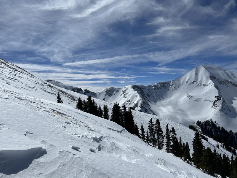
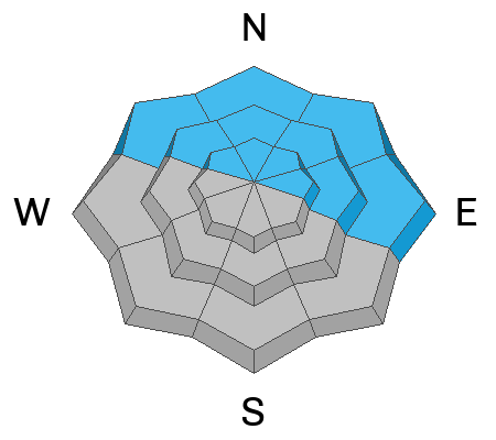
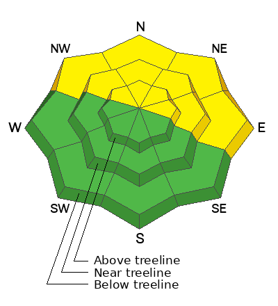
A MODERATE avalanche danger exists on all northerly facing slopes at all elevations. In these areas thick, hard slabs of wind drifted snow are occasionally overlying softer weaker, layers, and human triggered avalanches 1'-3' deep are possible.

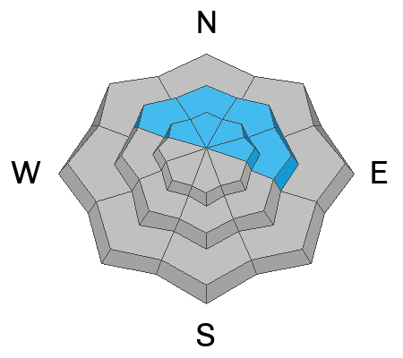
The danger is generally LOW on slopes facing the south side of the compass although shallow hard slabs of wind drifted snow may also be found on isolated terrain features.

Backcountry travelers should avoid wind drifted slopes and be able to determine the absence of a weak layer before committing to terrain steeper than 30 degrees.
Low
Moderate
Considerable
High
Extreme
Learn how to read the forecast here
Special Announcements
Geyser Pass Road: The road is OPEN and has been recently plowed and widened.
Grooming: Matt groomed all trails on Tuesday and they are in great shape.
To help you safely enjoy the backcountry, the UAC team is constantly evaluating and implementing new programs and technologies. Donate to the Spring Campaign to help our team implement innovative tools and better provide you with the information you rely on.
Weather and Snow
6:00 a.m. Snow and Weather Data
24 Hour Snow 0" 72 Hour Snow 0" Season Total Snow 229" Base Depth at Gold Basin 78"
Winds on Pre Laurel Peak WSW 19 G 25 Temp 10

Weather
Quiet weather is on tap today before the next Atmospheric River event moves into the region. Today look for sunny skies, light westerly winds, and high temps near 30 degrees. Tonight will see increasing clouds and southwesterly winds. Moisture should begin spreading into the region by mid day tomorrow with periods of heavy snowfall from late Friday through Saturday. Upwards of a foot of dense, wind driven snow seems likely.

General Conditions
Great weather, bad snow. Life is all about trade offs. The ravages of wind and sun have taken their toll on the snow surface and it's a really mixed bag out there. Dave Garcia was up on Tuesday and he reported widespread wind damage and sun crusts with occasional areas of soft snow in sheltered terrain. Five consecutive days of strong, southwest winds have left behind old, hard slabs of wind drifted snow on leeward slopes near and above treeline. These are growing increasingly more stubborn to human triggers but on some northerly aspects, thick slabs overly layers of weaker snow underneath. If you are traveling on northerly aspects you'll want to get out your shovel and look for buried weak layers that exist on some slopes in the top meter of the snowpack.
Mathew Sumner was up in the high country yesterday and he observed isolated hard wind slabs and poor snowpack structure. Read his observation here.
The wind has really done a number on alpine terrain. Dave Garcia photo.
For recent observations go here. If you are getting out in the backcountry, let us know what you find.

Snowpack and Weather Data
Gold Basin Storm Stake (10,000')
Gold Basin SNOTEL site (10,000')
SNOTEL site near Geyser Pass Winter Trailhead (9600')
Wind Station on Pre-Laurel Peak (11,400')
NWS forecast for the La Sal Mountains.
Recent Avalanches
No recent avalanches have been reported. See the La Sal avalanche database here.
Ad
Avalanche Problem #1
Wind Drifted Snow
Type
Location
Likelihood
Size
Description
Most northerly slopes near treeline and above are fat with old, hard slabs of wind drifted snow. Some of these slabs may be overlying buried weak layers. Many of these drifts will be locked in place by now, however, if you go looking for it, there are still some places where it is possible to trigger an old drift. The danger with these lingering old drifts is they will allow you to get well out onto them before they break.
Although found primarily on northerly aspects, isolated hard slabs of wind drifted snow may exist on all aspects in wind affected terrain. Look for them on the leeward sides of ridge crests and terrain features such as gully walls and sub ridges. And beware of areas the have a smooth rounded appearance or that sound hollow underneath.
Avalanche Problem #2
Persistent Weak Layer
Type
Location
Likelihood
Size
Description
In our recent travels we have been finding reactive weak layers in the upper meter of the snowpack. The distribution of these layers is spotty - they exist in some places and not in others. Regardless, these layers are capable of producing avalanches. The strategy right now for northerly aspects is to dig occasional pits and look for facets as you ascend. If this is beyond your skill set, choose a different aspect or keep your slope angles under 30 degrees. For more information about these faceted weak layers read Dave's observation from Tuesday.
Photo illustrates a weak layer of faceted snow under a slab that we found over in the Corkscrew Glades on Saturday (10,100' NW aspect). An extended column test produced results of ECTP 21. On Monday we also located this weak layer over near Miner's Basin. It was easily discernible by poking your pole down through the snow. Though not widespread, it's something you want to be continually looking for.
Additional Information
General Announcements
This forecast is from the U.S.D.A. Forest Service, which is solely responsible for its content. This forecast describes general avalanche conditions and local variations always occur. This forecast will be updated by 7:30 tomorrow morning.