Forecast for the Moab Area Mountains

Eric Trenbeath
Issued by Eric Trenbeath for
Saturday, February 24, 2024
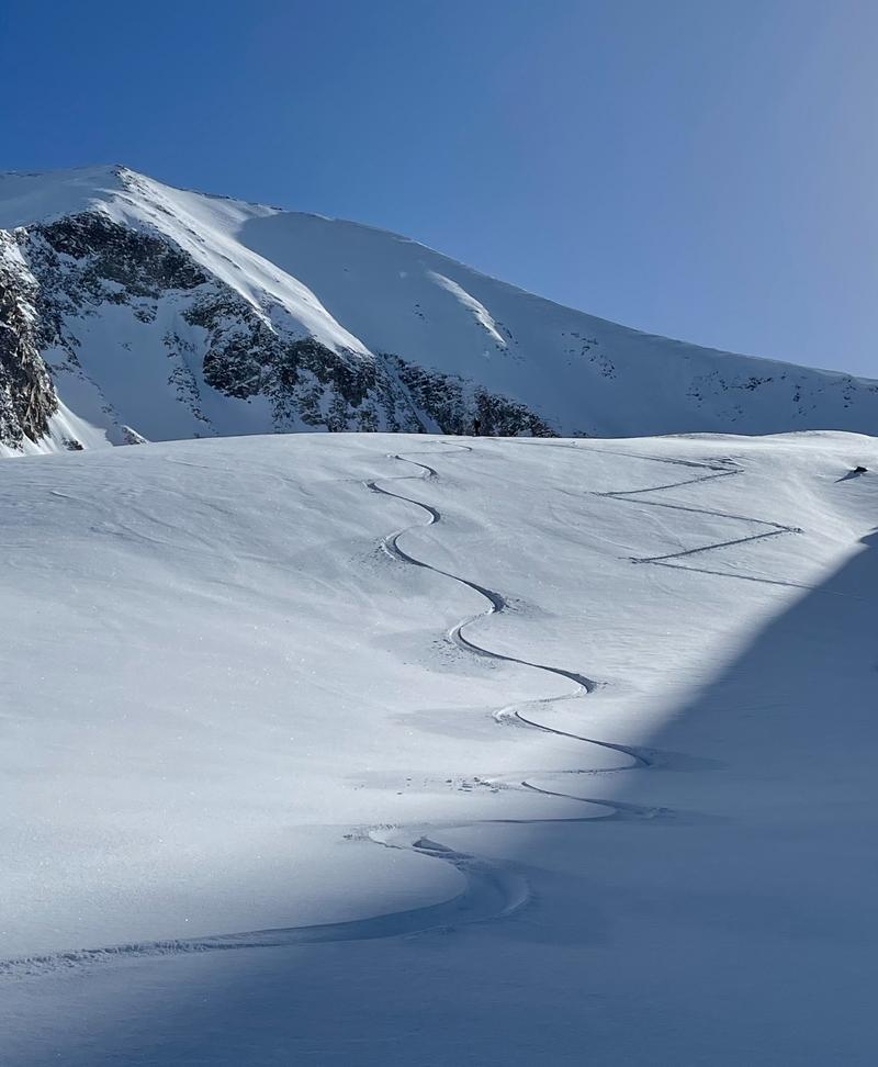
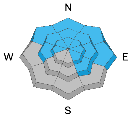
The overall danger remains MODERATE. Although increasingly unlikely, human-triggered avalanches failing on a buried persistent weak layer remain possible on steep slopes that face W-N-E-SE. The danger is most prominent on slopes that face NW-N-E. You are most likely to trigger an avalanche in thin snowpack areas. You can reduce your risk by avoiding steep, rocky areas and slopes with complex terrain features.
A generally LOW danger exists on slopes facing S-SW.
Low
Moderate
Considerable
High
Extreme
Learn how to read the forecast here
Special Announcements
We are seeking a passionate individual to join us as Executive Director of the nonprofit Utah Avalanche Center. Click here for more information.
Road Conditions: The Geyser Pass Road is plowed but snowpacked and slick!
Grooming: LUNA last groomed Gold Basin through Geyser Pass and set classic track on Sunday.
Weather and Snow
6:00 a.m. Snow and Weather Data
24 Hour Snow 0" 72 Hour Snow 0" Season Total Snow 132" Depth at Gold Basin 48"
Winds on Pre-Laurel Peak: WSW 5-10 Temp 15° Percent of Normal: 100%

Weather
Dry and unseasonably warm temperatures carry us through the weekend. We should see a few clouds developing later today, with light westerly winds and high temps in the upper 30's. Sunday looks sunny and slightly warmer. Quiet weather ends Sunday night as moisture from the latest atmospheric river (AR) moves into the region. Although widespread heavy snow is forecasted for much of region, these AR events have been hit or miss for us and the stars need to align for us to be in the bullseye. This hasn't happened as of yet, but we should some snow Mon-Tues. Let's hope the models show a little more focus on our mountains over the next couple of days.
General Conditions
Tim Mathews and Nate Ament reported some surprisingly good, sleeper conditions out there yesterday. It seems like a passing front on Thursday put down a nice layer of graupel that barely registered on the storm board. Winds have also been calm for the past couple of days so it looks like there will be some good turns to be had out there this weekend. Look for sheltered, lower angle slopes to take advantage of these conditions. We're also getting reports of people pushing it into steep, consequential terrain without incident. The likelihood of triggering a deep avalanche down into weak, faceted snow has decreased significantly, but you can keep the odds in your favor by avoiding areas of steep, rocky, radical terrain, or slopes with complex terrain features. Thinner snowpack areas remain suspect where your weight can much more easily affect the weak layer. Pull out your shovel, or simply probe around. I'd personally like to see close to 200 cms of snow before I'd feel good about skiing something steep.
Quality low angle turns in a graupel layer on top of a few inches of dry snow. Tim Mathews photo.
Snowpack and Weather Data
Gold Basin Storm Stake (10,000')
Gold Basin SNOTEL site (10,000')
SNOTEL site near Geyser Pass Winter Trailhead (9600')
Wind Station on Pre-Laurel Peak (11,400')
NWS forecast for the La Sal Mountains.
Ad
Avalanche Problem #1
Persistent Weak Layer
Type
Location
Likelihood
Size
Description
Persistent weak layers (PWL) of faceted snow that formed in November and December remain our primary concern. The likelihood of triggering an avalanche on a deeply buried PWL continues to decrease, but it is still possible. We are now in a low likelihood, high consequence scenario. If you are stepping out into avalanche terrain, evaluate each slope on an individual basis. Aim to ride in areas with a deep snowpack. Avoid steep, rocky terrain, thinner areas along slope margins, and steep, blind rollovers or convexities. These are all likely trigger points.
Additional Information
Want some more insight into the La Sal Mountains as well as the communal impacts of a tragic avalanche? Check out the latest UAC podcast with forecaster Eric Trenbeath where he discusses the range, it's often treacherous snowpack, and how the devastating avalanche in February, 1992, affected the Moab community.
Our avalanche beacon checker sign and beacon training park are up and running. A huge thanks to Talking Mountain Yurts for sponsoring those this season!
Sign up for forecast region-specific text message alerts. You will receive messages about changing avalanche conditions, watches, warnings and road plowing closures.
Follow us on Instagram @utavy_moab
General Announcements
This forecast is from the U.S.D.A. Forest Service, which is solely responsible for its content. This forecast describes general avalanche conditions and local variations always occur.