Forecast for the Moab Area Mountains

Eric Trenbeath
Issued by Eric Trenbeath for
Saturday, December 8, 2018
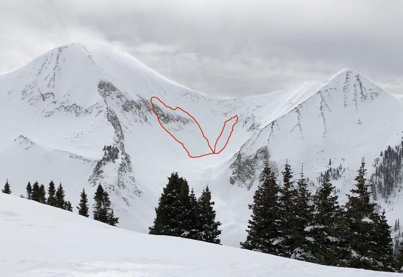
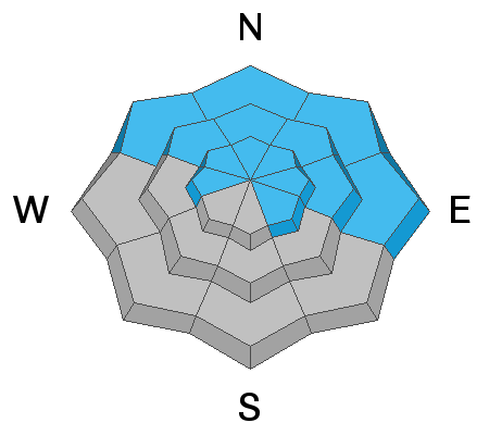
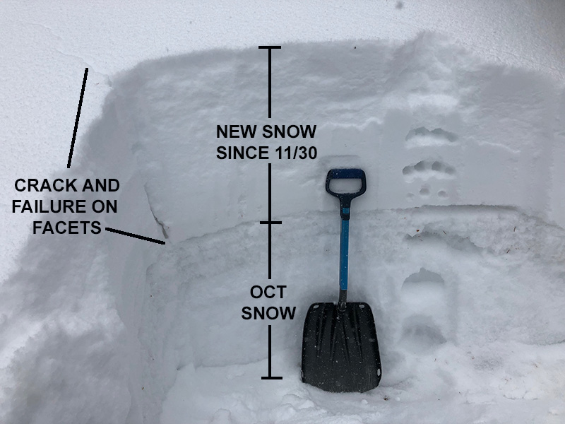
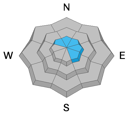
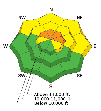
The avalanche danger remains CONSIDERABLE today on steep, upper elevation terrain that faces NW-N-E, and human triggered avalanches breaking down into buried, persistent weak layers are likely in these areas. In addition, recent deposits of wind drifted snow have added more weight to these fragile weak layers. Avoid wind drifted slopes that have a smooth rounded appearance, and look for signs of instability such as cracking in the snow surface. At mid and lower elevations the danger is MODERATE and human triggered avalanches are still possible on northerly facing slopes that have buried, weak, faceted snow.
Low
Moderate
Considerable
High
Extreme
Learn how to read the forecast here
Special Announcements
I'll be giving a free Know Before You Go avalanche awareness presentation Thursday, Dec 13, at 6:00 pm at the Grand County Library. Hope to see you there!
Weather and Snow
Skies are clear, WNW winds picked up around 3:00 a.m. and are blowing 15-20 mph along ridge tops, and 10,000' temps are in the mid teens. Today look for mostly sunny skies, light to moderate NW winds and high temps in the low to mid 20's. A ridge of high pressure is building over the region and we will see dry conditions through Tuesday. Our next chance for snow looks to be on Wednesday.
The past weekend's 30" of low density snow has settled considerably and strong SW winds on Wednesday ravaged exposed slopes, but you can still find good riding conditions in sheltered locations. Base depth in Gold Basin is a solid 36". Lots of folks have been out and about enjoying the early December snow, and much thanks to all who have sent in observations this week! Check them out here. Below is a clip of what we saw out there on Wednesday.
New snow totals in Gold Basin (10,000')
Snow totals at the Geyser Pass Trailhead (9600')
Wind, temperature, and humidity on Pre Laurel Peak (11,700')
National Weather Service point forecast.
Recent Avalanches
On Wednesday I observed the first natural activity high up in Red Snow Cirque and off the north face of Mount Tukuhnikivatz. Blowing and drifting snow from the strong WSW winds yesterday tipped the scales, and I noted two slides that appeared to break down into old snow with fractures 3'-4' deep. Read the report here.
Ad
Avalanche Problem #1
Persistent Weak Layer
Type
Location
Likelihood
Size
Description
Time heals and it's been about a week since nearly 30" of snow was added to persistent weak layers in the snowpack. These layers of weak, sugary, faceted snow are prevalent on any slope that has held snow since October. Basically any slope above about 10,000' that faces NW-N-E. These layers are beginning to gain strength and adjust to the new load, but backcountry travelers are still reporting cracking and collapsing in the snowpack, a sure sign that these layers are still reactive to the weight of a skier or rider. Continue to avoid steep slopes that face NW-N-E as human triggered avalanches are likely in these areas.
Avalanche Problem #2
Wind Drifted Snow
Type
Location
Likelihood
Size
Description
Deep wind drifts formed from blustery WSW winds on Wednesday. Though most of these wind slabs have strengthened and stabilized, the additional weight has put added stress on buried persistent weak layers. Continue to avoid steep, wind drifted terrain. Look for tell tale signs such as smooth rounded pillows, or cracking in the snow surface. A triggered wind slab stepping down into buried persistent weak layers will cause a deep and dangerous avalanche.