Join us at our 2nd Annual Blizzard Ball

Forecast for the Moab Area Mountains

Eric Trenbeath
Issued by Eric Trenbeath on
Monday morning, December 20, 2021
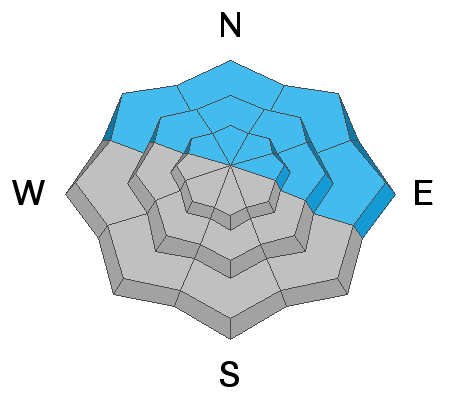
A MODERATE avalanche danger exists on steep slopes that face NW through E where a dense slab 2'-3' thick exists on top of a persistent weak layer of sugary faceted snow. Human triggered avalanches are possible in these areas. The danger increases with elevation where deposits of wind drifted snow have added additional stress to the underlying, weak snowpack structure. Managing steep terrain with this kind of snowpack is tricky, and for my part I'm going to continue to avoid steep, northerly facing slopes for awhile.
Most south facing terrain has a generally LOW danger.
It's also still very low tide out there. Beware of rocks, stumps, and deadfall lurking beneath the surface.
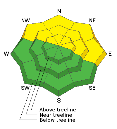
Low
Moderate
Considerable
High
Extreme
Learn how to read the forecast here
Special Announcements
Road Conditions: The road is snowpacked and slick and AWD with good tires recommended.
Grooming: LUNA (Lower Utah Nordic Alliance) has plans to go up and groom today.
Weather and Snow
24 Hour Snow 0" 72 Hour Snow 0" Base Depth in Gold Basin 23" Wind WSW 5-10 Temp 19F
Under a ridge of high pressure, we'll again see sunny skies, light southwesterly winds, and high temps in the mid to upper 20's. Dry conditions continue through Wednesday. Models are coming into better agreement for an atmospheric river event to affect the region starting on Thursday, and it's looking like we just may see a white Christmas!
Overall snow cover remains quite thin but the 20" of dense snow we received way back on December 10, has built a nice, supportable cushion that belies how shallow the snowpack really is. This dense snow has also built a slab on top of weak, sugary, facets that formed in the mid-October snow. This weak layer has grown less reactive over time, and outward signs of instability such as cracking and whumphing have been steadily decreasing. Nevertheless, a poor snowpack structure still exists, and in my mind is still very suspect. It's early season, the snowpack is still very shallow, and a ride in an avalanche would be devastating. Consider this, and choose terrain wisely.
Weather Links
Gold Basin SNOTEL site (10,000')
Recent Avalanches
No new avalanches have been reported since last week's storm event. Here is the current avalanche list.
Ad
Avalanche Problem #1
Persistent Weak Layer
Type
Location
Likelihood
Size
Description
A dense, cohesive slab exists on a persistent weak layer of loose, sugary facets that formed in the October snow. Any avalanche triggered on this layer would be 2' deep or more, and would be very dangerous. It's early season, and with a snowpack structure consisting of a slab on top of an obvious persistent weak layer, I'm going to continue to avoid steep, northerly facing slopes for the time being.
Additional Information
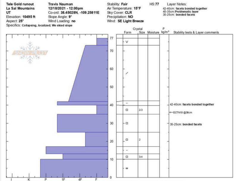
And for you snow geeks out there. Check out this snowpit from Travis Nauman. Picture it as building blocks as it illustrates hard or denser layers over weak layers. The further a layer is shown stretching out to the left, the harder it is. The weak layer of concern is between 35-40 cms. Thanks Travis!
General Announcements
Who's up for some free avalanche training? Get a refresher, become better prepared for an upcoming avalanche class, or just boost your skills. Go to https://learn.kbyg.org/ and scroll down to Step 2 for a series of interactive online avalanche courses produced by the UAC.
This forecast is from the U.S. Forest Service, which is solely responsible for its content. This forecast describes general avalanche conditions and local variations always occur.