Check out our Holiday Auction - Sign Up for the Utah Snow and Avalanche Workshop (USAW)

Forecast for the Moab Area Mountains

Eric Trenbeath
Issued by Eric Trenbeath on
Monday morning, December 2, 2024
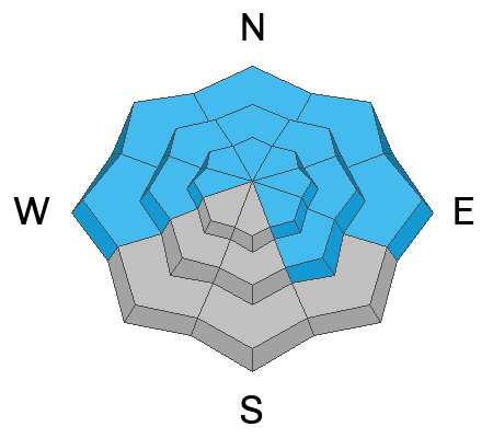
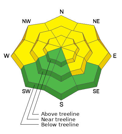
The avalanche danger is MODERATE on all steep slopes facing W-N-SE and human triggered avalanches failing on persistent weak layer of faceted snow are possible. Slopes with a northerly aspect are the most dangerous.
Danger ratings have a spectrum, and we have just entered the high end of moderate. Although the likelihood has decreased, you can still trigger an avalanche and the consequences remain the same.

The danger is mostly LOW on slopes facing SW-S near treeline and below, and on low elevation SE aspects.

Conditions remain thin and rocks, stumps, and dead fall still pose a significant hazard.
Low
Moderate
Considerable
High
Extreme
Learn how to read the forecast here
Special Announcements
We have several events coming up to kick off the winter season:
Thursday, December 5 - FREE Know Before You Go avalanche awareness talk 6 PM at the Grand County Public Library
Saturday, December 7 - 17th Annual Utah Snow and Avalanche Workshop (USAW) - Information and tickets available here.
Saturday, December 14 - 3rd Annual UAC Moab/LUNA Winter Kickoff Party, 6 PM at the MARC. Information and tickets available here.
Geyser Pass Road: The Geyser Pass Road is plowed but snowpacked and slick in some areas. All wheel drive and good tires recommended. Thank you Grand County!
Weather and Snow
6 A.M. Snow and Weather Data
24 Hour Snow: 0" 72 Hour Snow: 0" Season Total Snow: 44" Depth at Gold Basin: 25"
Winds on Pre-Laurel Peak: NW 3-8 mph Temp: 24° F Percent of Normal (SWE): 109%
Weather
Winds are light from the NW and there's really nothing new to say. Another warm and sunny day in the mountains with high temps in the mid 30's at 10,000'.
General Conditions
It's now been almost a week since the last storm more than doubled our snowpack and built a dense slab over weak, sugary facets in the process. Outward signs of instability such as cracking and collapsing have decreased and our party yesterday observed none (see this observation from Tim Mathews). To be clear however, poor snowpack structure remains and stability tests remain reactive. This means you can still trigger an avalanche and neither myself, nor any of our regular observers are yet willing to step on to terrain steeper than 30 degrees.
Last week's dense snow has made for supportable skiing and riding and conditions are far better than they should be considering how little snow there is. A strong sun and warm temperatures yesterday cooked sun exposed slopes and they'll be crusted over this morning. Low angle, northerly aspects remain fast and soft, and you are able to stay above many of the rocks, stumps, and dead fall. It's still low tide out there however, so use caution.
Snowpack and Weather Data
Gold Basin SNOTEL site (10,000')
SNOTEL site near Geyser Pass Winter Trailhead (9600')
Wind Station on Pre-Laurel Peak (11,400')
NWS forecast for the La Sal Mountains.
Recent Avalanches
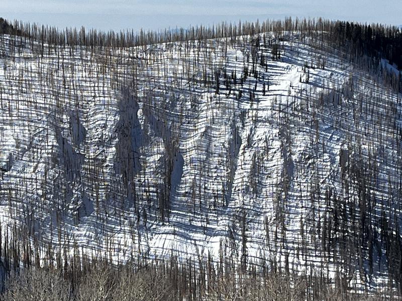
Old news but we continue to find evidence of natural activity from last week's storm. It's becoming clear that there were many avalanches during the storm, and that a lot of them had filled back in. It's a little hard to see what's going on, but if you study it, you can see a connected crown across most of this terrain.
Ad
Avalanche Problem #1
Persistent Weak Layer
Type
Location
Likelihood
Size
Description
A dense, cohesive slab exists on top of a layer of weak, faceted snow at the base of the snowpack. This layer exists at all elevations on slopes facing W-N-E, and on SE aspects near and above treeline that still held snow prior to the storm. The danger is greatest on steep slopes near and above treeline that face NW-N-E, but human triggered avalanches are possible on all aspects where this structure is present. This problem will be with us for awhile even though signs of instability are decreasing. In fact, it now becomes even more scary as you aren't sure which slopes will slide and which won't. In some cases, a slope can be skied or ridden multiple times before it releases. Avoidance of slopes steeper than 30 degrees remains the best course of action, especially those slopes that have a northerly aspect.

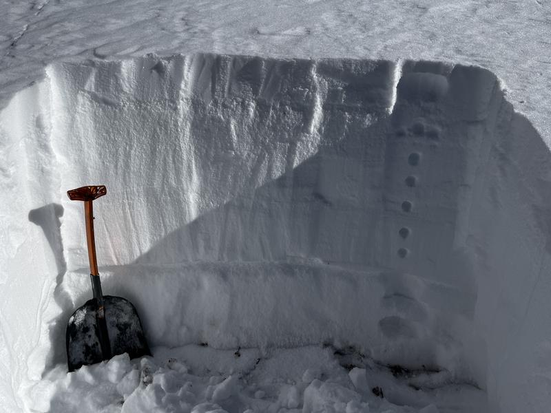
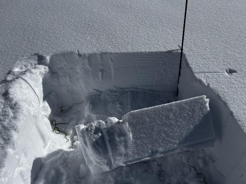
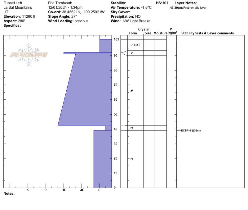
Yesterday, our party dug this snowpit on a NW aspect at 11,200' on the lower left side of the Funnel. Once again, we found a dense strong slab over weak, faceted snow. An extended column test produced a propagation score of 15 (ECTP 15).
Additional Information
Sign up for text alerts to get the most up to date information about changing conditions, road plowing, special avalanche announcements.
Follow us on Instagram @utavy_moab
General Announcements
This forecast is from the U.S.D.A. Forest Service, which is solely responsible for its content. This forecast describes general avalanche conditions and local variations always occur.