Check out the most recent
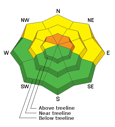
blog post from Chris Benson with a recap of the current state of the snowpack and an analysis of the sometimes thin line between Moderate and Considerable danger.
Do you have the essential avalanche rescue gear (transceiver, probe, and shovel) and do you know how to use them?
Watch this video to see how the three pieces of equipment work together.
The Geyser Pass Road Expect an inch or two of new snow on dirt and patches of old snow and ice.
The Lower Utah Nordic Alliance (LUNA) will be up packing down the new snow today.
24 Hour Snow 3" 72 Hour Snow 0" Base Depth in Gold Basin 24" Wind SW 20-25 G 40 Temp 21F
Over promise and under deliver. 3" of new snow has accumulated as of 6:00 a.m. with perhaps up to 6" at upper elevations. Showers will linger this morning but they should wrap up by noon with another couple of inches possible. Skies will remain cloudy with ridge top SW winds blowing in the 20-25 mph range with higher gusts. High temps will be in the low 20's. A second wave brings another chance for snow on Sunday followed by another system on Tues. This system is no longer looking as strong.
Snowpack Discussion
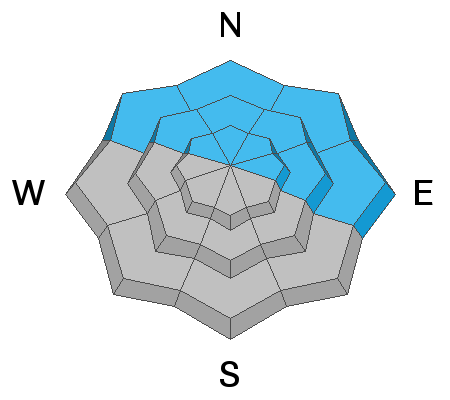
Fresh wind drifts will cause an increase in danger, particularly in upper elevation, wind-exposed terrain. The underlying snowpack is very weak and faceted, and in my travels yesterday I continued to experience signs of instability such as cracking and collapsing. Drifted snow will add additional stress to these buried weak layers. Unfortunately, the new snow load is not quite enough to overtly tip the scales and the balance remains tenuous. As before, steep, northerly facing terrain that has enough snow to ski or ride should be avoided.


