Forecast for the Moab Area Mountains

Dave Garcia
Issued by Dave Garcia for
Wednesday, January 17, 2024
A CONSIDERABLE avalanche danger exists on all steep slopes facing W-N-E, near and above treeline, and on slopes facing NW-N-E below. Deep and dangerous human triggered avalanches involving a buried persistent weak layer are likely in these areas.
A MODERATE avalanche danger exists on steep slopes facing SW-S-SE at all elevations, and on W and E aspects below treeline. Human triggered avalanches failing on a buried persistent weak layer are possible.

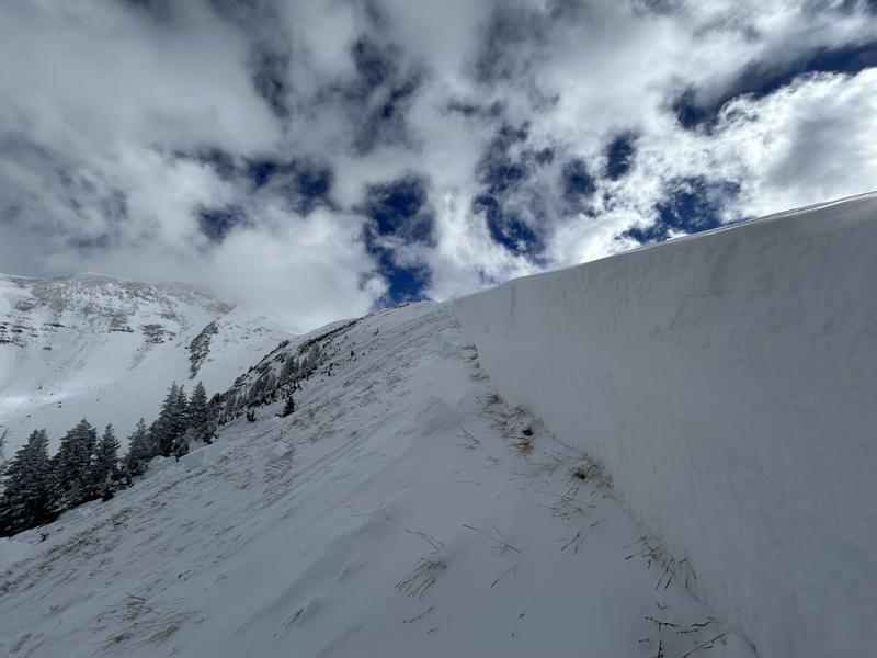
Avalanches breaking deep and wide on persistent weak layers remain your primary concern, but a quick shot of snow and gusty winds today will deposit fresh, sensitive slabs of wind-drifted snow near treeline and above.
Low
Moderate
Considerable
High
Extreme
Learn how to read the forecast here
Special Announcements
With the arrival of new snow, sign up for our Backcountry 101 course Jan 19, 20!
Sign up for forecast region-specific text message alerts. You will receive messages about changing avalanche conditions, watches, and warnings.
Follow us on Instagram @utavy_moab
Road Conditions: The Geyser Pass Road was plowed on Tuesday. 4x4 and good tires are recommended.
Grooming: LUNA rolled Gold Basin through Geyser Pass on Sunday.
Weather and Snow
6:00 a.m. Snow and Weather Data
24 Hour Snow 0" 72 Hour Snow 1" Season Total Snow 77" Base Depth at Gold Basin 35"
Winds on Pre-Laurel Peak: NW 19 G 26 Temp 23˚ F

Weather
A fast moving storm will affect our area today. Mountain temperatures are about 15 degrees warmer this morning than they were 24 hours ago. We have already reached our high temperature for the day, and the mercury should hover around 20 degrees. Winds will blow out of the WSW at 15-20 mph with gusts up to 30 mph. Periods of heavy snowfall are possible before 2 PM and 2-4" of accumulation is expected. The storm makes a quick exit by this evening and tomorrow brings a return to sunny skies. Another chance for snow arrives late in the day on Saturday.
General Conditions
Plenty of soft, settled powder remains in sheltered areas, and another 2-4" today should make for great ski conditions. January has been an active month in the La Sals, and we have seen about 3' of snow. That's the good news, however, all of this new snow has settled into a cohesive slab and it sits on top of a very weak foundation. Red Flag indicators of unstable snow have been in your face recently. Multiple backcountry parties have reported widespread collapsing at all elevations. These problems are not limited to shady slopes, we have seen collapsing, poor snowpack structure, and stability tests indicating unstable snow on Southerly aspects as well.
I was up on Monday and red flags of unstable snow were obvious. See my field work here.
Eric tells the story of the past week in this great video. Check it out.
Snowpack and Weather Data
Gold Basin Storm Stake (10,000')
Gold Basin SNOTEL site (10,000')
SNOTEL site near Geyser Pass Winter Trailhead (9600')
Wind Station on Pre-Laurel Peak (11,400')
NWS forecast for the La Sal Mountains.
Recent Avalanches
On Monday, while stomping around the low angle slopes adjacent to Coyote Chute, I remotely triggered this large avalanche in the Horse Creek Chutes. This avalanche is about 1,500' wide with an average depth of 4' and a maximum depth of 6.5'. Get the full details here.
Ad
Avalanche Problem #1
Persistent Weak Layer
Type
Location
Likelihood
Size
Description
A slab of cohesive snow now exists above a persistent weak layer of faceted snow on all aspects and elevations. I anticipate this weak layer to be active for a long time. Signs of instability like cracking and collapsing may be less obvious today, but make no mistake, conditions remain dangerous.
The remotely triggered avalanche in Horse Creek on Monday tells us that human-triggered sensitivity remains elevated. This avalanche is a great example of the poor snowpack structure in alpine terrain. Large, hard slabs of wind-drifted snow rest on top weak, faceted snow, and they are hanging in the balance just waiting for a trigger. Once triggered, these avalanches will break deep and wide, and be unsurvivable.
The danger is not limited to Northerly aspects, as we have started to see collapsing and poor pit results on Southerly slopes as well.
Avalanche Problem #2
Wind Drifted Snow
Type
Location
Likelihood
Size
Description
This mornings snowfall and gusty winds out of the SW will create fresh sensitive drifts on all aspects above treeline and on leeward slopes near treeline. Freshly formed wind-drifts can be quite sensitive to the weight of a skier or rider. Shooting cracks in drifted snow are a sure sign of instability.
Additional Information
To fulfill our mission, the UAC relies on our amazing backcountry community. Your support helps pay for the daily avalanche forecast, free awareness presentations across the state, and new tools like the new Avalanche and Observation Explorer. As we welcome the new year, please consider donating to the UAC.
General Announcements
This forecast is from the U.S.D.A. Forest Service, which is solely responsible for its content. This forecast describes general avalanche conditions and local variations always occur.