Sign Up for the Utah Snow and Avalanche Workshop (USAW) on December 7th!

Observation: Laurel Highway

Observation Date
1/15/2024
Observer Name
Garcia
Region
Moab » Laurel Highway
Location Name or Route
Laurel Highway
Weather
Sky
Overcast
Precipitation
Light Snowfall
Wind Direction
West
Wind Speed
Light
Weather Comments
Sky was overcast at time of Obs, sun poked through at the end of the day. Occasional light snow today, no accumulation
Snow Characteristics
Snow Surface Conditions
Powder
Snow Characteristics Comments
Ski quality remains great. Five inches of fresh from Saturday night is sitting on top of a supportive slab formed during the stormy period beginning on 1-7.
Red Flags
Red Flags
Recent Avalanches
Cracking
Collapsing
Poor Snowpack Structure
Red Flags Comments
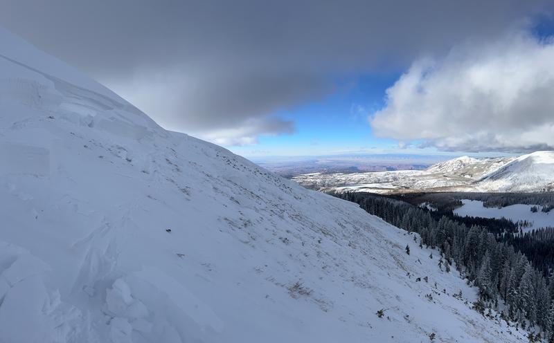
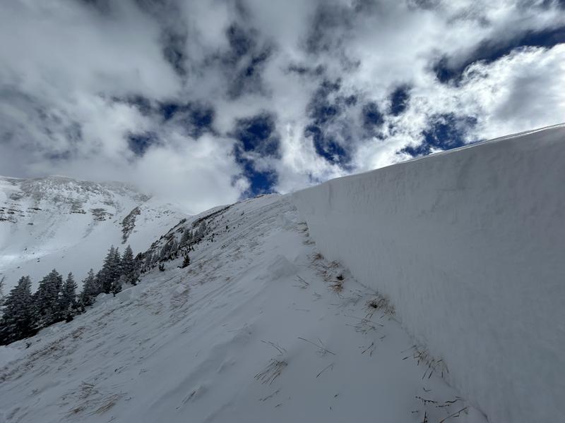
Recent Avalanches: I remotely triggered a large avalanche in the Horse Creek Chutes (AKA Old Reliable) from the skier's left side of Coyote Chute. While poking around the side of Coyote I felt and heard a BIG, LOUD collapse, and I felt like I dropped a couple inches. I walked up the ridge to see that Old Reliable had slid to the ground taking out the entire season's snowpack. Some photos are including below, but see the avalanche observation for the full details. Cracking and Collapsing: Collapsing remains widespread at all elevations if you get off the skin track. I observed small shooting cracks associated with some collapses, but not all of them. I traveled mostly on Northerly aspects. Poor Snowpack Structure remains and I'm continuing to get propagation with ECT's.
Avalanche Problem #1
Problem
Persistent Weak Layer
Trend
Same
Problem #1 Comments
Our PWL problem is alive and well on all aspects. It is especially sensitive on the Northerlies. Yesterday we experienced widespread collapsing while traveling on N, NW, and SW aspects. I continued to experience widespread collapsing today while traveling primarily on Northerlies. Other touring parties reported widespread collapsing as well. I also got propagation in two ECT's on NE facing slopes, one BTL, one NTL.
The weak layer is easily seen in this photo
Smaller facets (1mm) were observed at the top of the weak layer where the failure occured.
Larger facets (2mm) were observed near the ground.
A few things stand out to me about these pits. They are both in sheltered areas and have not been previously wind loaded this season. Both snowpacks are shallow with HS under 70cm. They are simple, with not many layers, and the weak, faceted layer is extremely obvious in both pits. Extended column tests produced propagation in both pits, with a low score (ECTP 7) in the Coyote Glades. These results combined with continued widespread collapsing tell us the snowpack is sensitive right now and human triggered avalanches remain likely in steep terrain.
The remotely triggered avalanche in Horse Creek is a huge red flag and an indication that Northerly aspects are sensitive to the weight of a skier or rider right now. This slope was heavily wind loaded (max depth 6.5 feet). This is a great example of the wind-drifted slopes in the alpine that are hanging in the balance just waiting for a trigger. These thick, hard slabs of wind-drifted snow are sitting on top of a very weak snowpack as illustrated by the Horse Creek avalanche. There are many more slopes in the alpine that have this dangerous structure.
Today's Observed Danger Rating
Considerable
Tomorrows Estimated Danger Rating
Considerable
Coordinates