Forecast for the Moab Area Mountains

Eric Trenbeath
Issued by Eric Trenbeath for
Monday, January 1, 2024
Most terrain has LOW danger.
An isolated or MODERATE danger still exists on steep slopes above treeline that face NW-N-NE-E. In these areas, old, hard slabs of wind drifted snow sitting on top of weak, sugary, faceted snow present the biggest threat. Suspect slopes that have a smooth, rounded appearance, or that sound hollow underneath.

The snowpack is still very shallow and rocks, logs, and stumps are a very real hazard right now.
Low
Moderate
Considerable
High
Extreme
Learn how to read the forecast here
Special Announcements
Happy New Year! May it bring us some snow!
Road Conditions: The road is plowed but the surface remains soft. AWD with good tires are required.
Grooming: Gold Basin was last groomed on Friday. Gavin tuned up the Geyser Pass Road yesterday.
Weather and Snow
6:00 a.m. Snow and Weather Data
24 Hour Snow 0" 72 Hour Snow 0" Season Total Snow 42" Base Depth at Gold Basin 23"
Winds on Pre-Laurel Peak: SE 10-15 Temp 20˚ F

Weather
Today, look for clearing skies, light southerly winds, and high temps at 10,000' of around 30F. Dry and sunny conditions continue through Wednesday. A southern storm system is on track to clip by our area on Thursday bringing us a chance for a few inches of snow. The crystal ball still indicates a more significant storm shaping up for Sunday although it's almost a week out and we've seen these things disappear many times this winter. But what's life without hope? I'm cautiously optimistic that this will bring the change we so desperately need.
General Conditions
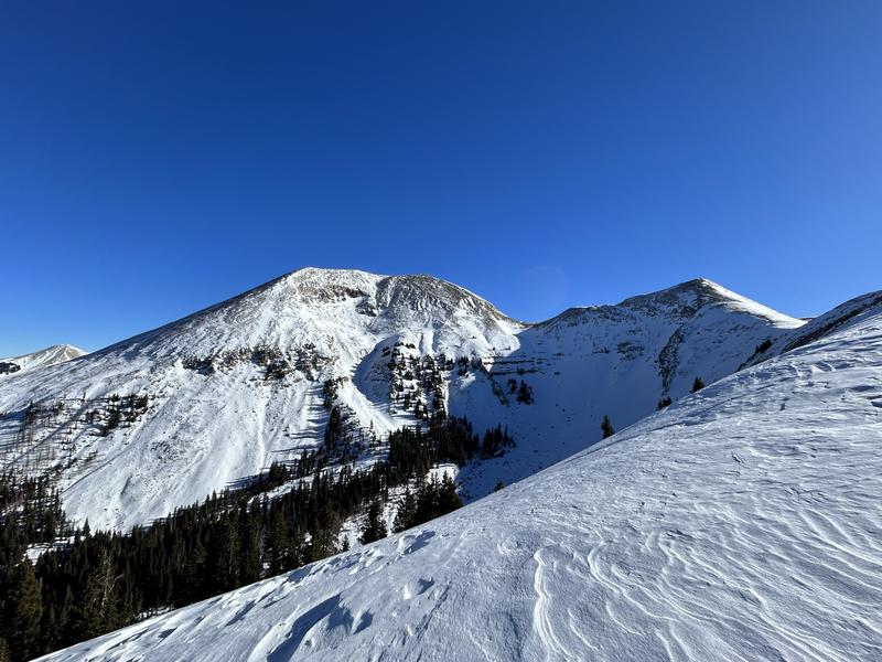
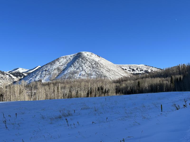
Conditions continue to deteriorate. The snowpack is weak and faceting, and not supportive enough to keep you on top of the rocks. Strong northerly winds last weekend, and again mid-week added insult to injury. In the alpine, you will find a mix of scoured slopes alternating with a variety of wind-sculpted snow, wind crusts, and old hard slabs. It's always beautiful up there though. The pics below either illustrate either dire conditions or beautiful mountains under sunny skies depending on your disposition.
Snowpack and Weather Data
Gold Basin Storm Stake (10,000')
Gold Basin SNOTEL site (10,000')
SNOTEL site near Geyser Pass Winter Trailhead (9600')
Wind Station on Pre-Laurel Peak (11,400')
NWS forecast for the La Sal Mountains.
Dave Garcia photos. 12/29/2023
Ad
Avalanche Problem #1
Persistent Weak Layer
Type
Location
Likelihood
Size
Description
The likelihood of triggering an avalanche is diminishing, however, the places where you could trigger an avalanche are about the only places that have enough snow to ride. On steep, wind loaded, northerly aspects, both soft and hard slabs of drifted snow are sitting on top of loose, sugary, faceted snow. You may still be able to trigger an avalanche failing on a buried persistent weak layer that is big enough to take you for a ride, rake you across rocks, or carry you over a cliff. Suspect steep, wind loaded slopes that have a smooth, rounded appearance or that sound hollow underneath.
Additional Information
To fulfill our mission, the UAC relies on our amazing backcountry community. Your support helps pay for the daily avalanche forecast, free awareness presentations across the state, and new tools like the new Avalanche and Observation Explorer. As we welcome the new year, please consider donating to the UAC.
General Announcements
This forecast is from the U.S.D.A. Forest Service, which is solely responsible for its content. This forecast describes general avalanche conditions and local variations always occur.