Join us at our 2nd Annual Blizzard Ball

Forecast for the Logan Area Mountains

Toby Weed
Issued by Toby Weed on
Tuesday morning, April 7, 2020
Heightened avalanche conditions and MODERATE danger exist today on steep slopes at all elevations in the Logan Zone. People could trigger 1 to 2 foot deep slab avalanches of wind drifted snow on steep upper elevation slopes. Warm daytime temperatures and high angle April sun will cause elevated danger of wet avalanches in steep terrain.
  • Evaluate snow and terrain carefully.
Low
Moderate
Considerable
High
Extreme
Learn how to read the forecast here
Special Announcements
Spring Awareness Campaign - Help us save lives through avalanche forecasts and education. Consider making a donation before April 8th.
Uncertainty, Risk, & Decision Making: before, during, and after COVID-19 - Read this thought-provoking blog post about how we take risks by guest author Tom Diegel.
Weather and Snow
It's 32°F at the 8400' Tony Grove Snotel and there is 98 inches of total snow with 113% of normal Snow Water Equivalent. It's 27°F at the 9700' CSI Logan Peak weather station, and southwest winds are blowing about 22 mph.

Heightened avalanche conditions exist at upper elevations, and people could trigger slab avalanches of wind drifted snow. Warming daytime temperatures and intense high angle sun will cause increasing probability of both wet loose and wet slab avalanches during the day in very steep terrain.
Evaluate terrain carefully and continue to practice safe travel protocols to minimize your risk. Staying off and out from under slopes steeper than about 30 degrees is the best way to avoid problems.

The stationary low pressure system off the central California coast will begin to work slowly south down the coast today. This low pressure will turn east into the desert southwest and bring somewhat cooler and wet conditions across mainly southern and central Utah midweek.
Expect partly sunny conditions in the mountains today, with a chance of snow showers this afternoon. 8500' high temperatures will climb to around 44°F, and south-southwest wind will blow around 11 mph. Temperatures at lower elevations will climb to around 60°F. It will be cloudy and low temperatures are expected to drop to around 30°F, with 14 to 26 mph southwest winds. Snow showers are possible again tomorrow, it will be partly sunny though, with high temperatures around 44°F, with 11 mph southwest winds. Snow showers are possible this evening, and it'll be partly cloud tonight, with low temperatures around 29°F and 10 mph southeast wind. Tomorrow will be sunny, with high temperatures near 47°F and 11 mph west wind.
Recent Avalanches
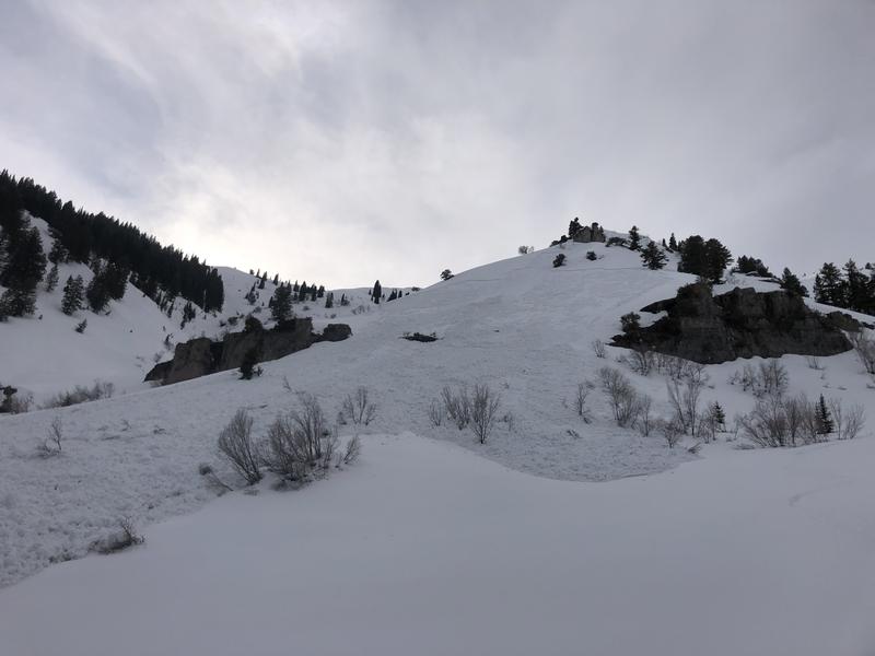
Sunday, a solo skier triggered a dangerous wet slab avalanche on a southeast facing slope at around 7600' in central Wood Camp. Report is HERE

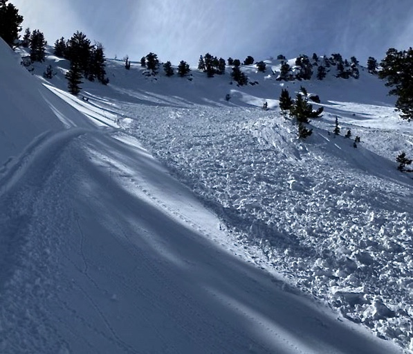
Riders came across a fresh human triggered avalanche Saturday near the Franklin County high point in St. Charles Canyon. There were fresh sled tracks at the top of the slope and under the fresh debris down in the bowl. The 18" deep and 200' wide avalanche occurred on a ENE facing slope at around 9000' in elevation.

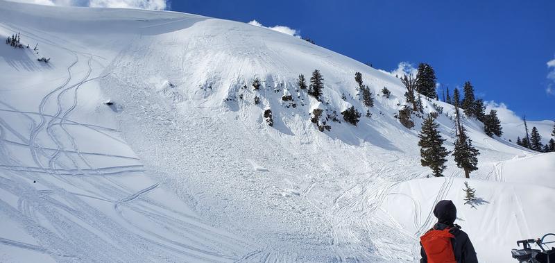
Friday afternoon on Cornice Ridge above Tony Grove Lake, a snowmobiler triggered an avalanche of wind drifted snow above a group of skiers building a jump. The 14" deep and a few hundred feet wide avalanche on a northeast facing slope at around 9200' in elevation overran the area, and the skiers narrowly escaped as a large pile of debris stacked up on their not yet completed jump.
Ad
Avalanche Problem #1
Wind Drifted Snow
Type
Location
Likelihood
Size
Description
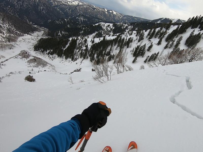
South winds drifted snow at upper elevations yesterday, and heightened avalanche conditions will exist today in drifted upper elevation terrain. People could trigger avalanches of wind drifted snow, with slabs ranging from 1 to 2 feet deep, on steep upper elevation slopes facing the northern half of the compass.
  • Watch for cracking as a sign of instability.
  • Avoid stiffer, recently drifted snow near the ridge tops, on corniced slopes, and in and around terrain features like sub-ridges, gullies, scoops, and cliff bands.
  • Stay off and out from under large ridge top cornices, which could break much further back than expected and might trigger avalanches on steep slopes below.
Avalanche Problem #2
Wet Snow
Type
Location
Likelihood
Size
Description
Overnight temperatures stayed above or close to freezing at most stations overnight. The saturated snow did not refreeze well and temperatures will warm throughout the day, the intense, high angled April sun will be out in force, and elevated conditions for wet loose and wet slab avalanches will once again develop on steep slopes. Sunday's skier triggered wet slab avalanche in Wood Camp indicates potential for similar dangerous wet avalanche activity on very steep slopes across the zone.
  • Watch for loose, unconsolidated snow, roller balls, pin-wheels, and natural sluffs as telltale signs of instability.
  • If you or your machine starts sinking into saturated snow or if the snow where you are gets warm and slushy, you should move off of and out from under steep slopes.
Our snowpit tests last week showed propagation of the new snow, failing on loose wet grains..... Watch the video HERE
Additional Information
Information on outdoor recreation - The State of Utah created this webpage with information about recreating on both state and federal public lands during the current health crisis.

Skiing and riding at closed ski resorts - Some resorts allow access now, and some do not. Please check HERE for the latest info on ski area access.

New to the backcountry (including riding at closed resorts) - Watch the award-winning, 15 minute Know Before You Go video, or take the 5-part, free online-learning series.
General Announcements
EMAIL ADVISORY. If you would like to get the daily advisory by email you subscribe HERE.
Remember your information can save lives. If you see anything we should know about, please help us out by submitting snow and avalanche observations....HERE. You can also call us at 801-524-5304, email by clicking HERE, or include #utavy in your tweet or Instagram.
This forecast is from the USDA Forest Service, which is solely responsible for its content. The forecast describes general avalanche conditions and local variations always occur.
We will update this forecast before about 7:30 tomorrow morning.