Forecast for the Logan Area Mountains

Toby Weed
Issued by Toby Weed for
Monday, April 1, 2024
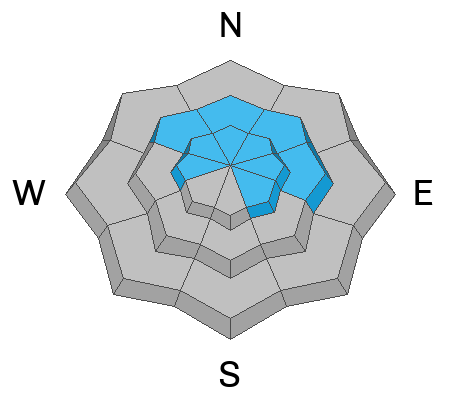
Heightened avalanche conditions exist in the backcountry, and the danger is MODERATE. People could trigger soft wind slab avalanches 1 to 2 feet thick in drifted mid and upper-elevation terrain. Partly sunny skies and warming temperatures today will elevate the potential for loose wet avalanches of saturated new snow on slopes steeper than 30°.

Evaluate the snow and terrain carefully
Low
Moderate
Considerable
High
Extreme
Learn how to read the forecast here
Special Announcements
Donate today to help us rebuild our website backend platform to ensure uninterrupted access to avalanche information and the ongoing security of the website and the data stored on the site.
Weather and Snow
Spring riding conditions are quite good. After several days with significant accumulations of new snow and drifting by winds primarily from the south and west, heightened avalanche conditions exist in the backcountry, particularly in drifted upper-elevation terrain. New snow and wind slab avalanche conditions generally stabilize fairly quickly and we are not seeing any problems with buried persistent weak layers in the Logan Zone. A significant issue today will be solar heating seasonal warmth, and the increasing potential for wet avalanches entraining heavy piles of moist or saturated fresh snow.

The Tony Grove Lake Snotel at 8400' reports .6 inches of SWE (snow water equivalent) in the past 24 hours. It's 26° F this morning, and there is 110 inches of total snow at the site containing 125% of normal snow water equivalent. At 06:00 on Logan Peak, winds are blowing from the northwest 15 mph with gusts in the mid 30s, and it's 20° F at 9700'. At our new Paris Peak weather station at 9500', it's 16 °F, and the wind is blowing from the north 20 mph. It's 22° F at our new Card Canyon weather station at 8800' and there is 94 inches of total snow.

Expect increasingly warm temperatures, clearing skies, and sunny conditions in the next few days. Snow showers are likely at the end of the week. For more information, visit our mountain weather page HERE
Recent Avalanches
There were several human-triggered avalanches and a few close calls in the Wasatch Range in the past few days. Visit our Avalanche Page for more details.
We noticed several natural loose snow sluffs on Saturday that likely occurred during the morning's high snowfall rate. No avalanche incidents were reported over the weekend in the Logan Zone, but riders triggered numerous small slides in steep terrain.

Check out all local observations and avalanches HERE.
Ad
Avalanche Problem #1
Wind Drifted Snow
Type
Location
Likelihood
Size
Description
You could trigger soft slab avalanches of drifted snow, especially in northerly and easterly-facing upper-elevation terrain on slopes steeper than 30°. Avalanches could fail on the interface on top of last week's melt-freeze crust or a density change within the newer snow.
  • Avoid travel on wind-loaded slopes capped by large cornices on the lee side of major ridges.
  • Watch for stiffer drifted snow or wind slabs in and around terrain features like sub ridges, gully walls, mid-slope rollovers, scoops, and cliff bands.
  • In drifted terrain, watch for cracking and other obvious signs of instability, like recent avalanches on similar slopes.
  • In steep, even sheltered terrain, you could trigger soft storm slabs or fast-moving sluffs of new snow. Although generally manageable, soft slabs or loose avalanches in steep terrain could carry you into potential terrain traps below, like trees, gullies, sinks, or cliff bands. These avalanches can easily be avoided by not traveling on slopes steeper than about 30°.
  • Practice safe travel protocols to avoid exposing more than one person to avalanche danger.
Avalanche Problem #2
Wet Snow
Type
Location
Likelihood
Size
Description
If the sun does peek out from behind the clouds today, the risk of wet avalanches of new snow will increase rapidly. Solar heating and/or greenhousing and seasonal warmth will cause the fresh snow to be moist and sticky and prone to producing loose wet avalanches. These could entrain large piles of heavy snow and grow to become large and dangerous avalanches on sustained slopes.
  • If you are sinking deeply into wet/moist snow, move to a lower-angle slope or cooler aspect or elevation.
  • Avoid being on or under steep slopes with moist or saturated fresh snow.
  • Be aware of terrain traps below like trees, gullies, sinks, or rock outcroppings that wet avalanches could sweep you into.
Additional Information
Moist storm snow running down the steep chutes in Hell's Canyon yesterday in the backcountry near Snow Basin produced a large pile of avalanche debris. The avalanche occurred on a north-facing slope at around 7500'. report is here
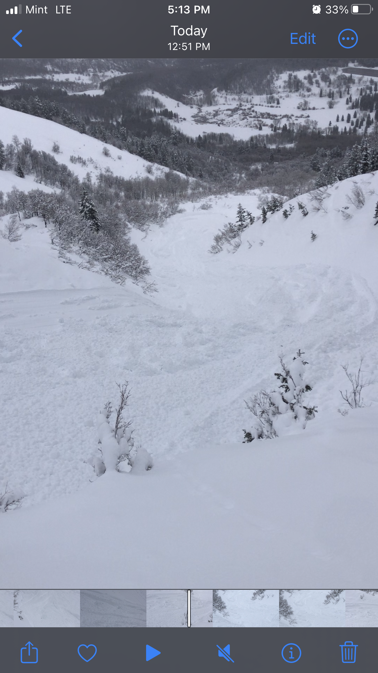
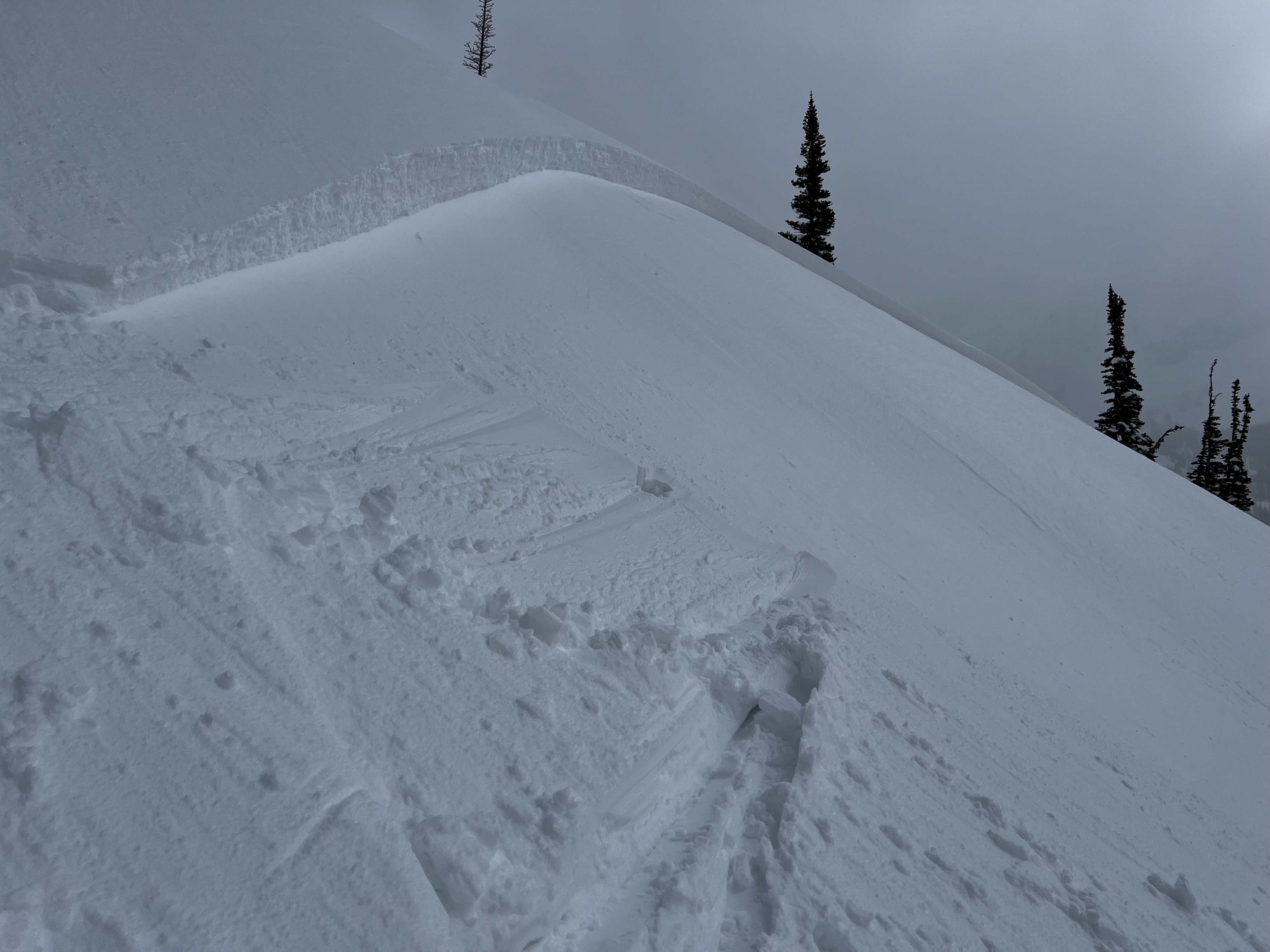
Yesterday afternoon, a UAC avalanche forecaster unintentionally triggered a soft wind slab avalanche on a cross-loaded west-facing slope at around 10,000' in the Wasatch Range above Salt Lake City. read the report
General Announcements
-National Forest Winter Recreation Travel Maps show where it's open to ride: UWCNF Logan, Ogden LRD Tony Grove, Franklin Basin CTNF Montpelier
-Listen to your very own Logan Zone avalanche forecasters on the UAC Podcast HERE.
-Read Toby's blog about wind, drifting, and avalanches HERE.
-Sign up for forecast region-specific text message alerts. You will receive messages about changing avalanche conditions, watches, and warnings...HERE.
-For all questions on forecasts, education, Know Before You Go, events, online purchases, or fundraising, call 801-365-5522.
-To report an avalanche or submit an observation from the backcountry, go HERE.
-Come practice companion rescue at the Franklin Basin TH Beacon Training Park. It's free and open to everyone. For easy user instructions, go HERE.
-We will issue regular daily updates of our forecast through April 14.
-We will update this forecast tomorrow by 7:30 AM.
This forecast is from the U.S.D.A. Forest Service, which is solely responsible for its content. This forecast describes general avalanche conditions, and local variations always occur.