Get Your Ticket to the 32nd Annual Backcountry Benefit on September 11th! Support Forecasting, Awareness, and Education
Ad

Forecast for the Logan Area Mountains

Toby Weed
Issued by Toby Weed on
Wednesday morning, April 1, 2020
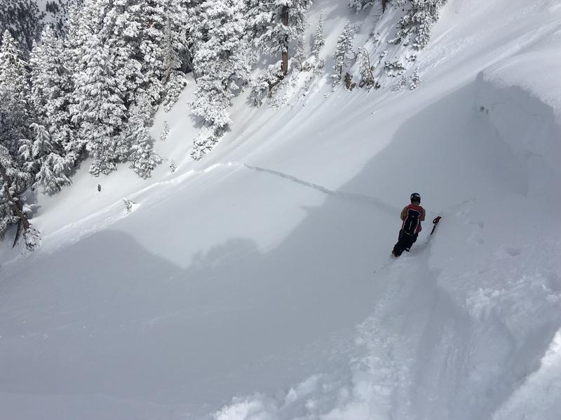
Yesterday's heavy new snow, rain down low, and drifting from sustained and gusty west winds created dangerous avalanche conditions in the Logan Zone. Heightened avalanche conditions exist on many steep slopes, and there are areas with CONSIDERABLE danger in high drifted terrain. Human triggered avalanches of wind drifted snow are likely and some natural activity is possible. Yesterday's rain on the snow and seasonally warm daytime temperatures will cause loose wet avalanches to be possible on steep lower and mid elevation slopes.
  • Evaluate snow and terrain carefully. Use caution while route-finding and make conservative decisions.
Low
Moderate
Considerable
High
Extreme
Learn how to read the forecast here
Special Announcements
Spring Awareness Campaign - Help us save lives through avalanche forecasts and education. Consider making a donation before April 8th.

Information on outdoor recreation - The State of Utah created this webpage with information about recreating on both state and federal public lands during the current health crisis.

January 5, 2019 - Read this collection of 6 stories and a podcast about that day with a low avalanche danger, 8 skier triggered avalanches, four catch and carries...a partial and critical burial, and a trip to the emergency room.
Weather and Snow
It's 28°F at the 8400' Tony Grove Snotel, and about 11 inches of heavy new snow with 1.4" Snow Water Equivalent fell in the last couple days. There is now 102 inches of total snow with 113% of normal SWE. It looks like even more snow fell in the northern part of the zone, with Franklin Basin Snotel at 8200' and just north of the state line reporting 1.6" SWE. It's 22°F at the 9700' CSI Logan Peak weather station, and west winds are currently blowing about 21 mph.

Several inches of heavy new snow fell at upper elevations and was drifted by sustained and gusty westerly winds. Expect dangerous avalanche conditions at upper elevations, with a good chance of people triggering avalanches of wind drifted snow. Heightened avalanche conditions exist on many steep slopes, and soft wind slab and loose avalanches of storm snow are possible. Rain on the snow and warm daytime temperatures created potential for loose wet avalanches in steep lower and mid elevation terrain.
  • Evaluate terrain carefully and continue to practice safe travel protocols to minimize your risk. Staying on slopes less than 30 degrees is the best way to avoid problems.

A weather system will cross northern and central Utah today through Thursday. A warming and drying trend will follow for the upcoming weekend.
Expect snow showers in the mountains today, with 1 to 3 inches of accumulation expected. It will be mostly cloudy, with 8500' high temperatures to around 34°F and 7 to 10 mph west-southwest winds. It will snow in the mountains tonight, with 1 to 3 more inches possible. Low temperatures are expected to be around 14°F, with northwest wind 9 to 17 mph, and wind chill values as low as -1°F. Snow is likely in the northern mountains again tomorrow, with another 1 to 3 inches possible. It will be partly sunny with high temperatures near 25°F, and increasing west-northwest winds will blow 15 to 20 mph.
Recent Avalanches
People triggered several avalanches in the Logan Zone after last week's storm, with half-a-dozen reported on Thursday, the day after the storm.
Over the weekend; a skier intentionally triggered a slab avalanche of wind drifted snow on an upper elevation north facing slope in Mill Hollow Saturday afternoon. Earlier, the party had been skiing north facing terrain in the area without seeing any red flags, but the stiffer snow on the slope was obviously wind drifted.

On Friday, a very experienced rider triggered a soft slab avalanche and was thrown off his sled in Three Terraces Bowl on the east side of Providence Peak.
Ad
Avalanche Problem #1
Wind Drifted Snow
Type
Location
Likelihood
Size
Description
Heightened conditions exist on drifted upper and mid elevation slopes, and there are pockets of more dangerous conditions and CONSIDERABLE danger up high. People are likely to trigger avalanches of wind drifted snow on steep upper elevation slopes today and some natural activity is possible.
  • Watch for cracking as a sign of instability.
  • Avoid stiffer, recently drifted snow near the ridge tops, on corniced slopes, and in and around terrain features like sub-ridges, gullies, scoops, and cliff bands.
Avalanche Problem #2
Wet Snow
Type
Location
Likelihood
Size
Description
Loose wet avalanches are possible on steep slopes at lower and mid elevations. Clouds and cool temperatures should help keep natural wet avalanche activity to a minimum again today, but rain on snow and seasonal warmth will create heightened loose wet avalanche conditions in steep mid and lower elevation terrain.
  • If the saturated snow where you are gets warm and sticky or slushy, you should move off and out from under steep slopes.
Additional Information
Skiing and riding at closed ski resorts - Some resorts allow access now, and some do not. Please check HERE for the latest info on ski area access.
New to the backcountry (including riding at closed resorts) - Watch the award-winning, 15 minute Know Before You Go video, or take the 5-part, free online-learning series.
General Announcements
EMAIL ADVISORY. If you would like to get the daily advisory by email you subscribe HERE.
Remember your information can save lives. If you see anything we should know about, please help us out by submitting snow and avalanche observations....HERE. You can also call us at 801-524-5304, email by clicking HERE, or include #utavy in your tweet or Instagram.
This forecast is from the USDA Forest Service, which is solely responsible for its content. The forecast describes general avalanche conditions and local variations always occur.
We will update this forecast before about 7:30 tomorrow morning.