Donate to Our Spring Campaign or Bid on our Spring Auction to Support Forecasting

Forecast for the Logan Area Mountains

Paige Pagnucco
Issued by Paige Pagnucco on
Sunday morning, March 16, 2025
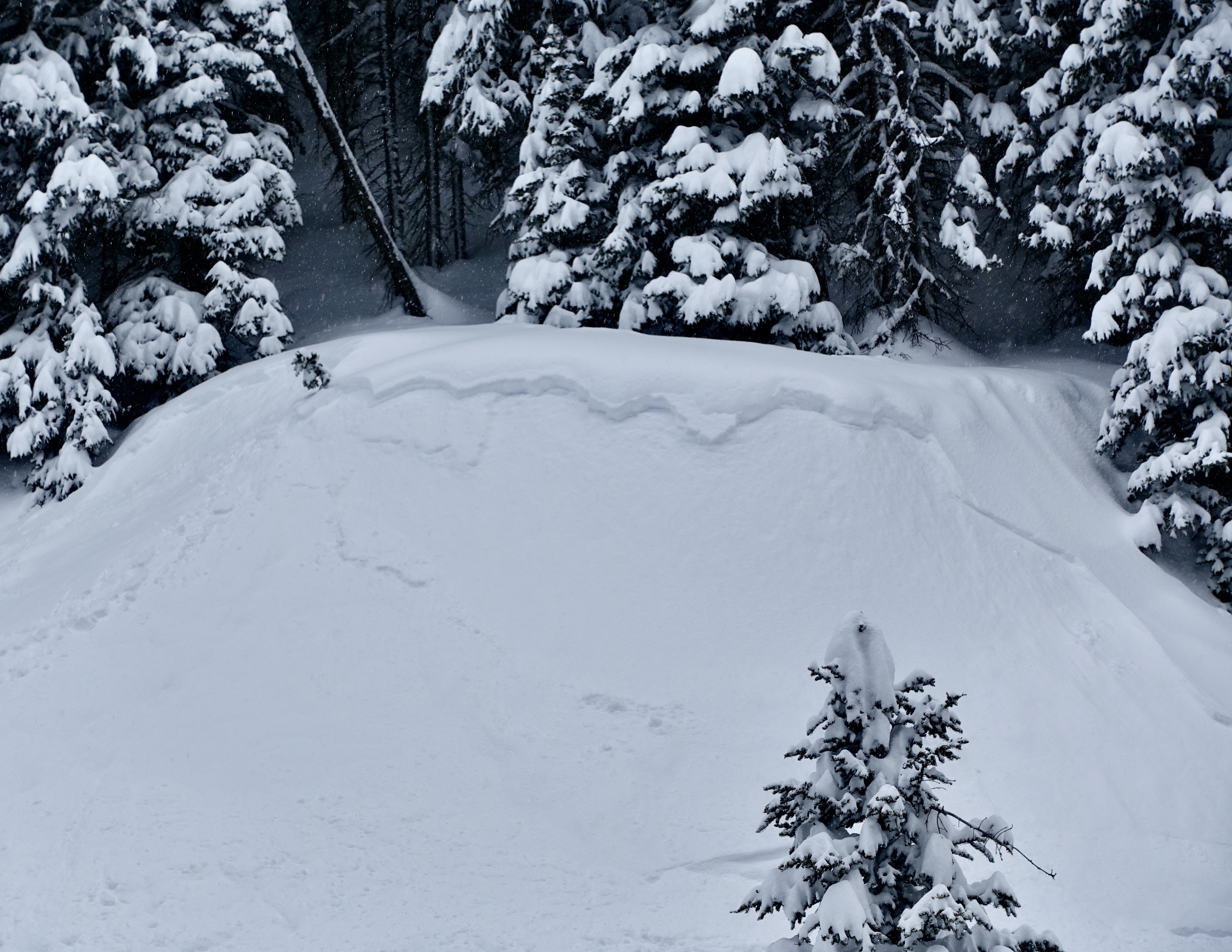
The avalanche danger is CONSIDERABLE today. Human-triggered wind-drifted avalanches and soft storm slabs are likely on upper-elevation slopes and possible on mid-elevation slopes steeper than 30 degrees. Expect to see wet avalanche activity in low and possibly mid-elevation terrain as the day warms.
Make conservative choices, evaluate snow and terrain carefully, and avoid steep, drifted slopes and overhanging cornices.
Follow safe travel protocols by only exposing one person at a time in avalanche terrain.
Low
Moderate
Considerable
High
Extreme
Learn how to read the forecast here
Special Announcements
Our Spring Campaign is in full swing, and there are two great ways to support forecasting, awareness, and education across Utah:
Every dollar helps keep the backcountry community on top. Thank you for your support!"
Weather and Snow
Riding conditions are exceptional right now. Over the past few days, high-elevation terrain has received 12-22 inches (1.2-2 inches swe) of snow, and the cold temperatures have kept it light and powdery. Most of the avalanches reported yesterday were dry loose and soft storm slabs. While weak layers in the storm snow should stabilize, there is still a possibility of triggering a soft slab up to 1-2 feet deep. Winds remain a significant concern today, with gusts regularly exceeding 45 mph near ridgelines. Temperatures will be much warmer than yesterday, so the forecast few inches of snow may be a bit denser. Wet avalanches are also likely at lower elevations and possibly in mid-elevations, depending on how warm it gets.

The Tony Grove Snotel at 8400 feet reports 10 inches of new snow (1.2" swe) in the past 24 hours. It's 21° F, with 105 inches of total snow. It's 17° F at the Card Canyon weather station with 5 inches of new snow and 78 inches of total snow. At 9700 feet at CSI's Logan Peak Wx station, winds are blowing 25 to 30 mph from the southwest, gusting in the 40s, and it's 14° F. The winds on Paris Peak at 9500 feet are blowing 22 to 29 mph from the south-southwest.

The storm will wind down today, with another 3-5 inches of snow possible at high elevations. Winds blowing from the southwest will be moderate in the morning and become stronger in the afternoon. 8500' highs will be in the mid-30s F, with low elevation temperatures in the mid-40s F. Tomorrow will be warm and windy ahead of an incoming storm arriving Monday night with colder temperatures and 7-11" of snow.

For more information, visit the UAC weather page here: Weather - Utah Avalanche Center
For Logan-specific weather, go here: Logan Mountain Weather - Utah Avalanche Center
Recent Avalanches
Dry loose and soft storm slab avalanches were reported in upper elevation terrain yesterday. Katz ob.
Read about all avalanches and observations HERE.
Ad
Avalanche Problem #1
Wind Drifted Snow
Type
Location
Likelihood
Size
Description
Winds are again the big story today. They are expected to blow fairly consistently from the southwest, around 20-30 mph, with gusts in the 40s mph. There is plenty of fresh snow to blow around and hard and soft wind slabs will continue to develop on the lee side of exposed ridges and around terrain features like cliff bands, sub-ridges, and gullies.
  • Watch for and avoid stiffer wind drifted snow on the lee side of major ridges, below cornices, and in and around terrain features like cliff bands, sub-ridges, and gully walls.
  • Wind slabs appear smooth, chalky, and rounded, and they can sound hollow, like a drum, when you move around on them.
  • Cracking is a red flag indicating unstable snow.
  • Hard wind slabs sometimes let you get out on them before releasing suddenly. Freshly formed, softer wind slabs are often very easily triggered, sometimes remotely (or from a distance).
  • People should stay off of, out from under, and well away from large overhanging cornices, which are deceptive and often break much further back than expected. Natural cornice falls are possible, and these could trigger avalanches on slopes beneath.
Avalanche Problem #2
New Snow
Type
Location
Likelihood
Size
Description
Weaknesses in the storm snow should be stabilizing, but you may still be able to trigger a soft storm slab up to 2 feet deep. These will be a bit more cohesive today and may break wider than you expect. With a few more inches of snow falling, you may also see shallow soft slabs breaking on the interface between yesterday's cold snow and today's denser snow. Be mindful of terrain traps below steep slopes and only expose one person at a time in avalanche terrain.
Avalanche Problem #3
Wet Snow
Type
Location
Likelihood
Size
Description
Expect to see wet avalanches as the day warms, particularly on low-elevation solar slopes and possibly some mid-elevation slopes. It is mid-March, and the snow will become slushy and lose cohesion when/if the sun comes out.
  • Rollerballs and pinwheels are sure signs of instability.
  • Move off of and out from under slopes holding saturated snow.
Additional Information
General Announcements
-National Forest Winter Recreation Travel Maps show where it's open to ride: UWCNF Logan, Ogden LRD Tony Grove, Franklin Basin CTNF Montpelier
-For all questions on forecasts, education, Know Before You Go, events, online purchases, or fundraising, call 801-365-5522.
-Remember the information you provide could save lives, especially if you see or trigger an avalanche. To report an avalanche or submit an observation from the backcountry, go HERE.
-Receive forecast region-specific text message alerts to receive messages about changing avalanche conditions, watches, and warnings. Sign up and update your preferences HERE.
-We are excited to announce the launch of our new mobile application available on both Android and IOS. Get all the information you need to plan your backcountry adventure and keep the information at the tip of your fingers while you are out. Install the Android version HERE and the IOS version HERE.

This forecast is from the U.S.D.A. Forest Service, which is solely responsible for its content. This forecast describes general avalanche conditions, and local variations always occur.