Forecast for the Logan Area Mountains

Trent Meisenheimer
Issued by Trent Meisenheimer for
Thursday, March 14, 2024
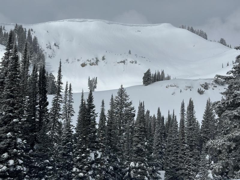
Today, the avalanche danger is MODERATE across all mid and upper-elevation steep slopes for wind-drifted snow (wind slab) avalanches. The strong northeast wind will create shallow, soft, or hard slabs of wind-drifted snow that could be sensitive to the weight of a rider. Human-triggered avalanches 1-2 feet deep are possible.
Out of the wind-drifted snow problem, you will find a LOW avalanche danger where 4-6 inches of new snow sits over a firm base.
Low
Moderate
Considerable
High
Extreme
Learn how to read the forecast here
Special Announcements
Support the UAC website rebuild by donating to our spring campaign. Save lives by making a donation today!
The UAC is proud to present "To the Hills & Back", a heart-wrenching documentary that delves into the lives of two backcountry skiers, Katie Combaluzier and Adam Campbell, who navigate through the aftermath of separate avalanche tragedies. This film is a testament to human endurance and the transformative power of adversity. Watch it here.
Weather and Snow
Under cloudy skies, it's snowing in some locations of the Logan Mountains. Beaver Mountain web cam shows the situation. This brings snow totals for the past 48 hours to roughly 4-6 inches of new snow (0.30-0.90 swe). Mountain temperatures range from 15-22 °F. Winds from the northeast are blowing 15-25 mph, gusting into the 30s across the upper elevations.
Today, as a closed low-pressure system parks and spins over Sin City we will see wrap-around moisture on a northeasterly flow. Clouds will be streaming overhead and in some areas there will be bands of snowfall at times. Unfortunately, nothing good ever comes from an easterly flow. The National Weather Service has announced a high wind warning for areas of northern Utah. The northeast wind could reach speeds of 20-30 mph or greater with gusts into the 30s and 40s by this afternoon.
Recent Avalanches
No new avalanches were reported to the UAC. Check out all local observations and avalanches HERE.
Ad
Avalanche Problem #1
Wind Drifted Snow
Type
Location
Likelihood
Size
Description
The northeast wind is currently blowing 15-25 mph gusting to 40 on Logan Peak and could reach higher speeds later today. This wind, combined with 4-6 inches of new snow, will create shallow, soft, or hard slabs of wind-drifted snow (wind slabs). Human-triggered avalanches 1-2 feet deep will be possible on wind-loaded slopes.
The tricky part: Northeast wind is not our typical loading pattern. In fact, the wind hardly ever blows from this direction. So, be on guard for unusual loading patterns, look for snow drifted by the wind, and avoid those areas. Remember wind-drifted snow can look wavy, pillowy, or sound hollow like a drum (See picture. Can you spot the wind-drifted snow?).
The excellent news: Lose the wind and lose the problem. Outside of slopes being loaded by the wind, you will find a LOW avalanche danger. Yesterday, we rode miles of terrain in the meadows and had a blast.
General Announcements
-National Forest Winter Recreation Travel Maps show where it's open to ride: UWCNF Logan, Ogden LRD Tony Grove, Franklin Basin CTNF Montpelier
-Listen to your very own Logan Zone avalanche forecasters on the UAC Podcast HERE.
-Read Toby's blog about wind, drifting, and avalanches HERE.
-Sign up for forecast region-specific text message alerts. You will receive messages about changing avalanche conditions, watches, and warnings...HERE.
-For all questions on forecasts, education, Know Before You Go, events, online purchases, or fundraising, call 801-365-5522.
-To report an avalanche or submit an observation from the backcountry, go HERE.
-Come practice companion rescue at the Franklin Basin TH Beacon Training Park. It's free and open to everyone. For easy user instructions, go HERE.
-Trent will update this forecast by 7:30 AM tomorrow.
This forecast is from the U.S.D.A. Forest Service, which is solely responsible for its content. This forecast describes general avalanche conditions, and local variations always occur.