Rain is saturating the low-elevation snow, but it is snowing up higher. A few inches of heavy new snow should stick pretty well to the crusty old snow surface and do wonders for riding conditions. Wet avalanches are possible at lower elevations, but the new snow will not change avalanche conditions much higher in the mountains. People may encounter shallow and soft wind slabs in exposed upper-elevation terrain later in the day on slopes where more than expected new snow accumulates, but lower-angled terrain will offer much better conditions.
The wind is blowing from the east-southeast this morning around 20 mph at the 9700' CSI Logan Peak weather station, and it's 27° F. At 9500' on Paris Peak, it’s 25° F, and winds are blowing 5 to 10 mph from the southeast.
The Tony Grove Snotel at 8400' reports 31° F and an inch of new snow. The station reports 72 inches of total snow, containing 115% of the average SWE (Snow Water Equivalent).
The National Weather Service has issued a
Winter Weather Advisory continuing through Saturday evening. Today, expect snow in the mountains, with 3 to 5 inches of accumulation possible on upper-elevation slopes. Rainfall should change to snowfall this afternoon down lower. High temperatures at 8500' are expected to be around 33° F, with 10 mph winds blowing from the southeast this morning, but coming around from the west this afternoon.
Snow is expected to continue in the higher elevations tomorrow, with 1 to 3 inches of accumulation possible. Mountain temperatures are expected to top out at around 26° F, and winds from west-northwest are expected to continue, blowing in excess of 20 mph.
Light snowfall will continue through Sunday and Sunday night with little in the way of accumulation expected. Heavier snow is expected again on Monday, with 3 to 7 inches of accumulation possible.
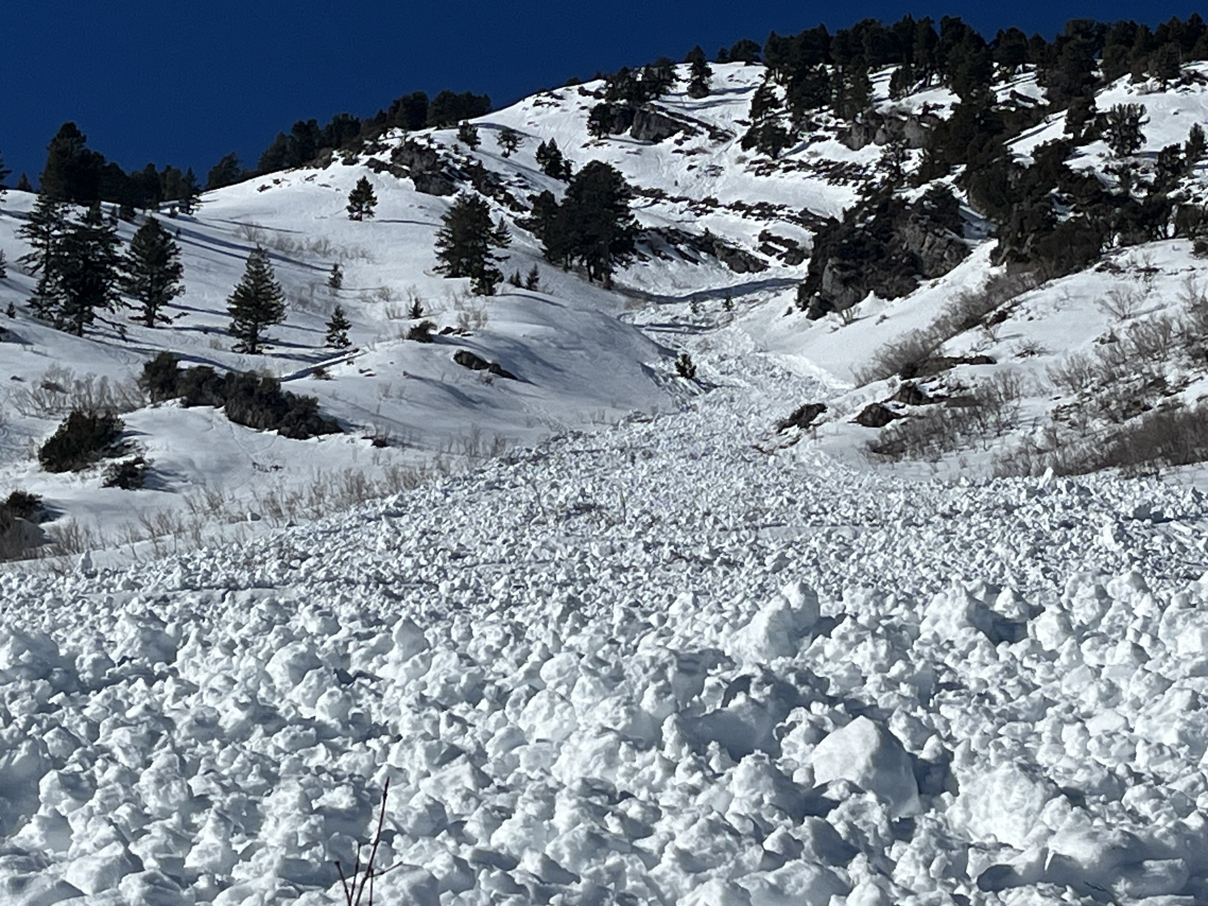
A natural wet loose and hard slab avalanche cycle occurred Sunday due to rapid warming. The wet activity mainly occurred on south-facing slopes at all elevations, and some large slab avalanches failed on the December persistent weak layer.
- Evidence of a large natural wet avalanche was observed Tuesday on Mitton Peak in the Wellsville Mountain Wilderness. The avalanche, visible from Highway 89/91, started at around 8400' in elevation on a southeast-facing slope and ran around 2000 vertical feet.
- A very large natural wet avalanche was witnessed by a professional observer in Green Canyon a little after noon on Sunday. see the report
- A large avalanche on Wilderness Peak near Gibson Lakes in Franklin Basin was either naturally occurring or remotely triggered by riders on Sunday. It was reported on Monday by riders who noticed recent sled tracks in the area. report is here
Tuesday's wet avalanche on Mitton Peak entrained a large pile of heavy debris and ran around 2000 vrt'
Check out local observations and avalanches
HERE.