UDOT PLANNED AVALANCHE CLOSURES!!

Forecast for the Logan Area Mountains

Toby Weed
Issued by Toby Weed for
Monday, February 13, 2023
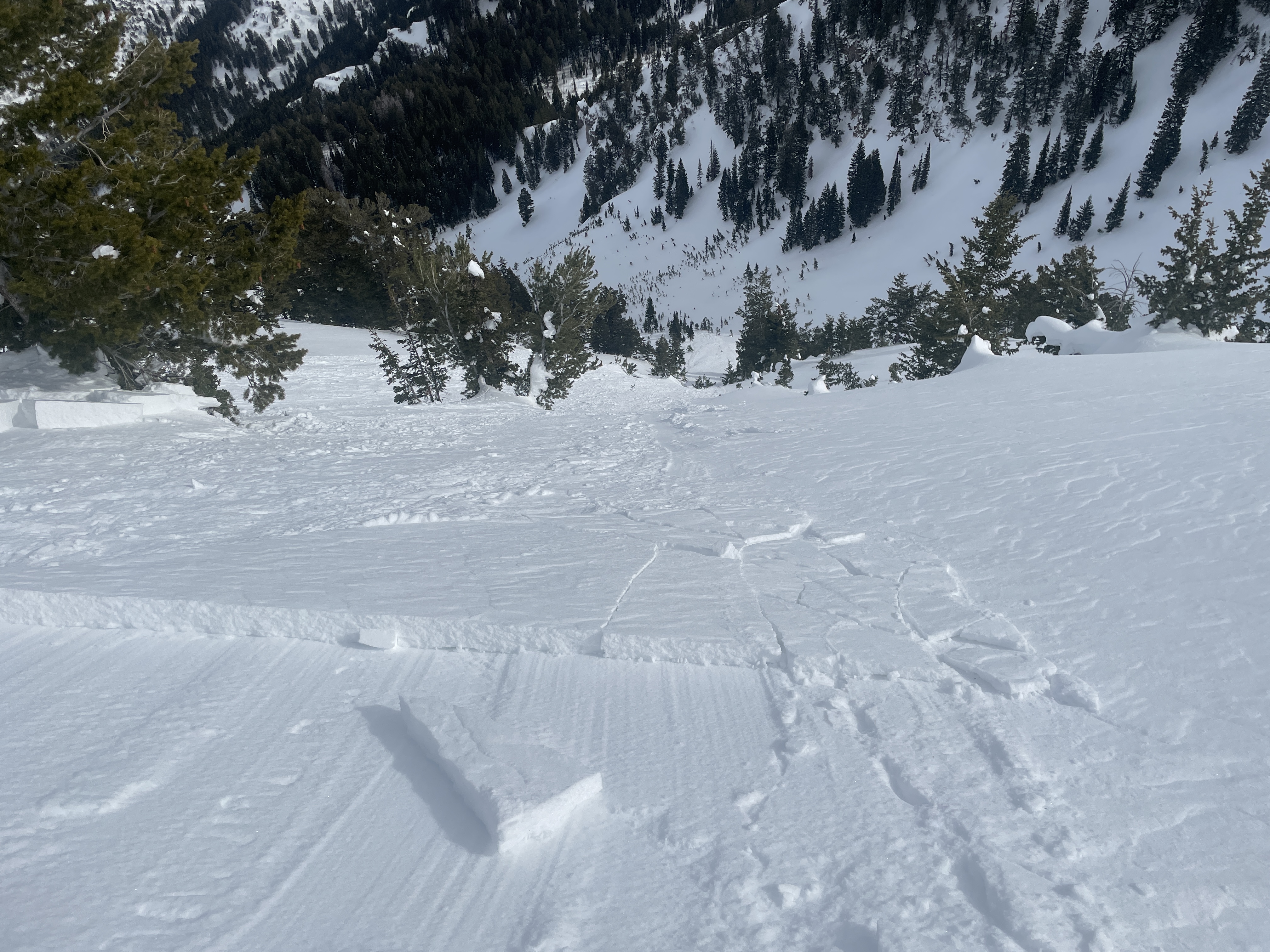
The avalanche danger is LOW in the backcountry. Stable snow conditions are found on most slopes and avalanches are unlikely. However, people still might trigger small slab avalanches on isolated drifted slopes steeper than 30°.
  • Use normal caution, go one at a time and keep and eye on your backcountry partners. Regularly check all of your rescue equipment and practice using it with your companions.
  • Heavy snow and drifting from strong west winds from a quick hitting winter storm tonight and tomorrow will elevate the avalanche danger.
  • Very low wind chill values will create dangerously cold conditions in the mountains tonight and tomorrow.
Low
Moderate
Considerable
High
Extreme
Learn how to read the forecast here
Weather and Snow
We've been finding really good shallow powder conditions in sheltered northerly terrain and on lower angled slopes, especially at mid and lower elevations. But it's getting a bit sparse, and it's time for a refresh. Winds last week damaged the powder in exposed terrain and on many upper elevation slopes, and sun melted and crusted the surface in sunny terrain.
Winds at the 9700' CSI Logan Peak weather station are blowing from the southwest at 18 mph this morning. The Tony Grove Snotel at 8400' reports 29° F and just under 8 feet, (95 inches) of total snow.

Today, we'll see increasing clouds and southwesterly wind speeds, with high temperatures at 8500' around 28°F.
Tonight, expect snow to fall heavily at times, with 5 to 9 inches of accumulation and widespread areas of blowing snow in the early morning hours. Low temperatures around 2° F and strong and gusty winds from the west-northwest will drive wind chill values as low as -18° F.
Tomorrow, snow and drifting or blowing snow are expected to continue in the morning, with 3 to 7 inches of additional accumulation possible. High temperatures around 13° F, and gusty west winds will create wind chill values around -21°F
Expect snow to taper off Tuesday, with gradual clearing, some sun, and continued cold weather through the work week.
Recent Avalanches
Saturday, skiers near Logan Peak in Mill Hollow remotely triggered a 8" deep and 60' wide wind slab avalanche that ran around 500 vrt'. Report is HERE

For a list of avalanches in the Logan Zone go HERE
Find a list of all recent observations & avalanches from across Utah HERE.
Ad
Avalanche Problem #1
Wind Drifted Snow
Type
Location
Likelihood
Size
Description
Significant drifting occurred last week, elevating avalanche danger in exposed terrain. Some hard and soft wind slabs formed on weak surface snow and may still be unstable. Although unlikely, avalanches could still be triggered remotely or from a distance.
  • Avoid corniced slopes and stiffer drifts on steep slopes near ridges and in and around terrain features like cliff bands, sub-ridges, mid-slope break-overs, and gully walls.
Avalanche Problem #2
Normal Caution
Type
Location
Likelihood
Size
Description
  • Always follow safe travel protocols in the backcountry. Go with a partner, but travel one at a time through avalanche terrain.
  • Get in the habit of checking and practicing with you beacon, probe, and shovel. Use our beacon training park at the Franklin Basin Trailhead.
  • Dangerously cold temperatures, blowing snow, and chill values around -20° F are expected in the mountains tonight and tomorrow.
Additional Information
Skiers remotely triggered this avalanche of wind drifted snow in Mill Hollow yesterday. The avalanche ran around 500 vrt' and would have been a dangerous ride if anyone had been caught. People could trigger similar avalanches on drifted upper elevation slopes today.
General Announcements
  • Please submit your observations from the backcountry HERE.
  • For a list of avalanche classes from the Utah Avalanche Center go HERE
  • For information on where you can ride your sled or snowbike, check out this map of the winter travel plan for the Logan and Ogden Ranger Districts HERE, and a close up of the Tony Grove and Franklin Basin Areas HERE.
This forecast is from the U.S.D.A. Forest Service, which is solely responsible for its content. This forecast describes general avalanche conditions and local variations always occur.