Forecast for the Logan Area Mountains

Toby Weed
Issued by Toby Weed for
Monday, February 11, 2019
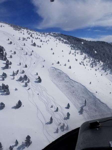
CONSIDERABLE: Areas with dangerous avalanche conditions exist on drifted upper and mid-elevation slopes. Beware of large unstable cornices and slopes overloaded by wind drifted snow. Dangerous human triggered avalanches consisting of wind drifted snow and failing on a buried persistent weak layer remain likely in some places. You can find safer conditions and nice powder at lower elevations, in sheltered terrain, and on lower angled slopes.
  • Make conservative decisions and evaluate snow and terrain carefully.
  • Avoid and stay out from under large ridge-top cornices and steep slopes with recent or previous deposits of wind drifted snow.
Low
Moderate
Considerable
High
Extreme
Learn how to read the forecast here
Weather and Snow
Dangerous conditions exist in drifted upper and mid-elevation slopes, but you can find nice snow and safer conditions at lower elevations, in sheltered terrain, and on lower angled slopes.
Drifting was significant over weekend from strong south winds.
The Tony Grove Snotel at 8400' reports 7 inches of light snow from yesterday, with .4" SWE. It's 5º F this morning and there's 76" of total snow containing 97% of average SWE for the date. It's -2º F, at the 9700' CSI Logan Peak weather station. West winds are currently averaging around 26 mph, with gusts around 36 mph.
High pressure moving into the Great Basin will bring dry conditions to Utah through early Wednesday. The active weather pattern will return to northern and western Utah for the latter half of the week.
Today in the Logan Zone, it'll be windy and mostly cloudy in the mountains, with 2 to 4 inches of snow possible. High temperatures at 8500' expected to be around 21º F, and increasing west-southeast winds, 26 to 31 mph with gusts around 45 mph. Wind chill values of -11º F. Tonight, temperatures will be around 14º F and 23 to 30 mph west-southwest wind with gust of 44 mph will cause wind chills around 12º F below zero. It'll be mostly sunny tomorrow, with high temperatures around 25º F and 22 to 24 mph southwest winds, with 40 mph gusts.
Recent Avalanches
A snowmobile rider was buried and killed Thursday Evening in a large avalanche east of Beaver, UT near Circleville Mountain. Report is.....HERE
A rider was buried and killed on Saturday in the Chalk Creek Area of the Western Uintas, northeast of Coalville. Preliminary Report is HERE

Friday, heli-ski guides remote triggered a large hard slab avalanche failing on a buried persistent weak layer near the ground in the southern Bear River Range. The avalanche was on a northwest facing slope at around 8400' in elevation... report is HERE
Ad
Avalanche Problem #1
Wind Drifted Snow
Type
Location
Likelihood
Size
Description
Dangerous conditions exist on drifted upper and mid-elevation slopes. Human triggered avalanches, 1 to 3 feet deep and large cornice falls are likely today. Cornices are likely to break much further back than expected and could be quite large. You could encounter fresh, soft wind slabs or stiff harder old drifts that allow you to get out on them before releasing. Avalanches and cornice falls are most likely at upper elevations on slopes facing north, northeast, and east, but possible on many upper and mid elevation slopes.
  • Avoid wind drifted snow on the lee side of major ridges and in and around terrain features like sub-ridges, scoops, stringers, cliff bands, and gullies.
Avalanche Problem #2
Persistent Weak Layer
Type
Location
Likelihood
Size
Description
Avalanches of wind drifted snow could fail on a buried persistent weak layer. Frost or feathery surface hoar and thick and thinner layers of small-grained near surface facets plagued the snow surface on many slopes before the Superbowl Storm. These are notorious persistent weak layers, and in some areas were buried intact, so the danger of avalanches failing on one will linger for a while.
Recent storms added a good deal of weight to slopes with poor snow structure and increased the danger of avalanches failing on a deeper persistent weak layer. Buried layers of loose, sugary, faceted snow have been reactivated in some areas. Dangerous, 2 to 4-foot-deep hard slab avalanches are possible for people to trigger, especially on steep, recently drifted slopes with poor snow structure.
  • It is possible to trigger a deep hard slab avalanche from a thin area of the slab.
  • In some areas you could trigger avalanches remotely or from a distance.
These loose faceted snow crystals are lurking in the lower snowpack on a west facing slope near Beaver Mountain, 2/10/19

Additional Information
I will update this forecast Wednesday morning.
The new weather station at the WSU Bloomington Canyon Yurt is up and running. Data available HERE
Now is a great time to practice companion rescue techniques with your backcountry partners. You should check out and use the new Avalanche Beacon Training Park we set up at the Franklin Basin trailhead. Special thanks to Northstars Ultimate Outdoors and USU Outdoor Program for helping us to make this possible.
General Announcements
The Beaver Mountain Backside is the backcountry, and it is avalanche terrain. Same goes for the steep rocky terrain adjacent to Cherry Peak Resort. If you leave a ski area boundary, you and your partners should carry and practice with avalanche rescue equipment and follow safe backcountry travel protocols.
Check out the improved weather links, road conditions, and weather links for each forecast region on the new UAC IOS App. Do you use the NOAA point forecast? If so, now you can bookmark your favorite weather locations in "My Weather" in the App. HERE
Are you new to the backcountry or looking to refresh your skills? The UAC has released a free 5-part avalanche skills eLearning series. HERE
If you would like to get the daily advisory by email you subscribe HERE.
Support the UAC through your daily shopping. When you shop at Smith's, or online at REI, Backcountry.com, Patagonia, NRS, Amazon, eBay by clicking on these links, they donate a portion of your purchase to the UAC. If you sell on eBay, you can have your See our Affiliate Page for more details on how you can support the UAC when you shop
Remember your information can save lives. If you see anything we should know about, please help us out by submitting snow and avalanche observations. HERE You can call us at 801-524-5304, email by clicking HERE, or include #utavy in your Instagram.
This forecast is from the U.S.D.A. Forest Service, which is solely responsible for its content. The forecast describes general avalanche conditions and local variations always occur.