Forecast for the Logan Area Mountains

Toby Weed
Issued by Toby Weed for
Thursday, December 6, 2018
MODERATE: Dangerous human triggered avalanches are possible, and heightened avalanche conditions exist and on shady upper elevation slopes that had snow before Thanksgiving. Triggered avalanches involving wind drifted snow are also possible at upper elevations. The snow is much more stable and you can find very nice powder conditions elsewhere.
  • Evaluate snow and terrain carefully, use safe travel protocols.
Low
Moderate
Considerable
High
Extreme
Learn how to read the forecast here
Special Announcements
Thanks for your support of avalanche awareness and education in the Logan Area. Thanks to you our 15th Annual Pray for Snow Party and Fundraiser was a big success!
Weather and Snow
The Tony Grove Snotel at 8400' reports 3" of new snow with .4" SWE in the last 24 hours. It's 20º F and there's 38"of total snow, containing 116% of average SWE for the date. It's 17º F at the 9700' CSI Logan Peak weather station and southwesterly winds moderated overnight, currently blowing around 10 mph.
Expect partly sunny conditions in the mountains, with high temperatures at 8500' around 22º F and 5 to 10 mph east wind, veering south in the evening. Low temperatures around 12º F are expected tonight, with mostly cloudy skies and 7 mph east wind. It'll be mostly sunny tomorrow, with a high temperature around 22º F and 8 mph east wind, veering west in the afternoon.
High pressure will build into the area for the weekend and into early next week.
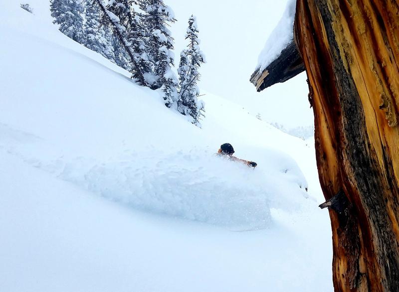
You can find very nice powder in the Logan Zone these days, but heightened avalanche conditions exist on upper elevation slopes that held snow before the Thanksgiving storm. Dangerous human triggered avalanches 2 to 3 feet deep remain possible. There is much less danger and excellent powder conditions where is no old pre-Thanksgiving snow, but you'll need to watch for fresh wind drifts in steep terrain.
Recent Avalanches
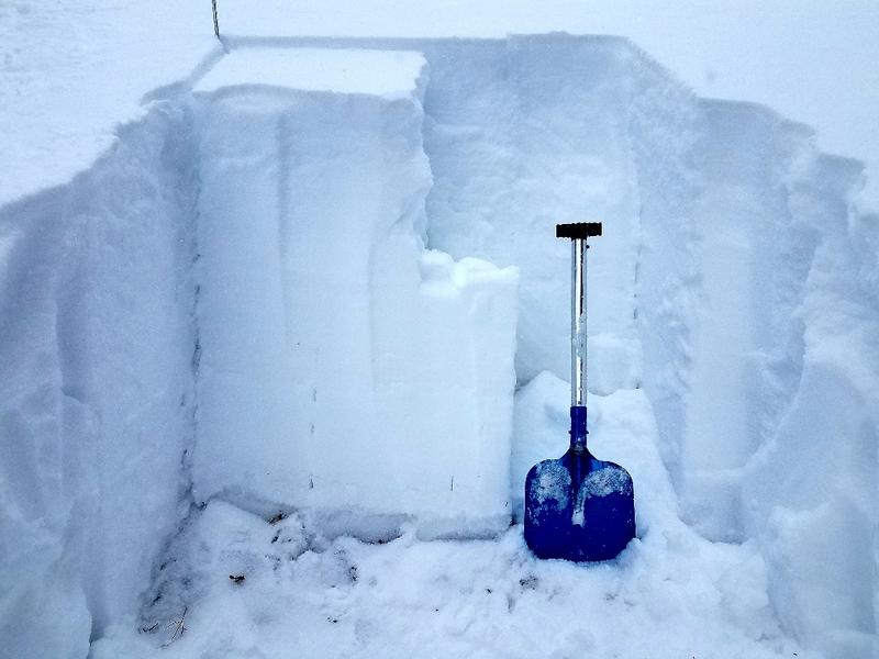
No new avalanches were reported in the Logan Zone since a natural cycle at upper elevations on Thanksgiving weekend. We could see evidence of some natural loose sluffs from the weekend in the Wood Camp Area.
Ad
Avalanche Problem #1
Persistent Weak Layer
Type
Location
Likelihood
Size
Description
We've noted an increase in stability in the past few days, and weak snow from early November is now deeply buried at upper elevations. However, dangerous human triggered avalanches running on a persistent weak layer are still possible in shady upper elevation terrain.
  • Dangerous deep slab avalanches are possible, but they're getting harder to trigger.
  • Very weak faceted snow pre-existed the Thanksgiving storm snow on shady upper and mid-elevation slopes.
  • The weak snow was fairly shallow in the Logan Zone, so resulting slab avalanches will likely be on smooth slopes or in pockets between rocky anchors and terrain features.
  • Collapsing and cracking indicate that the snow is unstable.
Shallow but loose faceted snow lurks under the Thanksgiving slab, and fresh powder is piling up on north facing slopes at upper elevations. (Flygare 12/5)
Avalanche Problem #2
Wind Drifted Snow
Type
Location
Likelihood
Size
Description
  • Even small avalanches can be very dangerous with shallow, early season snow cover. You could get dragged through rocks or deadfall if you get caught and carried.
  • West-southwest winds were able to drift snow around yesterday, and wind slab avalanches involving drifted snow are possible on steep exposed slopes.
  • Avoid recently drifted snow in steep terrain.
General Announcements
The Tony Grove Road is open but not maintained for winter travel of wheeled vehicles.
Beaver Mountain is glad to allow non-motorized uphill traffic. You can find generally safe conditions in lower angled terrain, and help pack out the ski hill. Nice powder conditions and good coverage were reported from over the weekend. Remember, before it opens, Beaver Mountain is the backcountry.
Now is a great time to practice companion rescue techniques with your backcountry partners. Here is our practice video.
Remember your information can save lives. If you see anything we should know about, please help us out by submitting snow and avalanche observations. HERE You can call us at 801-524-5304, email by clicking HERE, or include #utavy in your Instagram.
This advisory is from the U.S.D.A. Forest Service, which is solely responsible for its content. This advisory describes general avalanche conditions and local variations always occur.