Donate to the 2024 Spring Campaign to help rebuild the UAC website.

Forecast for the Logan Area Mountains

Toby Weed
Issued by Toby Weed for
Wednesday, December 5, 2018
MODERATE: Heightened avalanche conditions exist and dangerous human triggered avalanches are possible on shady upper elevation slopes that had snow before Thanksgiving. Triggered avalanches involving wind drifted snow are also possible at upper elevations. The snow is much more stable and there are very nice powder conditions elsewhere.
  • Evaluate snow and terrain carefully, use safe travel protocols.
  • Be sure everyone in your party has working safety equipment, and practice avalanche rescue techniques with your partners.
Low
Moderate
Considerable
High
Extreme
Learn how to read the forecast here
Special Announcements
Join us on Wednesday December 5th to celebrate the coming of winter! Our 15th Annual Pray for Snow Party and Fundraiser is at The Cache with music from Two Headed Trout, pizza from Lucky Slice, beverages from Moab Brewery, and a raffle and silent auction of amazing donated items. Thanks for your support of avalanche awareness and education. We look forward to seeing you! Tickets available online: CLICK HERE.
Weather and Snow
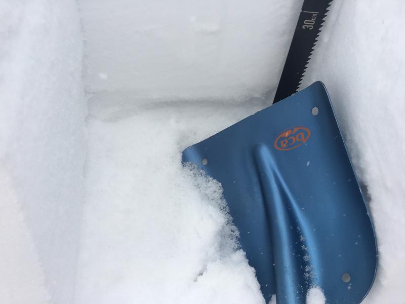
The Tony Grove Snotel at 8400' reports 15º F and there's 37"of total snow, containing 114% of average SWE for the date. It looks like it's snowing lightly in the mountains this morning. It's 14º F at the 9700' CSI Logan Peak weather station and a south wind is blowing around 25 mph.
A snow squall is moving northward through the zone this morning, and it may stall, bringing an inch or two of accumulation to Cache Valley and the surrounding mountains today. Expect cloudy conditions, with high temperatures at 8500' around 20º F and 10 mph southwest wind. Snow showers may continue into the evening, but little accumulation is expected overnight. Low temperatures around 13º F are expected with light and variable wind. Tomorrow will bring mostly cloudy skies, with high temperatures around 22º F and 10 mph southwest winds.
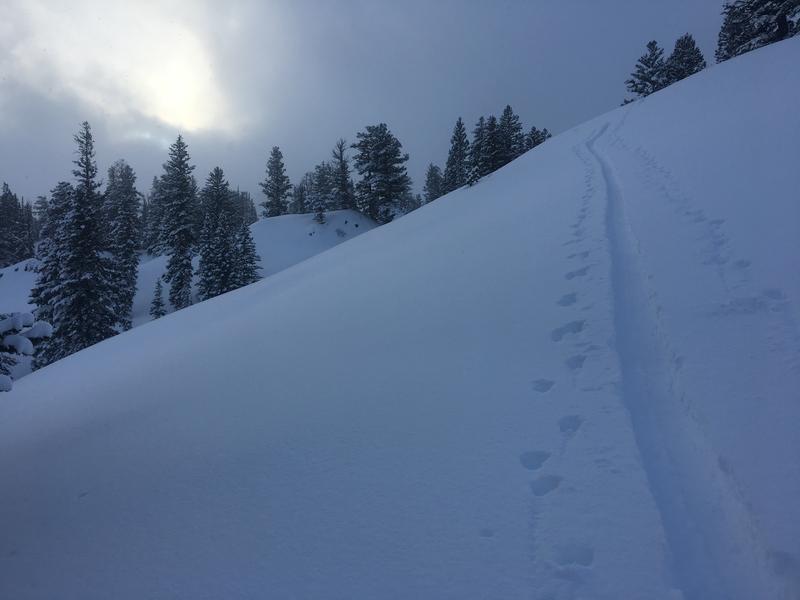
Areas with heightened avalanche conditions exist on upper elevation slopes that held snow before the Thanksgiving storm. Dangerous human triggered avalanches remain possible. Much less danger and excellent powder conditions exist where is no old pre-Thanksgiving snow, but you'll need to watch for fresh wind drifts in steep terrain.
Recent Avalanches
No new avalanches were reported in the Logan Zone since a natural cycle at upper elevations on Thanksgiving weekend. We could see evidence of some natural loose sluffs from Sunday in very steep terrain near Tony Grove Lake.
Ad
Avalanche Problem #1
Persistent Weak Layer
Type
Location
Likelihood
Size
Description
We've noted an increase in stability in the past few days, and weak snow from early November is now deeply buried at upper elevations. Dangerous human triggered avalanches running on a persistent weak layer are still possible in shady upper elevation terrain.
  • Dangerous deep slab avalanches are possible, but they'll be hard to trigger.
  • Very weak faceted snow pre-existed the Thanksgiving storm snow on shady upper and mid-elevation slopes.
  • The weak snow was fairly shallow in the Logan Zone, so resulting slab avalanches will likely be on smooth slopes or in pockets between rocky anchors and terrain features.
  • Collapsing and cracking indicate that the snow is unstable.
Shallow but loose faceted snow lurks under the Thanksgiving slab, and fresh powder is piling up on north facing slopes at upper elevations.
Avalanche Problem #2
Wind Drifted Snow
Type
Location
Likelihood
Size
Description
  • Even small avalanches can be very dangerous with shallow, early season snow cover. You could get dragged through rocks or deadfall if you get caught and carried.
  • South winds increased a bit overnight and wind slab avalanches involving drifted snow are possible on steep exposed.
  • Avoid recently drifted snow in steep terrain.
General Announcements
The Tony Grove Road is open but not maintained for winter travel of wheeled vehicles. Lots of folks made it up there over the weekend on sleds, and you won't get far if you try to drive up today.
Beaver Mountain is glad to allow non-motorized uphill traffic. You can find generally safe conditions in lower angled terrain, and help pack out the ski hill. Nice powder conditions and good coverage were reported from over the weekend. Remember, before it opens, Beaver Mountain is the backcountry.
Now is a great time to practice companion rescue techniques with your backcountry partners. Here is our practice video.
Remember your information can save lives. If you see anything we should know about, please help us out by submitting snow and avalanche observations. HERE You can call us at 801-524-5304, email by clicking HERE, or include #utavy in your Instagram.
This advisory is from the U.S.D.A. Forest Service, which is solely responsible for its content. This advisory describes general avalanche conditions and local variations always occur.