Get Your Ticket to the 32nd Annual Backcountry Benefit on September 11th! Support Forecasting, Awareness, and Education
Ad

Forecast: Logan Area Mountains

Forecast for the Logan Area Mountains

Toby Weed
Issued by Toby Weed on
Friday morning, December 27, 2019
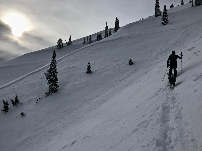
You can find stable snow and LOW avalanche danger on most slopes, especially in sheltered terrain and at mid and lower elevations. Areas with MODERATE danger exist on some upper elevation slopes, and you might trigger an avalanche of wind drifted snow. It is increasingly unlikely for a person to trigger a dangerous avalanche failing on a persistent weak layer near the ground, but it's still possible on an isolated upper elevation rocky or thin slope facing northwest through east.
  • Evaluate snow and terrain carefully.
Low
Moderate
Considerable
High
Extreme
Learn how to read the forecast here
Weather and Snow
It's 15°F at the 8400' Tony Grove Snotel this morning. An inch of light snow fell yesterday and there's 45 inches of total snow, with 107% of average SWE for the date. It's 11°F on Logan Peak, and a fairly light wind is blowing from the east-southeast this morning around 8 mph.
Light easterly winds this morning will veer from the northwest and strengthen a bit in the afternoon. The avalanche danger is Low and the snow is stable on most slopes in the Logan Zone, but heightened conditions persist on some
isolated upper elevation slopes. People should continue to avoid very steep rocky slopes with thin snow cover.
It will be sunny in the mountains with 8500' high temperatures around 22°F and wind chills around -2°F. East wind 6 to 8 mph becoming north-northwest in the afternoon. It will be partly cloudy tonight, with low temperatures around 2°F, and 9 to 11 mph north-northwest wind causing wind chill around -13°F. It should be partly sunny tomorrow with high temperatures near 15°F, north-northwest wind around 11 mph and wind chill values around -8°F.
Recent Avalanches
No new avalanches were reported in the Logan Zone since the mid December Storm.

We checked out a large natural avalanche in the Central Wood Camp Bowls. (12-17-19)
Ad
Avalanche Problem #1
Wind Drifted Snow
Type
Location
Likelihood
Size
Description
Human triggered avalanches involving wind drifted snow are possible on some upper elevation slopes. East winds will veer from the north-northwest this afternoon and increase a bit, drifting loose snow into upper elevation deposition zones.
  • Even small avalanches can be quite dangerous in shallow snow conditions.
  • Watch for and avoid stiffer drifted snow in and around terrain features like cliff bands, scoops, gully walls, and sub-ridges.
  • While soft, fresh drifts may be quite sensitive, harder wind drifts might allow a person to get well out on them before releasing.
Avalanche Problem #2
Persistent Weak Layer
Type
Location
Likelihood
Size
Description
Weak sugary, faceted snow from late October still lurks near the ground at upper elevations on northwest through east facing slopes. Although the deep persistent weak layer is currently dormant and it is unlikely for a person to trigger one, large and destructive avalanches, 2 to 4 feet deep are still possible on isolated slopes with poor snow structure. Deep slab avalanches might be triggered from a shallower area of the slab, so it's a good plan to avoid steep, thin, rocky terrain.
General Announcements
Thanks to the generous support of our Utah ski resorts and Ski Utah, we have discount lift tickets available. All proceeds from these go towards paying for avalanche forecasting and education! Get your tickets HERE.
EMAIL ADVISORY. If you would like to get the daily advisory by email you subscribe HERE.
Remember your information can save lives. If you see anything we should know about, please help us out by submitting snow and avalanche observations....HERE. You can also call us at 801-524-5304, email by clicking HERE, or include #utavy in your tweet or Instagram.
This forecast is from the U.S. Forest Service, which is solely responsible for its content. This forecast describes general avalanche conditions and local variations always occur. I will update this advisory before about 7:30 tomorrow morning.