Forecast for the Logan Area Mountains

Issued by Toby Weed on
Sunday morning, December 15, 2019
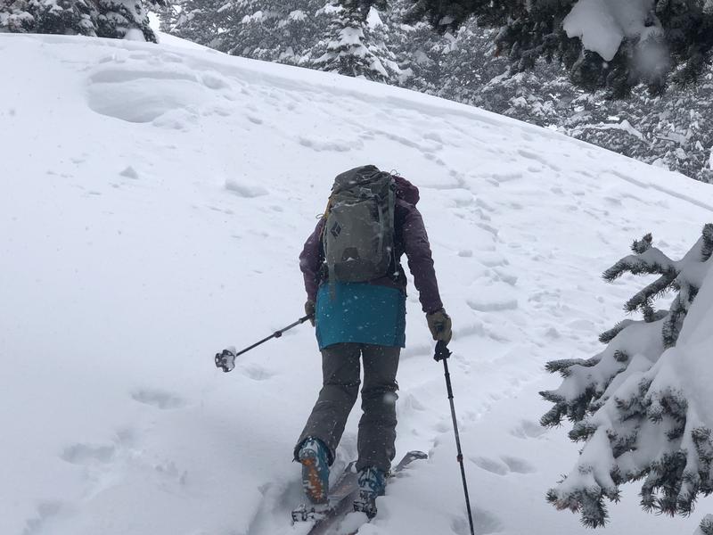
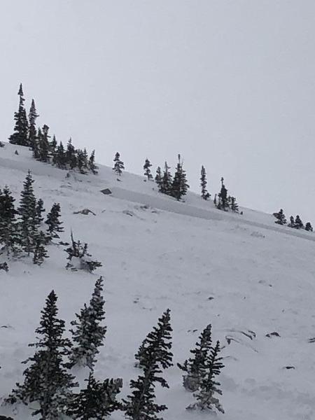
Heavy snow and strong westerly winds created dangerous avalanche conditions and CONSIDERABLE danger in the backcountry. Human triggered avalanches of wind drifted snow are likely, and avalanches involving new snow are possible on many slopes. More dangerous conditions exist on drifted upper elevation slopes facing northwest, north, northeast, and east, with large avalanches failing on a persistent weak layer near the ground possible. You can find safer options on slopes less steep than about 30 degrees and in lower elevation, sunny, and sheltered terrain.
- Continue to avoid steep wind-drifted slopes.
- Evaluate snow and terrain carefully. Use caution while route finding, and make conservative decisions.

Low
Moderate
Considerable
High
Extreme
Learn how to read the forecast here
Special Announcements
Beaver Mountain is closed to uphill traffic and all public use for set-up until opening day on Tuesday.
Weather and Snow
It's 7°F at the 8400' Tony Grove Snotel this morning, and there is about 9 inches of new snow, with .8" SWE in the past 24 hours and 4.2" of SWE so far from the storm. I'm reading 55 inches of total snow at the site. It's 5°F at the 9700' CSI Logan Peak weather station, and westerly winds are blowing about 14 mph.

Several people reported triggering small soft slab avalanches involving new snow yesterday (12-14-19).
Expect cloudy conditions in the mountains today, with 8500' high temperatures around 15°F, 5 to 9 mph west-northwest winds, and wind chills around -3°F. Snow showers are possible this evening, with mostly cloudy skies, low temperatures around 6°F, 9 mph west-northwest winds, and wind chills around -7°F. It will be mostly cloudy on Monday, with high temperatures around 14°F in the morning, falling to around 8°F in the evening, 9 mph west-northwest winds, and wind chills around -4°F. Dangerous avalanche conditions exist on drifted upper and mid elevation slopes.
Recent Avalanches
Friday in the Wasatch Mountains above Salt Lake City, a backcountry party had a very close call near Brighton in a backcountry area called Figure 8 Hill. A skier triggered and was caught and carried in a reported 3' deep and 100' avalanche that broke near the ground into the old weak early season snow. The skier came to rest with his head sticking out of the snow, but he had suffered a dislocated shoulder. Report is HERE

Locally:
-A few parties reported triggering small and manageable avalanches of new snow, some even in fairly gentle terrain.
-Two riders were caught and carried, and one of them was partially buried in an avalanche just north of the Idaho State Line last Saturday afternoon 12-7-19. Here's the Report
Avalanche Problem #1
Wind Drifted Snow
Type

Location

Likelihood

Size

Description
Human triggered avalanches involving wind drifted snow are likely today. Avoid steep slopes with recently drifted snow.
- Watch for and avoid stiffer drifted snow in and around terrain features like cliff bands, scoops, gully walls, and sub-ridges.
- Drifted snow often appears smooth and chalky, and it can be hollow sounding like a drum.
- Soft, fresh wind slabs are often quite sensitive, while harder wind slabs can be devious, sometimes allowing a person to get out on them before releasing.
Avalanche Problem #2
New Snow
Type

Location

Likelihood

Size

Description
On some slopes the new snow did not stick very well to the warm snow that was on the surface last week. Loose snow and soft slab avalanches consisting of storm snow are possible on steep mid and upper elevation slopes today, but the fresh snow will continue to settle and it should become stable pretty quickly today.
- Even small avalanches can be very dangerous in shallow snow conditions, because you could be dragged into rocks or stumps.
-
Cracking and collapsing are red flags indicating unstable snow conditions.
Avalanche Problem #3
Persistent Weak Layer
Type

Location

Likelihood

Size

Description
Very weak sugary, faceted snow from late October lurks near the ground at upper elevations on shady northerly facing slopes. Large, destructive, and very dangerous avalanches are possible where this poor snow structure exists. Dangerous avalanches on some slopes could be triggered remotely, from a distance, or below!

General Announcements
The Tony Grove Road is not maintained for wheeled vehicles in the winter.
Thanks to the generous support of our Utah ski resorts and Ski Utah, we have discount lift tickets available. All proceeds from these go towards paying for avalanche forecasting and education! Get your tickets HERE.
Consider taking an avalanche class, there are many different options. Click on the Education menu for a full list of classes from the UAC and other providers. Check out the Know Before You Go eLearning program for free, online, avalanche classes.... HERE
Need a Christmas present for your favorite backcountry partner? Get one of these cool t-shirts to support the UAC and other avalanche centers across the U.S. HERE
It's key to head into the early avalanche season with the proper mindset. In this podcast, we talk with UAC program director Bo Torrey. Bo talks about particular risks unique to the early season, tips and tricks for knocking the rust off your early season rescue skills, and charts out the path forward with avalanche education. HERE
EMAIL ADVISORY. If you would like to get the daily advisory by email you subscribe HERE.