Forecast for the Logan Area Mountains

Toby Weed
Issued by Toby Weed for
Thursday, November 22, 2018
Accumulating snow will cause rising avalanche danger today on slopes with previous snow cover. The danger will rise to Moderate on upper elevation north facing slopes. You could trigger new snow avalanches, especially in smooth terrain.
Low
Moderate
Considerable
High
Extreme
Learn how to read the forecast here
Special Announcements
Join us on Wednesday December 5th to celebrate the coming of winter! Our 15th Annual Pray for Snow Party and Fundraiser is at The Cache with music from Two Headed Trout, pizza from Lucky Slice, beverages from Moab Brewery, and a raffle and silent auction if amazing donated items. Thanks for your support of avalanche awareness and education. We look forward to seeing you! Tickets available online: CLICK HERE.
Weather and Snow
The Tony Grove Snotel at 8400' reports 6 inches of total snow containing only 32% of average Snow Water Equivalent (SWE) for the date. South winds increased overnight at the CSI Logan Peak weather station and are blowing 30 mph with gusts near 50 mph this morning. Shallow snow cover exists in shady terrain at upper elevations, but there is not enough to ski or ride on. A potent Pacific storm will bring significant snowfall to northern Utah over the Thanksgiving weekend. The first wave of storminess will impact the area today, as a weakening, moist and mild trough crosses the zone. Snow will fall in the mountains and perhaps down in Cache Valley as well, although the rain/snow line may remain around the benches. Expect increasing snowfall intensity this afternoon and several inches of accumulation on upper elevation slopes. A short-lived break in the storm is likely tonight, but warm advection will get snowfall rolling again on Friday. A colder, windy trough will move over the zone late Friday, lasting into Saturday and bringing significant snow accumulations to the mountains and some snow down to the valley floor. Two or three feet of new snow is possible on upper elevation slopes by Sunday
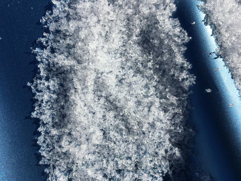
The shallow snow that remains on north facing slopes at upper elevations is plagued by loose, sugary faceted snow.
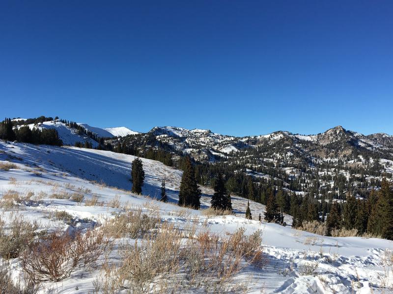
Looking northwest across Beginner Bowl at the Naomi Peak area west of Tony Grove Lake, 11-19-18. The weak snow is shallow at upper and mid elevations in the Logan Zone. A strong Pacific storm will bring significant accumulating snow over the Thanksgiving weekend.
Ad
Avalanche Problem #1
New Snow
Type
Location
Likelihood
Size
Description
Shallow and very weak faceted snow exists on shady upper and mid elevation slopes. Slopes that had snow cover yesterday will be suspect this afternoon as new snow piles up on preexisting weak snow.
Avalanche Problem #2
Persistent Weak Layer
Type
Location
Likelihood
Size
Description
The shallow snow currently on the ground in shady upper and mid elevation terrain is faceted and weak. Snow that has been on the ground for a while and is faceted like this often becomes a persistent weak layer at the very bottom of the snowpack after it is buried. The danger of persistent slab avalanches will increase later this weekend as heavy snow stacks up and is drifted onto the weak old snow in avalanche starting zones.
Additional Information
The Tony Grove Road is open but not maintained for winter travel of wheeled vehicles. It is quite icy currently in shady areas and on the upper section. Accumulations and drifting snow this weekend will likely make conditions serious, so be prepaired.....
General Announcements
Join the UAC for the 2nd Annual Ogden Backcountry Bash at The Front Climbing Gym in Ogden. Beer, pizza, silent auction, prizes, and climbing! November 29 6:30 PM - 9:30 PM The Front Climbing Club, 225 20th street, Ogden UT 84401
Utah State University Outdoors Program is hosting a Know Before You Go avalanche awareness clinic on Wednesday November 28th at 7pm at the OP Rental Shop. The event is FREE and open to the public.
Weber State University Outdoor Program just installed a new weather station at 7900' near their Bloomington Canyon Yurt in Bear Lake County Idaho. Stay tuned for useful weather data from this, as it will be made available to the public soon.