Get Your Ticket to the 32nd Annual Backcountry Benefit on September 11th! Support Forecasting, Awareness, and Education
Ad

Forecast: Logan Area Mountains

Forecast for the Logan Area Mountains

Toby Weed
Issued by Toby Weed on
Sunday morning, January 5, 2020
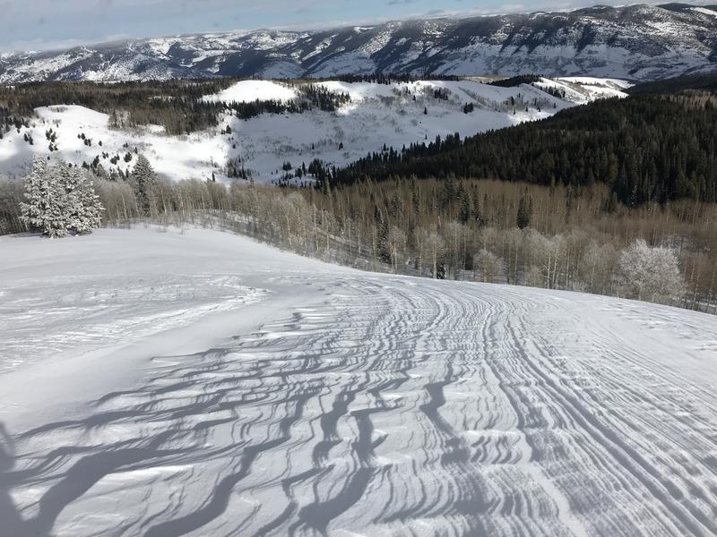
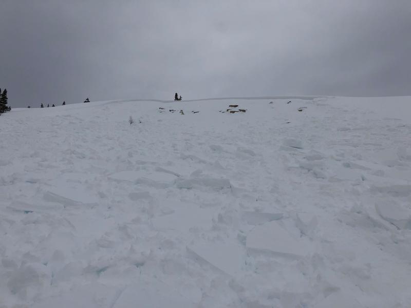
Heightened avalanche conditions exist in the backcountry, the danger is MODERATE, and human triggered avalanches are possible on drifted upper and mid elevation slopes.
  • Evaluate snow and terrain carefully.
Low
Moderate
Considerable
High
Extreme
Learn how to read the forecast here
Weather and Snow
It's 15°F at the 8400' Tony Grove Snotel this morning, and there is 52 inches of total snow, with 109% of average SWE for the date. It's 16°F at the CSI weather station at 9700' on Logan Peak, and southwest winds are currently blowing around 20 mph.
Strong westerly winds really messed with the nice powder at upper elevations and on exposed slopes. We found challenging riding and skiing yesterday in the Tony Grove Area, with nicer snow in sheltered terrain, in forested areas, and at lower elevations. Heightened avalanche conditions exist on drifted upper and mid elevation slopes, and people could trigger serious avalanches in the backcountry again today.
Sastrugi wave patterns caused by strong west winds stripping the snow off this nice northeast facing slope near Tony Grove Lake.

It will be mostly cloudy in the mountains today with 2 to 4 inches of snow likely this afternoon. Expect 8500' high temperatures around 25°F and west wind 11 to 18 mph. Snow will continue tonight, with another 2 to 4 inches likely, low temperatures expected to be around 11°F, rising to around 20°F during the night. It will be rather breezy, with 23 to 25 mph west winds. Snow showers will continue into tomorrow, with 1 to 3 inches of accumulation possible. Expect high temperatures around 20°F, drifting snow, and windy conditions, with 20 to 30 mph west winds.
Recent Avalanches
A close call occurred yesterday (1-4-2020) when a party of 4 riders triggered a sizable avalanche of wind drifted snow at about 9000' on an east facing slope in Corral Hollow, a couple miles north of the state line near Egan Basin out of Beaver Creek Canyon. The avalanche appears to be about 2' deep and around 100' wide. Details are limited...
Ad
Avalanche Problem #1
Wind Drifted Snow
Type
Location
Likelihood
Size
Description
Human triggered avalanches involving wind drifted snow are possible today, and some could be hard, large, and destructive.
  • Watch for and avoid stiffer drifted snow near ridge lines and in and around terrain features like cliff bands, scoops, gully walls, and sub-ridges.
  • Wind slabs are often rounded and chalky looking, and they might sound hollow, like a drum.
  • Soft fresh wind slabs can be quite sensitive, and are often remotely triggered. Hard wind slabs can be more devious, sometime allowing one to get out on them before releasing.
  • Avoid forming ridge top cornices, which can break much further back than expected and start avalanches on slopes below.
Avalanche Problem #2
Persistent Weak Layer
Type
Location
Likelihood
Size
Description
Human triggered avalanches failing on a newly buried persistent weak layer are possible on slopes steeper than about 30 degrees at upper and mid elevations. The cold weather last week created sugary weak surface snow in many areas, and some slopes were plagued by feathery surface hoar. A persitent weak layer associated with a thin sun-crust appears to be active on drifted sunny slopes in many areas across Northern Utah. Some avalanches today might be triggered remotely, from a distance or below. Some slopes in the area may stay unstable for a while.

Persistent weak layers consisting of feathery surface hoar and sugary near surface facets were buried by the New Years Storm on many slopes, and some of these may stay unstable for a while.

The sugary October persistent weak layer near the ground on northerly facing upper elevation slopes appears to be dormant for now, but it could be reactivated in some places by a new load of wind drifted snow. Dangerous hard slab avalanches might be triggered by smaller avalanches of wind drifted snow overrunning slopes with poor snow structure. It's unlikely that a person could trigger an avalanche on the Halloween weak layer these days because the snow above it is so deep and hard. No avalanches failing on this layer have occurred in the Logan Zone since the mid-December natural cycle, but the sugary faceted grains are still quite loose and weak on shady sloopes. If one was to hit a slope in the right place, a "sweet spot", like a thinner part of a the slab, or perhaps a steep rocky area or a convexity with thin snow cover, a large deep slab avalanche might be triggered.
General Announcements
Thanks to the generous support of our Utah ski resorts and Ski Utah, we have discount lift tickets available. All proceeds from these go towards paying for avalanche forecasting and education! Get your tickets HERE.
EMAIL ADVISORY. If you would like to get the daily advisory by email you subscribe HERE.
Remember your information can save lives. If you see anything we should know about, please help us out by submitting snow and avalanche observations....HERE. You can also call us at 801-524-5304, email by clicking HERE, or include #utavy in your tweet or Instagram.
This forecast is from the USDA Forest Service, which is solely responsible for its content. The forecast describes general avalanche conditions and local variations always occur.
I will update this forecast before about 7:30 tomorrow morning.