Forecast for the Logan Area Mountains

Paige Pagnucco
Issued by Paige Pagnucco for
Monday, January 22, 2024
The avalanche danger is CONSIDERABLE. Dangerous conditions exist, and people are likely to trigger avalanches failing on a widespread buried, persistent weak layer. Human-triggered avalanches are possible in low-elevation terrain.

Careful snowpack evaluation, cautious route finding, and conservative decision-making are essential for safe backcountry travel today. People should continue to avoid slopes steeper than 30°.
Low
Moderate
Considerable
High
Extreme
Learn how to read the forecast here
Special Announcements
Sign up for forecast region-specific text message alerts. You will receive messages about changing avalanche conditions, watches, and warnings...HERE.
Weather and Snow
We are in a tricky time as the snow slowly stabilizes and avalanche danger slowly decreases. Warning signs are fewer, but real potential exists to trigger an avalanche. We are still experiencing and getting reports of widespread collapsing due to poor snowpack structure on all aspects and elevations. Human-triggered avalanches are still likely and could be large and destructive. But there's a silver lining - with excellent coverage across the zone, it is easy to find safe terrain (slopes less than 30 degrees) to play on. With recent warm temperatures, low-elevation snow is damp and sticky. You'll need to get above 7500' to find drier snow.

Winds are blowing 10-20 MPH from the south-southwest this morning at the 9700' CSI Logan Peak weather station. At 9500' on Paris Peak, the wind is calm and it’s 21°F. The Tony Grove Snotel at 8400' reports 27° F and 81 inches of total snow containing 132% of normal SWE (Snow Water Equivalent).

We'll have a break in the weather today with mostly cloudy skies and a few flurries but little accumulation. Temperatures will remain warm with an 8800' high of 32° F and winds will be light from the south. We'll see unsettled weather for the rest of the week with gradually cooling temperatures and a few inches of snow. Sunshine is expected to return this weekend.
Recent Avalanches
We've received no reports of avalanches since 1/18/24.
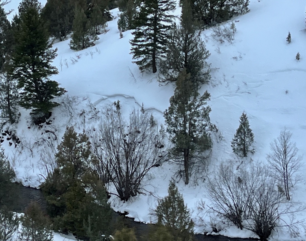
Over the weekend, we noticed this avalanche next to the river across from the Dugway that was likely remotely triggered last Thursday.

Check out local observations and avalanches HERE.
Ad
Avalanche Problem #1
Persistent Weak Layer
Type
Location
Likelihood
Size
Description
Today, human-triggered slab avalanches failing on a buried persistent weak layer could be large and life-threatening. During the last storm, heavy snowfall and drifting by winds from the west overloaded slopes plagued by widespread buried layers of weak, sugary snow or facets and feathery surface hoar that developed during the prolonged December dry spell.
  • Avalanches could be triggered remotely, from a distance, or worse, from below.
  • Collapsing or whumpfs and shooting cracks indicate unstable snow.
  • Avalanches are possible even when there are no obvious signs of instability.

  • Exposed slopes, where the wind drifted the heavy new snow, developed dangerous wind slabs that now are overloading buried persistent weak layers. Watch for and avoid stiffer drifted snow on the lee side of prominent ridges and in and around terrain features like sub-ridges, gully walls, mid-slope rollovers, and cliff bands.
  • ALSO - with unseasonably warm temperatures and rain, the low elevation snowpack is now saturated. Coupled with sitting on top of weak snow, it is possible to trigger an avalanche in unsuspecting terrain where the snow is deeper like the steep banks next to the Logan river.
Additional Information
On Thursday, Toby looked at a remotely triggered avalanche low on Beaver Mt. Backside.

Dangerous roof avalanches are likely due to the mild temperatures. Be sure to keep children and pets out from under snow-covered roofs.
Always follow safe travel protocols on or under slopes steeper than 30°.
  • Be sure everyone in your party has working avalanche rescue equipment, including a transceiver, probe, and shovel. Practice with this equipment regularly, and include and instruct new partners.
  • Cross avalanche paths and runout zones one person at a time, with the rest of the party watching from a safe place.
  • Reevaluate and be willing to change your plans if you encounter any signs of instability, like recent avalanches, audible collapses (whumpfs), or cracking in drifted snow.
General Announcements
-For all questions on forecasts, education, Know Before You Go, events, online purchases, or fundraising: call 801-365-5522.
-To report an avalanche or submit an observation from the backcountry: go HERE.
-We will update this forecast by 7:30 AM tomorrow.
This forecast is from the U.S.D.A. Forest Service, which is solely responsible for its content. This forecast describes general avalanche conditions, and local variations always occur.