Sign Up for the Utah Snow and Avalanche Workshop (USAW) on December 7th!

Forecast for the Logan Area Mountains

Toby Weed
Issued by Toby Weed on
Monday morning, January 2, 2023
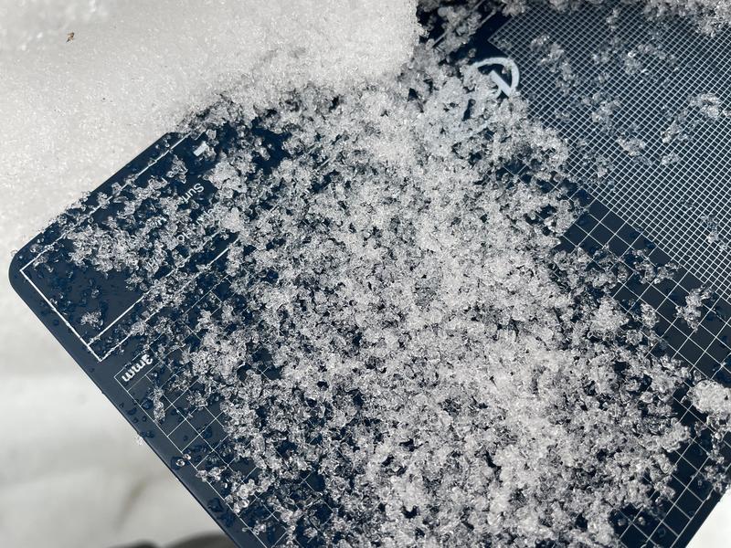
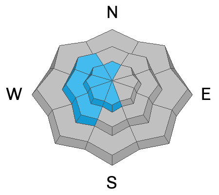
The danger is HIGH in the backcountry. People are likely to trigger large and dangerous avalanches, and naturally occurring avalanches could be long-running and destructive. Heavy new snow and drifting created slabs of unstable snow on slopes with a sugary persistent weak layer buried 2 to 4 feet deep. Dangerous avalanches could be triggered from a distance or below.
  • With very dangerous avalanche conditions in the backcountry, traveling in avalanche terrain is not recommended, and people should stay off and out from under slopes steeper than 30 degrees.
Low
Moderate
Considerable
High
Extreme
Learn how to read the forecast here
Avalanche Warning
What: The avalanche danger is HIGH.
When: In effect from 6 am this morning to 6 am Tuesday
Impacts: Very dangerous avalanche conditions exist. Natural and human triggered avalanches are likely on many slopes and may be triggered at a distance. Stay off of and out from under slopes steeper than 30 degrees.
Weather and Snow
We should be able to find great powder riding conditions in safe lower angled terrain and mountain meadows, but extra caution is required to stay off and out from under slopes steeper than 30° that could avalanche. Riding the lifts and skiing in bounds at Beaver Mountain, Cherry Peak, or one of the many other great options to our south is another good plan for people to avoid avalanche danger today.
Showery light snowfall will continue for today and tomorrow with little accumulation expected. Temperatures at 8,000' will drop to around 20° F and winds blowing out of the east this morning will shift and blow from the southwest this afternoon. It'll be mostly cloudy tonight, with low temperatures around 13° F and 10 to 15 mph wind from the southwest. Tomorrow's weather will be similar to today's, with cloudy skies, snow showers, but with slightly increased west-southwest winds.
Recent Avalanches
With a brief increase in visibility on Saturday morning, I noticed three very large new natural avalanches on the big east facing slopes in the Wellsville Range. Here's a picture of one in Gibson canyon:
Be sure to check out all observations HERE.
Ad
Avalanche Problem #1
Persistent Weak Layer
Type
Location
Likelihood
Size
Description
In many places, people who do not stay off and out from under slopes steeper than about 30° are likely to trigger large and dangerous avalanches failing on a deeply buried sugary persistent weak layer. Such an avalanche could be triggered remotely, from a distance or below. The persistent weak layer from November is now buried 2-4 feet deep, and any avalanche that fails on it will likely be hundreds of feet wide. We are still able to get consistent test results showing propagating tendencies in many of our test pits..
Avalanche Problem #2
New Snow
Type
Location
Likelihood
Size
Description
  • Cracking within the new snow is a obvious sign of unstable snow.
  • Of course, people should avoid and stay out from under all slopes with significant accumulations of drifted or heavy new snow.
Avalanche Problem #3
Wind Drifted Snow
Type
Location
Likelihood
Size
Description
East and northeast winds have been fairly strong at upper elevations in the last 24 hours or so, and this is a somewhat unusual wind direction for sustained winds to blow from. While calm conditions were observed in some areas, in others winds at upper and mid elevations drifted snow even as it fell yesterday, depositing slabs of stiffer snow in unusual or perhaps unexpected places and overloading slopes with poor snow structure that have up till now not seen a significant load. Here is a current wind reading from the CSI Logan Peak weather station at 9700'.
Additional Information
General Announcements
  • Remember, when you leave the ski area boundary, Beaver Mt or Cherry Peak, you are entering the backcountry, and you could trigger dangerous avalanches.
  • Please submit your observations from the backcountry HERE.
  • For a list of avalanche classes from the Utah Avalanche Center go HERE
  • For information on where you can ride your sled or snowbike, check out this map of the winter travel plan for the Tony Grove and Franklin Basin Areas HERE.
This forecast is from the U.S.D.A. Forest Service, which is solely responsible for its content. This forecast describes general avalanche conditions and local variations always occur.