Join us for the 17th Annual Professional Snow and Avalanche Workshop (PROSAW) on November 4 - Purchase tickets here!

Forecast for the Logan Area Mountains

Toby Weed
Issued by Toby Weed on
Friday morning, January 13, 2023
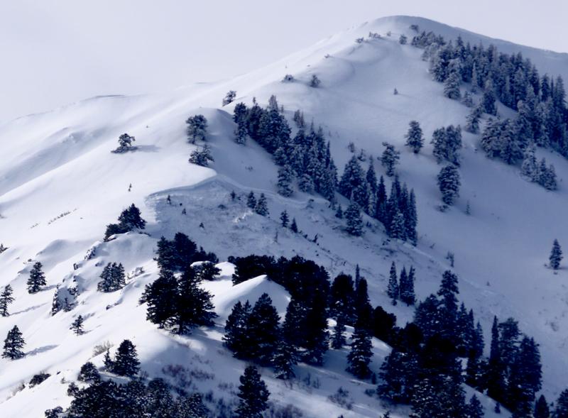
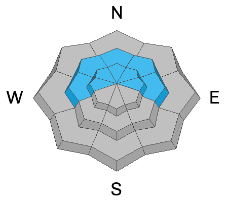
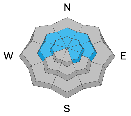
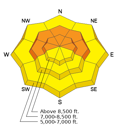
Elevated avalanche conditions, MODERATE danger exist in most areas in the Logan Zone, and avalanches are possible on steep slopes at all elevations. However in some areas, like in the Wellsville Range and perhaps the Logan Peak area, pockets with CONSIDERABLE danger exist in upper and mid elevation terrain facing west, north, and east. In these areas, and in wind exposed places with generally shallow snow cover and poor snow structure, people are likely to trigger dangerous avalanches failing on a deeply buried persistent weak layer.

Careful snowpack evaluation, cautious route-finding and conservative decision-making are essential for safe backcountry travel today.
Low
Moderate
Considerable
High
Extreme
Learn how to read the forecast here
Weather and Snow
The Tony Grove Snotel at 8400' reports a couple feet of heavy new snow with a whopping 3.5" of Snow Water Equivalent from this week's storm. It's 31° F and there is 85 inches of total snow. At the 9700' CSI Logan Peak weather station, winds are blowing 25-30 mph from the south, and the temperature is 28° F.
Today, we can expect partly sunny conditions, with high temperatures at 8500' around 36° F and moderate winds blowing from the south. Tonight will be cloudy with low temperatures around 22° F and increasing winds from the southwest. Tomorrow will be cloudy with snow showers, high temperatures around 33° F and winds from the southwest.
*The moisture train continues to march on with snow on tap for Sunday, MLK day, and more beyond that.
Recent Avalanches
We noticed evidence of widespread natural avalanches in the Wellsville Range from this week's storm, some running into lower elevation bench areas.
Large natural avalanches were less widespread in the Bear River Range, but an observer reports a large slide from early in the storm in northern Wood Camp. Many storm snow avalanches are likely now covered up by heavy snow from later in the storm.
Ad
Avalanche Problem #1
Persistent Weak Layer
Type
Location
Likelihood
Size
Description
People or smaller natural avalanches could trigger large and dangerous hard slab avalanches failing on a deeply buried persistent weak layer. Poor snow structure still exists in many places where a person could trigger the slope from an area where the hard slab is shallower, and a dangerous deep hard slab avalanche could result. A person might trigger and avalanche from around slope margins, in steep rocky terrain, and in generally shallow outlying mid and upper elevation areas. In the Logan Zone, terrain with generally shallower snow like the Wellsville Range and the Logan Peak Area is most suspect.
  • An avalanche failing on a buried persistent weak layer could still be triggered remotely, from a distance or below.
  • Avalanches failing on sugary weak snow near the ground could be very large and long running, perhaps descending into lower elevations.

Avalanche Problem #2
Wind Drifted Snow
Type
Location
Likelihood
Size
Description
Strong south and west winds earlier in the week transported plenty of snow. The wind picked up snow in fetch areas on windward slopes and in low angled terrain and deposited it on lee slopes and in terrain influenced deposition areas. The drifting built fresh slabs of thicker snow and added more weight to slopes with poor snow structure.
  • A smaller wind slab avalanche overrunning a slope with a poor snow structure could cause a much larger avalanche to step down to our now deeply buried November persistent weak layer.
  • As always, look for and avoid drifts on the lee side of prominent ridges, on corniced slopes, and in and around terrain features like cliff bands, mid-slope break overs, gully walls, sub ridges, saddles, and sinks.
  • Human-triggered avalanches 1-2' deep are possible in drifted areas.
Avalanche Problem #3
Wet Snow
Type
Location
Likelihood
Size
Description
Cooler temperatures last night will help to set up the saturated new snow and lower the danger of wet avalanches at lower elevations. At upper and mid elevations, the fresh snow on sunny slopes could get damp and prone to sluffing. Small wet loose avalanches overrunning a slope with buried persistent weak layers could cause a much larger hard slab avalanche.
General Announcements
  • Remember, when you leave the ski area boundary, Beaver Mt or Cherry Peak, you are entering the backcountry, and you could trigger dangerous avalanches.
  • Please submit your observations from the backcountry HERE.
  • For a list of avalanche classes from the Utah Avalanche Center go HERE
  • For information on where you can ride your sled or snowbike, check out this map of the winter travel plan for the Tony Grove and Franklin Basin Areas HERE.
This forecast is from the U.S.D.A. Forest Service, which is solely responsible for its content. This forecast describes general avalanche conditions and local variations always occur.