Forecast for the Abajos Area Mountains

Eric Trenbeath
Issued by Eric Trenbeath for
Monday, January 8, 2024
Heavy snowfall and strong winds have created dangerous avalanche conditions in the Abajo Mountains!
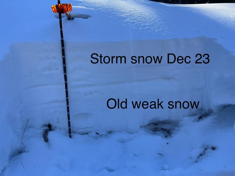
Heavy snowfall has piled up on a very weak, pre-existing snowpack. Human triggered avalanches are likely, and natural avalanches are possible. Backcountry travelers need to have good route finding skills. Stay off of slopes steeper than 30 degrees and avoid avalanche run out zones. Consider staying home if you don't have these skills.
Low
Moderate
Considerable
High
Extreme
Learn how to read the forecast here
Special Announcements
Sign up for our Backcountry 101 course in the La Sal Mountains on Jan 19, 20!
Weather and Snow
18" to 24" of new snow has fallen in the Abajos. This is a significant load on the underlying weak snowpack and conditions are dangerous. The underlying snowpack is very weak consisting of loose, sugary, faceted snow. Strong NW winds will blow and drift snow today making avalanches possible on all aspects.
NWS forecast for the Abajo Mountains.
Snow totals and temps at Buckboard Flat (8924')
Snow totals and temps at Camp Jackson (8858')
Additional Information
The snowpit below was dug on a northeast aspect just below North Creek Pass on December 31, it shows a very weak, underlying snowpack of loose, sugary, faceted snow with the storm snow of December 23, on top. For now, all layers are soft. The most recent storm has piled 2' of new snow on top of this weak set up, and this is exactly what we need for avalanches to happen.
The entire snowpack, including the top layer of the most recent storm snow is soft, and is lacking a slab. We call this stable but weak.
This photo illustrates large, non-cohesive, sugary facets from the base of the snowpack.
General Announcements
This forecast is from the U.S.D.A. Forest Service, which is solely responsible for its content. This forecast describes general avalanche conditions and local variations always occur.