The Abajo Range is finally going to see some much needed snow this weekend. As of Saturday morning, there is 2" of new snow at Buckboard flat. Today is going to be a cold and windy day, with NW winds blowing 20-30 mph. Snowfall will start tonight, and heavy snow will continue on Sunday into Monday. I'm optimistic for 7-11" by Monday. The new snow will bring a corresponding rise in avalanche danger.
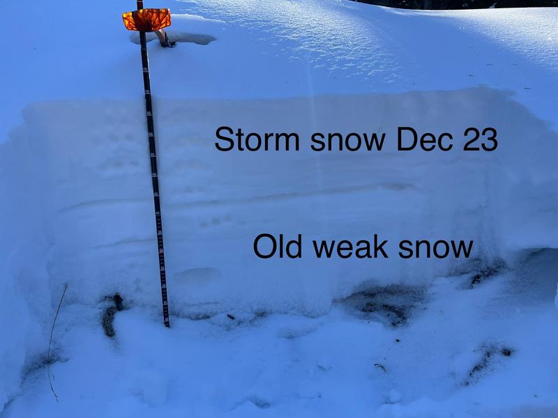
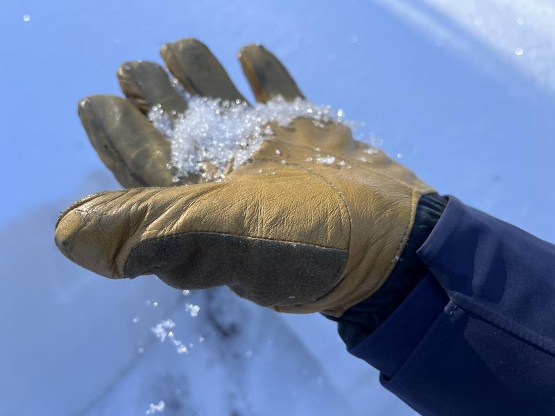
The existing snowpack is very weak. Basically, any slope that has snow on it right now, has a very weak and
faceted snowpack. It won't take much of a new load for avalanches to start running on this weak snowpack. Strong winds will blow and drift snow into sensitive slabs. These slabs will be deposited on top of the weak, pre-existing snow pack. It will be relatively easy to trigger an avalanche in any fresh slab of wind-drifted snow
Suspect wind drifts or wind slabs are often smooth and rounded looking, like lenses or flying saucers.
Wind slabs often form on the lee side of exposed ridges and in and around terrain features. Watch for and avoid drifts on gully walls, under cliff bands, along sub-ridges, in scoops, saddles, and sinks.
Drifted snow is stiffer and more compacted than non-drifted snow, and hard drifts often produce hollow drum-like sounds when you walk on them.
Freshly formed wind slabs can be quite sensitive and are often remotely triggered.
Shooting cracks in drifted snow are a sure sign of instability.
Conservative decision-making includes giving the snow some time to adjust. Wait out the storm and see where avalanches happen and how big they are. In the mean time we can recreate on low angle slopes and meadows.