Forecast for the Abajos Area Mountains

Eric Trenbeath
Issued by Eric Trenbeath for
Monday, January 1, 2024
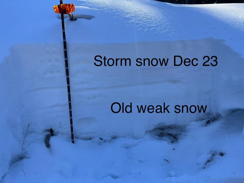
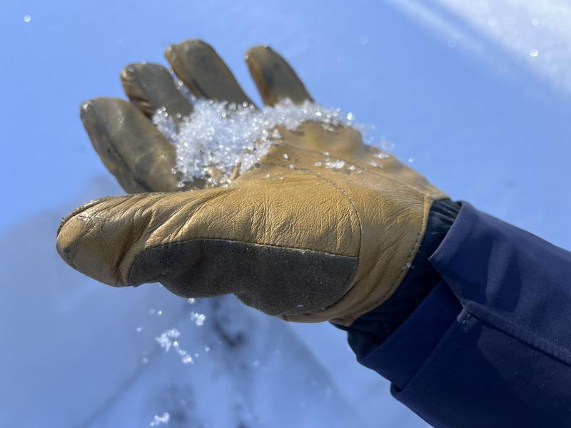
Triggering an avalanche is unlikely. In very isolated areas it may be possible to trigger an avalanche where old, hard slabs of wind drifted snow overly weak, sugary snow underneath. You are most likely to encounter this problem on steep, upper elevation, wind drifted slopes. Areas of greatest deposition are the most suspect. Look for wind deposits on the leeward sides of ridge crests and other terrain features like gully walls and sub-ridges. Wind drifts are recognizable by their smooth, rounded appearance and they may sound hollow underneath.
Low
Moderate
Considerable
High
Extreme
Learn how to read the forecast here
Weather and Snow
It's been more than a week since the last snowfall of 7" fell in lower North Creek (Buckboard SNOTEL). That storm did produce signs of instability as a stress load was applied to the underlying, weak snowpack. These instabilities have largely settled out for the time being. However, in our travels up and over North Creek Pass over the weekend, we observed continued deteriorating and weakening of the snowpack. It's basically a house of cards under there, and any future snow load will result in a corresponding rise in danger.
Snow cover remains very thin and sunny, south facing slopes are mostly bare. On shady aspects snow depths range from just over a foot in lower North Creek, to up around 30" at the pass. Camp Jackson SNOTEL is at 67% of normal.
NWS forecast for the Abajo Mountains.
Snow totals and temps at Buckboard Flat (8924')
Snow totals and temps at Camp Jackson (8858')
Additional Information
The snowpit below was dug on a northeast aspect just below North Creek Pass on December 31, it shows a very weak, underlying snowpack of loose, sugary, faceted snow with the storm snow of December 23, on top. For now, all layers are soft. What we need for an avalanche is a layer of harder, dense snow, or slab, on top of loose, weak snow. New snow, especially when wind drifted, forms slabs on top of older, weaker snow. This is what we'll be looking for next time it snows.
The entire snowpack, including the top layer of the most recent storm snow is soft, and is lacking a slab. We call this stable but weak.
This photo illustrates large, non-cohesive, sugary facets from the base of the snowpack. Does that look strong? We'll be keeping a sharp eye on any future snow load as stacks up on top.
General Announcements
This forecast is from the U.S.D.A. Forest Service, which is solely responsible for its content. This forecast describes general avalanche conditions and local variations always occur.