Nikki Champion
Forecaster
Week in Review: Avalanche Conditions and Snowpack Developments (April 4 - April 10, 2025)
Each week, we look back at the key snowfall, weather, and avalanche events from the previous week. For archived forecasts, visit the Salt Lake Mountains’ past updates.
This marks the final Week in Review for the season. As things wind down and the persistent weak layer finally phases out, we'll shift our focus away from daily breakdowns and instead provide a broader overview of the week's overall trends and patterns.
Overall Summary:
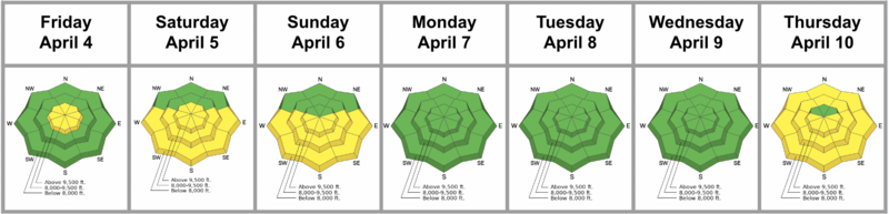
After an eventful week of heavy snowfall and winter storms—bringing 18–36" of new snow—the sun finally returned, marking the transition toward more typical springtime conditions. Avalanche danger quickly decreased across the danger rose, with the primary concern shifting to new snow instabilities in the upper elevations, where the danger remained MODERATE.
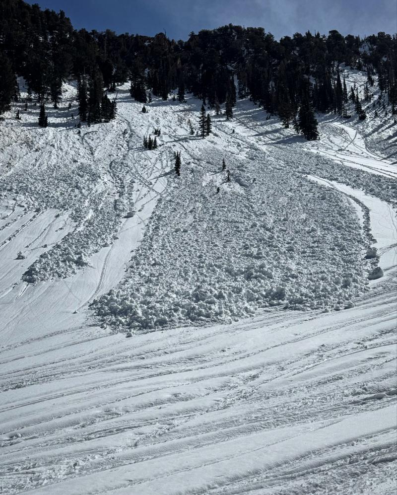
Several avalanches were reported to the UAC on Friday, including two incidents where individuals were caught and carried. Fortunately, no injuries occurred. These were soft slab avalanches failing within the new snow, primarily due to density changes. Most were 12–18 inches deep, with one measuring 150 feet wide. Reported incidents included:
- Birthday Chutes (LLC): 12" deep, 35' wide, caught and carried (photo below)
- Meadow Chutes (BCC): Caught and carried; dimensions unknown (second-hand report)
- Wolverine Cirque (BCC): 18" deep, 150' wide, remotely triggered
As temperatures rose and skies cleared, avalanche danger remained MODERATE on all aspects in the upper elevations, where long-running sluffs and shallow soft slabs of new snow remained possible. These avalanches ranged from 1–2 feet deep and up to 150 feet wide. On east through west-facing slopes (E, SE, S, SW, W), danger from wet snow quickly rose to MODERATE and may have reached CONSIDERABLE during periods of strong sunshine and warming, as the snow became increasingly unstable.
By Saturday, no new avalanches were reported. Most new snow instabilities appeared to have settled, and the danger held at MODERATE, with the primary concern shifting to solar aspects during the afternoon.
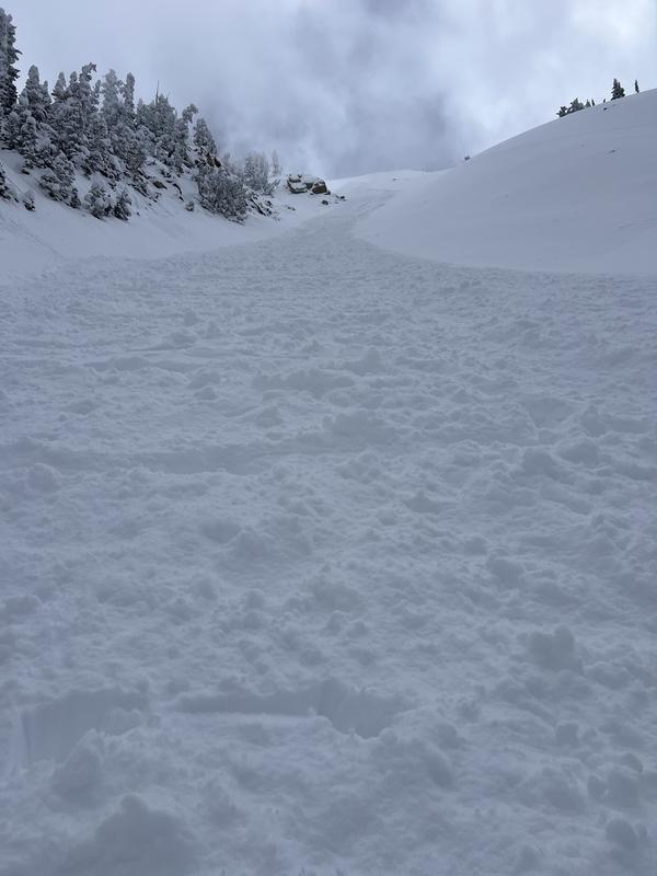
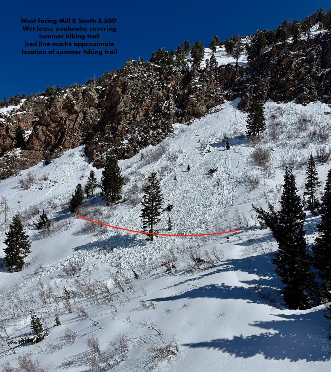
On Sunday, avalanche danger remained MODERATE due to lingering wet snow and new snow instabilities. No specific incidents were reported, but photos and observations pointed to wet loose activity during the afternoon heat on both Saturday and Sunday.
D. Kelly
On Monday, high clouds and increased winds helped keep the wet snow in check, and the overall danger dropped to LOW with normal caution advised.This pattern continued into Tuesday and Wednesday, with only a few isolated reports of wet loose activity and generally well-behaved wet snow and an overall LOW danger.
Wet activity from the lat few days on W-NW facing and dry settled powder on the high N - M. White