Greg Gagne
Forecaster
Our Week in Review highlights significant snowfall, weather, and avalanche events of the previous week. (Click here to review the archived forecasts for the Salt Lake mountains.)
The danger roses for the Salt Lake mountains from Friday Feb 15 through Thursday Feb 21:

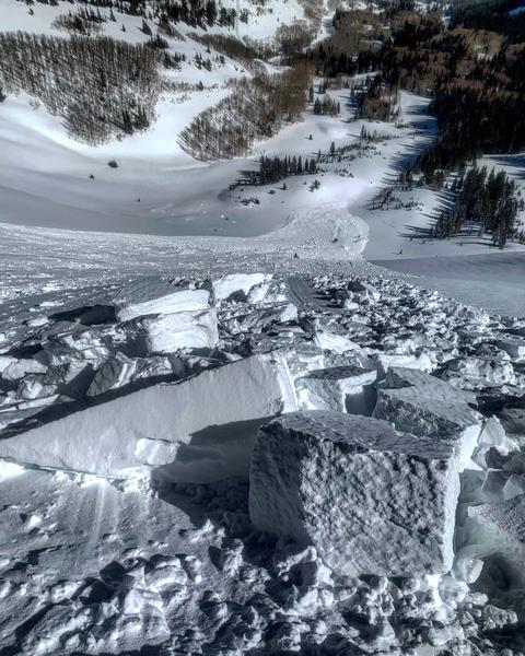
Summary: Periods of west/northwest winds deposit fresh wind slabs at the mid and upper elevations, with many wind-sheltered slopes holding cold, dry powder from recent storms. A few significant human-triggered avalanches, including one full burial. As indicated in the danger roses through the week, increasing stability of the snowpack, including a deep snowpack at the mid and lower elevations. Of note are the immense cornices adorning upper elevation ridgelines - some of the largest we've seen in the past few years. [pic: Grainger]

Continued snowfall throughout the week with approximately 12-18" new snowfall since Friday, with the highest amounts in Little Cottonwood Canyon.
Friday February 15 - After a lengthy period of moderate to strong south/southwest winds and denser snow, the flow switches to the northwest and drops 4-8" of cold, dry snow in the Cottonwoods and Park City mountains. The only reported avalanche activity is from an intentional cornice drop in West Monitor along the Park City ridgeline that triggered a slide 1-2' deep and 250' wide. [pic: Mark White]

Saturday February 16 - Strong winds from the west/northwest drift leeward easterly aspects, and at least three human-triggered avalanches are reported. The most significant avalanche involved a full burial and quick recovery by the group (observation). This was on an east aspect at 9000' in the Guardsman Pass area. Trent has an excellent video recap of this accident, and discussion of the good outcome.
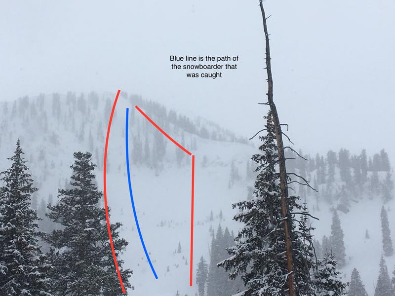
Sunday February 17 - Southeast winds and a few more inches of cold, dry snow. A snowboarder-triggered slide on a northeast aspect at 10,300' on Pioneer Peak triggered a 12" windslab that propagated 500' wide. The boarder was carried 1000' and ended up on the surface of the debris (observation).

Monday February 18 - A trace to nearly 6" of cold powder is reported. Cold temperatures and cloud cover preserve the powder on all aspects. No new avalanches are reported.
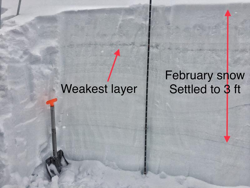
Tuesday February 19 - Light snowfall continues, with another 2-3" falling. No new avalanches are reported, but signs of faceting in the top 12" of the snowpack due to the cold temperatures and low-density snow. The photo below from Millcreek Canyon shows the location of the facets in the top 3-4' of the snowpack [pic: Mark Staples]

Wednesday February 20 - A shallow wind slabs is reported from Limber Pine - a steep southerly aspect dropping down into Little Cottonwood - is reported. This slide was 6" deep and 200' wide, running over 1000' vertical.
Thursday February 20 - Southeast/east winds get into mid and upper elevation terrain, while cross-loading various aspects. No backcountry avalanches are are reported.


