
Route Name
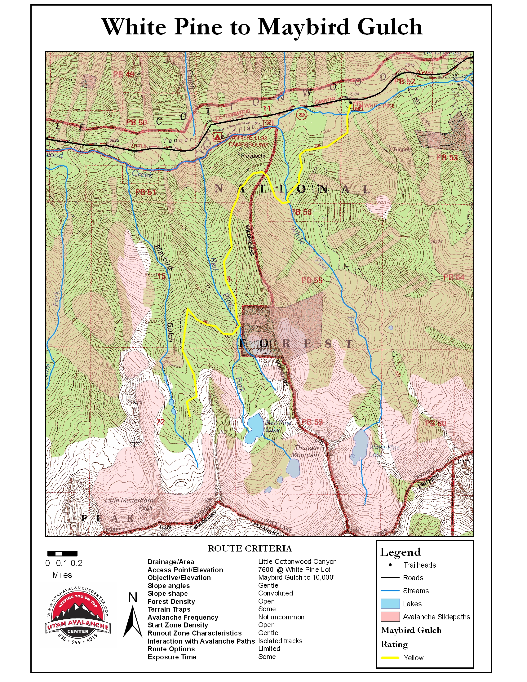
White Pine to Maybird Gulch
Route Rating
Yellow
Route Description
Park 5.2 miles beyond electronic signage at the mouth of LCC and look for the White Pine lot on your right. Cross the creek at the bridge and follow the summer trail across the White Pine Creek and wrap west then south into upper Red Pine. Cross the Red Pine Creek at the bridge and ascend through the firs and spruces to gain a spur ridgeline within Maybird. Work the ridgeline south avoiding the small avalanche bowl to your left. Four and a half miles and 2000’ gain brings one to the impressive views of the Pfeifferhorn, looming to the south. Dogs are not allowed in the watershed of LCC.
Printable Map
Route Map


