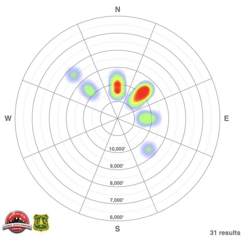
Reports of avalanche activity are critical to the forecast. Not only do they help verify the forecast, but reported avalanche activity helps relay the type, sensitivity, size, and location for predicting other avalanches. By gathering snow, weather, and avalanche data, the forecaster strives to find a pattern and then convey this pattern to the general public. We often use avalanche occurrence aspect/elevation roses, or "heat-maps" to convey the spatial patterns of the avalanches and these often correlate with our forecast danger roses.
A quick note on what we mean by "recent activity' and reporting bias. New snow, wind-drifted snow, and wet snow avalanche activity is extremely perishable where the instability lasts just hours to only a couple of days. This is why these seldom make the news if they are greater than 72 hours old. On the flip-side, even days-old avalanches involving persistent weak layers remain pertinent to the backcountry traveler as the instability typically lasts days to weeks without subsequent loading. Avalanches into older snow layering are generally larger and more dangerous and contribute to over two-thirds of avalanche fatalities in Utah and as such we see a reporting bias toward these more significant avalanches over smaller, more ephemeral avalanches involving new or new wind drifted snow. (Sample heat map below)