


Observation Date
3/24/2017
Observer Name
mark white
Region
Salt Lake » Big Cottonwood Canyon » Cardiff Fork
Location Name or Route
Cardiff Fork
Comments
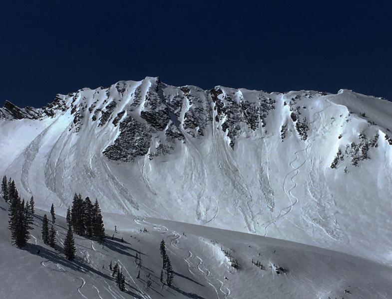
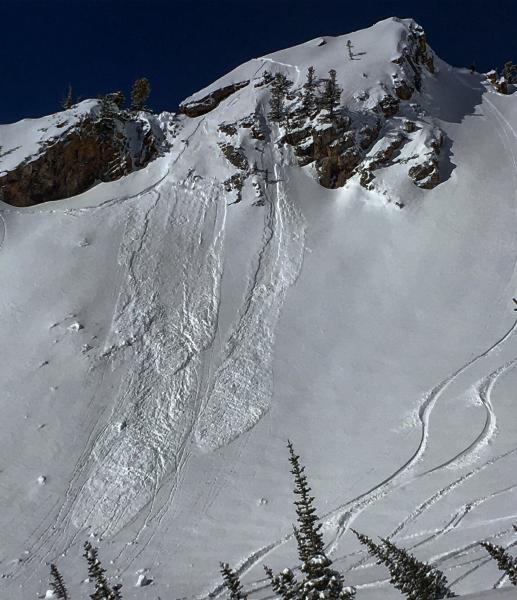
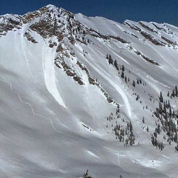
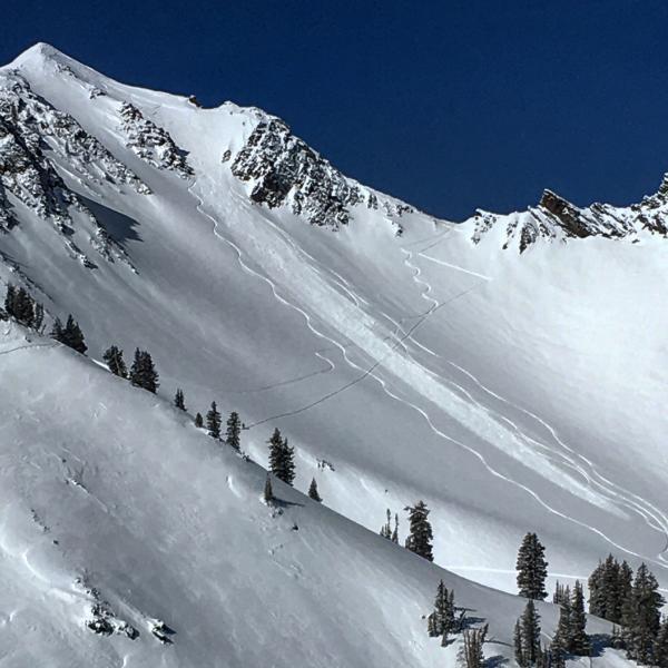
Dry snow sluffing in the steeper terrain was not quite as sensitive as yesterday but was still a issue in tight radical terrain, in most other terrain it was manageable with ski cuts and not packing much of a punch. Wet activity started right on cue on the SE facing around 10:00-10:30, these wet snow slides were larger than the dry ones naturally occurring and leaving bigger debris piles. We did the usual spring time rotation starting with S early then moving to E, NE, and due N by 1:00pm, we did have to exit out S which was fully manked by 1:30pm.
Photos: skier triggered and natural wet and dry activity from today

Today's Observed Danger Rating
Moderate
Tomorrows Estimated Danger Rating
Moderate