Observation Date
1/10/2017
Observer Name
Dave Garcia
Region
Moab
Location Name or Route
Laurel Highway
Weather
Sky
Scattered
Wind Direction
Southwest
Wind Speed
Strong
Weather Comments
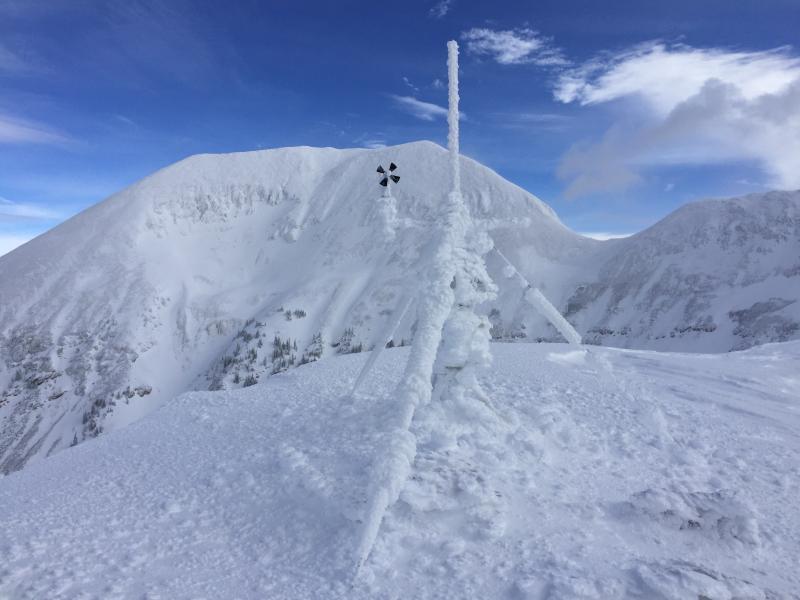
Scattered clouds and intermittent sunshine today. Winds remained strong on the ridge tops, gusts in the low 30's. Moderate winds down low. Very impressive riming in the tress all over the place.
Snow Characteristics
New Snow Depth
8"
New Snow Density
High
Snow Surface Conditions
Dense Loose
Wind Crust
Rain-Rime Crust
Snow Characteristics Comments
Really hard to gauge just how much new snow we received since yesterday. The Gold Basin station was reporting 7 to 8 inches, and I trust that it probably did snow that much, but as Brian Murray said, "It all blew to western Colorado." The winds have not let up over the past several days and have done some serious damage. When the snow did arrive yesterday it was warm and wet and fell during humid conditions. This created a very upside down snowpack on almost all aspects. It was like someone sprayed 2 to 3 inches of foam insulation on top of all the new snow we had been receiving over the past several days. Our skis would barely penetrate the surface as we skinned across. Under snow surface conditions I clicked "rain/rime crust." Ignore the rain part, but the riming definitely had an influence in forming this surface crust. In the sheltered areas you can still find some dense, somewhat loose snow that made for fun skiing.
Red Flags
Red Flags
Wind Loading
Red Flags Comments
The wind has been the main story the past few days. A couple inches of snow here and there each day, with the most falling yesterday afternoon/last night. Yesterday (Monday) the winds were so strong I skinned past some freshly fallen trees that still smelled of fresh cut timber. This has continued to load N and E facing slopes. Slopes like upper horse creek are looking very rounded and pillowy. On the windward side of the ridge cross loading is occurring on several aspects. We attempted to ski Goldminer's, but it was so cross loaded we backed off. This is a south facing slope.
Avalanche Problem #1
Problem
Wind Drifted Snow
Trend
Same
Problem #1 Comments
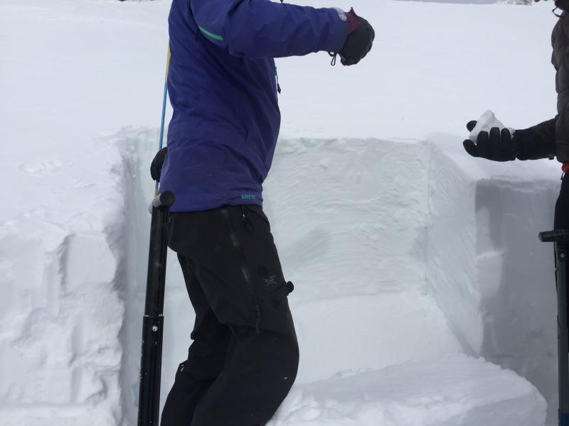
As stated above the biggest avalanche problem right now is wind slab. We thought Goldminer's would be a scoured mess, but as we approached, it started to feel like it might be fun skiing. An inch or two of soft snow on a firm surface. We decided to dig a pit and have a look. Pit was South facing, 32 degree slope. Pit depth was 99 cm. Total Snow depth was 140 cm. What we found was 60 cm of windslab on top of a 5 cm sun crust over a thin facet layer. On Wednesday 1/4 I stood on top of a mostly scoured Goldminer's and watched as it was starting to cross load. It has been loading ever since, resulting in the dense 60 cm of windslab we saw today. The slab starts out at four finger density, changes to one finger, and is sitting on a pencil sun crust. Facets have formed below this sun crust. These facets are about 70 cm below the surface. The facets beneath the sun crust easily failed the compression test CTE 1 Q2. One tap from the wrist is all it took. We performed an ECT on this layer and it failed that as well, ECTP 10 Q2. I'll post a video of the ECT below. After these two tests we decided not to ski the slope. The 60 cm of wind slab is obviously very heavy and is putting a good deal of stress on that facet layer below the sun crust. The wind slab is so thick and dense it may have bridged the weight of a skier just fine, and we may have gotten away with skiing the slope, but the four of us opted not to try our luck today. Overall danger is considerable in the wind zone, and otherwise moderate. Tomorrow is looking like more snow and wind, the danger should remain Considerable.
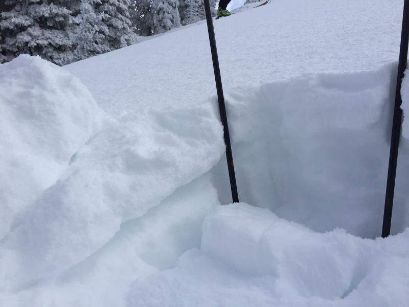
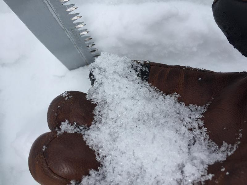
The surface conditions in the prelude, a NW facing slope. The stout crust that was keeping us on top all day can easily be seen on the left side of the picture.
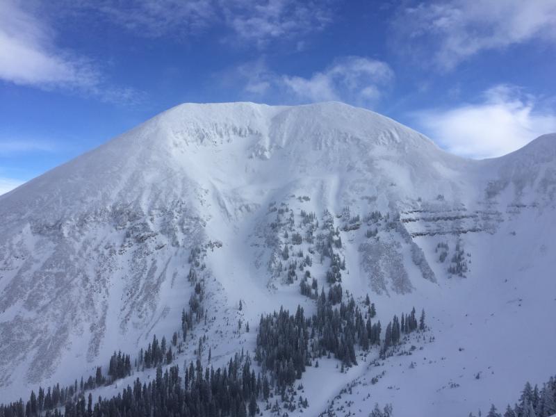
A good look at Mellenthin, the upper half is heavily rimed while the lower half is obviously cross loaded. This shot is a good example of how cross loading occurred on windward slopes during this storm. Second photo is the heavily rimed weather station.
Video
The first photo here was taken after the ECT and you can see the depth of the slab that pulled out. The second photo is the weak layer of facets that failed below the sun crust. Lastly a video taken by Brian Hayes of Sarah Crosier performing the ECT. Quick note on the test, right before the failure she pauses and goes for a tap from the elbow. She thought she had ten taps already, so we originally scored it ECTP 11, but watching the video I count ten taps total. Either way, I think the test told us what we needed to know.
Today's Observed Danger Rating
Considerable
Tomorrows Estimated Danger Rating
Considerable
