Observation Date
1/4/2017
Observer Name
C Brown
Region
Uintas » Upper Weber Canyon » Weber Canyon
Location Name or Route
Upper Weber Canyon
Weather
Sky
Obscured
Precipitation
Moderate Snowfall
Wind Direction
Southwest
Wind Speed
Moderate
Weather Comments
High PI rates, recieved about 4" between 10:00 and 14:00 at 8,700'. Very poor visability throughout the day at mid elevations. Winds picked up around 12:00 with as the font passed. By 14:00 the front seemed to pass and the winds and precip calmed and the visability increased slightly. Temps were pretty mild, probably in the mid to upper 20's.
Snow Characteristics
New Snow Depth
9"
New Snow Density
Medium
Snow Surface Conditions
Powder
Dense Loose
Snow Characteristics Comments
At 8,700 feet there was 5.5" from the past 24hrs with about 0.65 water for some some ~12% snow. By 14:00 there was 4" of new. I am estimating that this is equating to over an inch of water in the past 24hrs. Snow was slightly heavier than anticipated. Snow close to ridge lines below 10,000' was slabbing up close to the ridges, and slightly less consolidated down lower with a little more protection. Tough riding conditions while keeping the slope angles down due to the amount and the higher densities.
Red Flags
Red Flags
Recent Avalanches
Heavy Snowfall
Wind Loading
Cracking
Red Flags Comments
The red flags were flying today. Saw a little bit of everything, even without being able to see very far due to visibility. Dug a quick pit at 9,700' on a SE aspect and got some results from two CT, and an ECT. CTE6 down 26cm Q2 RP, CTH23 down 49cm Q2 RP on a density change and buried NSF. The 49cm slab went from F to 4F/1F with F snow with NSF below. Second CT, CTE3 down 26cm Q2 RP, and CTH 23 down 49cm Q2 RP to confirm. ECTN7 26cm down Q2 RP, and ECTP26 down 49cm.
Avalanche Problem #1
Problem
Wind Drifted Snow
Problem #1 Comments
Wasn't able to get into the higher elevations, but imagine the wind slabs are growing and all over the place. High winds, cross loading, lots of precip and snow for transport. I think as soon as we get some visibility we will be able to get eyes on these. I would assume there was a natural cycle up high with the wind slabs. I think with the continued high winds these are going to continue to grow and overload themselves.
Avalanche Problem #2
Problem
New Snow
Problem #2 Comments
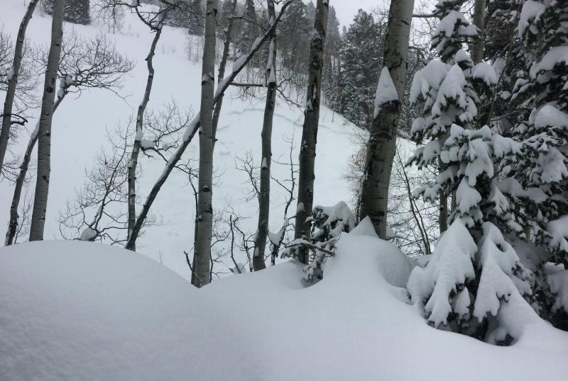
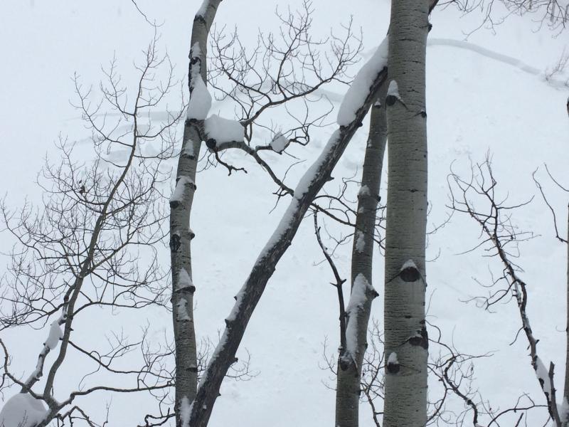
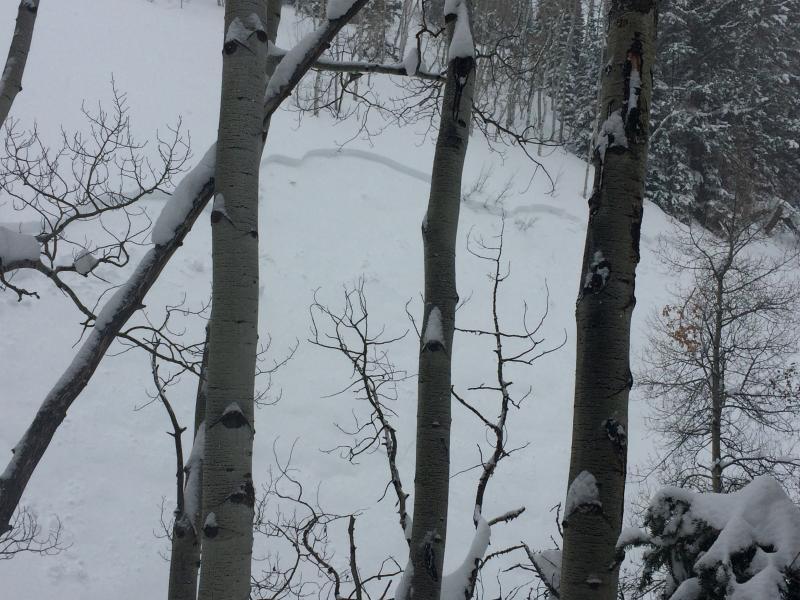
With all this new snow and the dense snow sitting on less dense snow the storm slab is getting deep and it had gone over the tipping point this afternoon. With over an inch of water in lower and mid elevations I witnessed the beginning of a natural cycle as a ~16" slab 100' wide broke and ran a short ways right into a creek/terrain trap. With continued precip the storm slab will grow as well and continue to produce avalanches.
Comments
Picture of the natural storm slab that happened in a 20 min absence from the area. Went by this spot around 14:30, no avalanche, 20 minutes later when passed by again the slab had released.
Today's Observed Danger Rating
Considerable
Tomorrows Estimated Danger Rating
Considerable