Observation Date
1/3/2017
Observer Name
Kikkert
Region
Uintas » Upper Weber Canyon
Location Name or Route
Upper Weber Canyon
Weather
Sky
Overcast
Wind Direction
Southwest
Wind Speed
Moderate
Weather Comments
Partly cloudy early AM, with increasing clouds throughout the day. SW wind were also ramping up throughout the day becoming strong by afternoon; however, there were mostly confined to ridgelines above 9,500' and off the ridgelines the wind was light. As result, chose moderate as the wind speed to reflect the overall wind.
Snow Characteristics
New Snow Depth
12"
New Snow Density
Low
Snow Surface Conditions
Powder
Snow Characteristics Comments
Storm total since Sunday night of about a foot at mid-elevations. Probably a bit more at upper elevations, but it was difficult to tell at the upper elevations due to wind. Very light density, particularly the snow that feel overnight Monday night. It was over the head and over the hood as a wise man once said.
Red Flags
Red Flags
Heavy Snowfall
Wind Loading
Poor Snowpack Structure
Red Flags Comments
Maybe on the border of heavy snowfall, but coupled with the storm coming in tonight, the attenae should be up and keyed in to snowfall amounts and loading in upper elevation terrain. There are some buried near surface facets that formed last week underneath the new snow, but found that there was either not enough slab above them in areas out of the wind, or they got destroyed in wind exposed areas prior to the storm. However, did not look at sheltered North facing, where the structure could be poorer.
Avalanche Problem #1
Problem
New Snow
Problem #1 Comments
Storm snow as well behaved, just wasn't quite enough/low density prevented it from behaving like a slab. This will change tomorrow, when heavier snow falls on top of last night's light density snow.
Avalanche Problem #2
Problem
Wind Drifted Snow
Problem #2 Comments
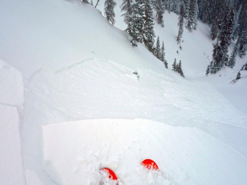
Wind slabs were beginning to become active by early afternoon in exposed areas. Was able to watch cornices break off naturally and trigger 4-6" wind slabs on steep north facing terrain (see photo below). Cornice kicks and ski cuts produced the same. Slabs were the drifted snow from today failing on last nights low density snow. Expect them to be deeper and more connected tomorrow.
Snow Profile Comments
Did not find the recently buried near surface facets to be reactive as shown in the attached profile. Numerous ECTs on mulpile slopes could not produce propagation on this layer (or any others).
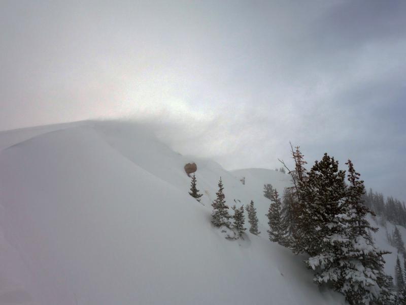
Photo shows wind loading at around 10,000',
Photo shows shallow wind slab triggered with a cornice drop on a steep N facing slope at around 10,000'.
Hazard today was an overall moderate, with considerable on upper elevation wind loaded slopes. Expect more of an overall considerable tomorrow.
Today's Observed Danger Rating
Considerable
Tomorrows Estimated Danger Rating
Considerable


