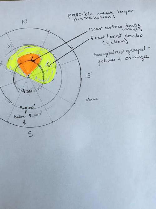
A return to "winter" and storms this month, with dry spells, have given us a layered upper snow pack. The layers of concern are fairly limited, mostly to northerly and northeasterly upper elevation slopes The snow on most other slopes is stabilizing - warm temperatures and strong sun are creating melt-freeze layers on all other aspects and elevations, that will be strong when frozen. I think in most places, these weaker layers don't have enough of a load for slides to break down into them yet, but they could continue to weaken and/or get overloaded with the next storm. There are 3 "funky" layers I've been seeing -
- re-crystallized graupel, from the 2 storms around March 6th and March 9th.
- a very localized layer of near surface facets
- Crusts with facets beneath them
Below is a very rough aspect/elevation rose of where I think some of these weak layers may be found. It's going to be worth keeping an eye on this upper layering, especially ahead of the next storm.

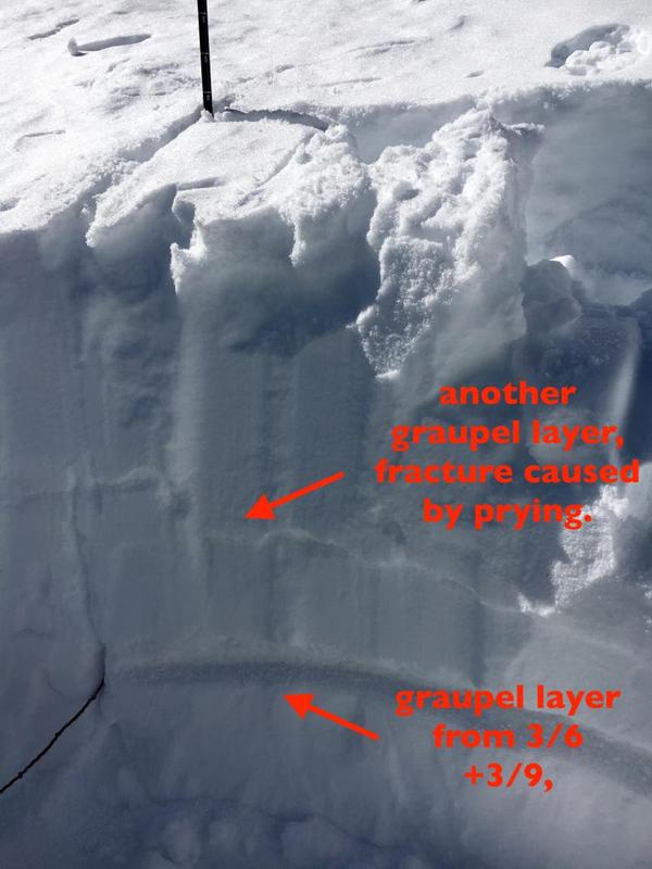
Below - another pit today, 9,800', north facing. This one had 2 shears on graupel. The lower graupel layer is the one I'm more concerned with, as it's stayed loose in some places for 10 days, indicating faceting. No results from ECT's where I was, but distinct shears.


