31st Annual Backcountry Benefit - September 12th - Tickets Available Here!

Observation: Mt Aire

Observation Date
2/4/2016
Observer Name
Tyler Falk
Region
Salt Lake » Parleys Canyon » Mt Aire
Location Name or Route
Mt. Aire
Weather
Sky
Overcast
Precipitation
Light Snowfall
Wind Direction
West
Wind Speed
Light
Weather Comments
Light S1 snowfall early that ended by mid morning. Not much wind on low to mid elevation terrain.
Snow Characteristics
Snow Surface Conditions
Powder
Dense Loose
Snow Characteristics Comments
First walk up Mt. Aire this season, I found snow heights around 120cm on the North facing ridge once you hit the pines at around 7600ft, HS went up to 150cm at 8200ft. About 15cm of F hardness on top of 1F snow that went down to the crust combo that was 45cm down from the top of the pack.
Red Flags
Red Flags
Recent Avalanches
Wind Loading
Poor Snowpack Structure
Red Flags Comments
Recent avalanches, wind loading and a poor snowpack structure were the main red flags out there today. An aditional red flag for me in this terrain was the thiner and likely weaker snowpack outside the cottonwoods.
Avalanche Problem #1
Problem
Wind Drifted Snow
Trend
Same
Problem #1 Comments
Not tons of wind slabs in my travels today but I did see a few small 10cm deep windslabs on North aspects at 8k.
Avalanche Problem #2
Problem
Persistent Weak Layer
Problem #2 Comments
Seamed like a fairly widespread rain crust around 35-50cm down in the lower elevation terrain I was in today which was the layer that concerned me the most. Facets on the ground are 1-1.5mm and seam to be rounding and getting stronger in this location.
Comments
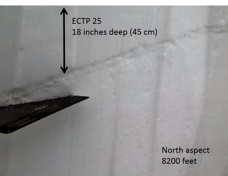
ECTP25 Q2 Resistant Planar at 8181ft on a North aspect. This failed 44cm down on the rain crust from the end of January.
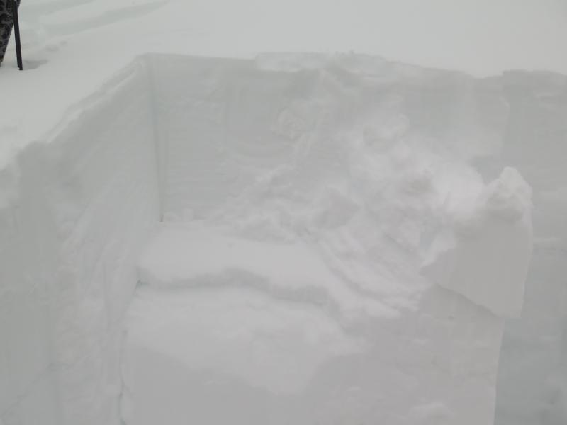
Pic 1. Rain Crust 45cm down from the top of the pack.
Pic 2. Propagation within the rain crust
Today's Observed Danger Rating
Considerable
Tomorrows Estimated Danger Rating
Considerable