We rode in the Tony Grove Area today and found nice settled powder conditions on the Northern half of the compass. Anything on the southern half of the compass got a lot of sun and was pretty sloppy by mid-day. By 2:00 when we left, a crust was beginning to form on the surface.
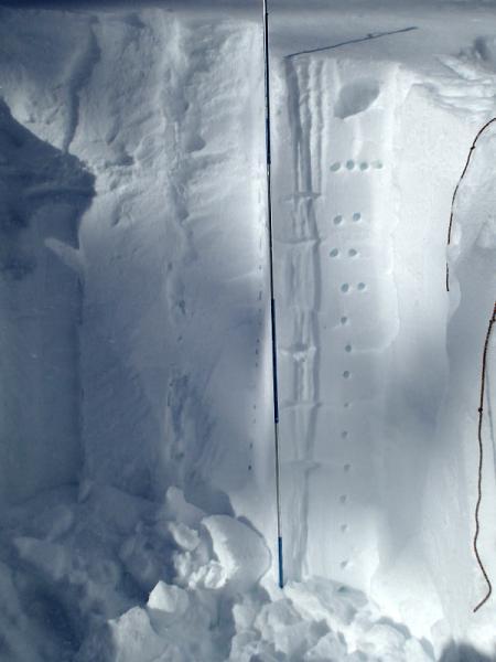
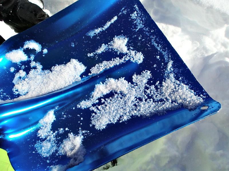
We did a bunch of tests on a 36 degree East facing slope at around 9200 feet (total depth, 80 inches). The shovel shear test revealed a series of weak layers, the most notable were the interfaces between older snow and Sundays storm about 13 inches down, and another grauple layer 5 inches under that. The new/old snow interface failed around 16 taps, and the grauple layer failed around 19-21 taps. We did one Extended Column test and got failures on those same layers but surprisingly nothing propagated.
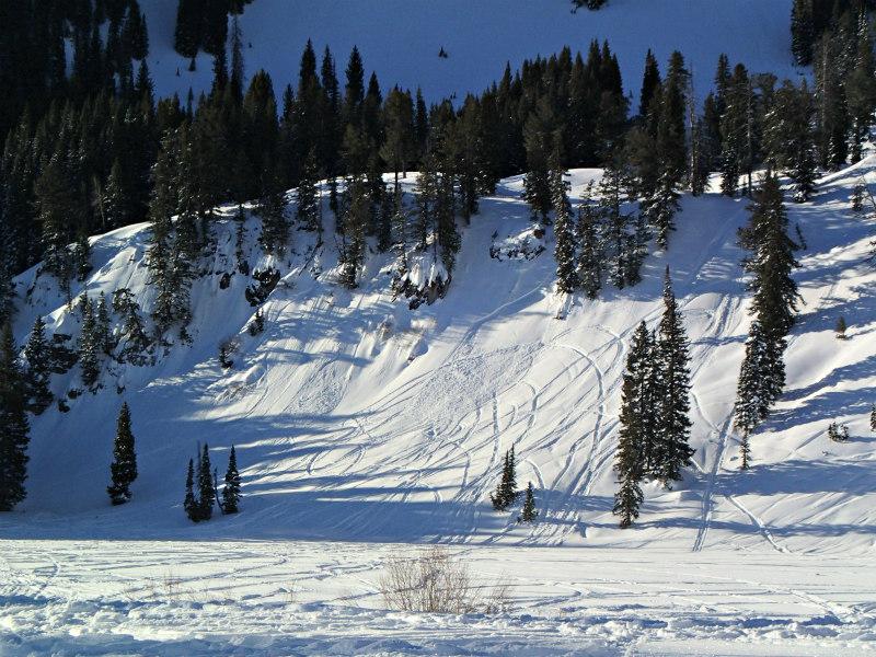
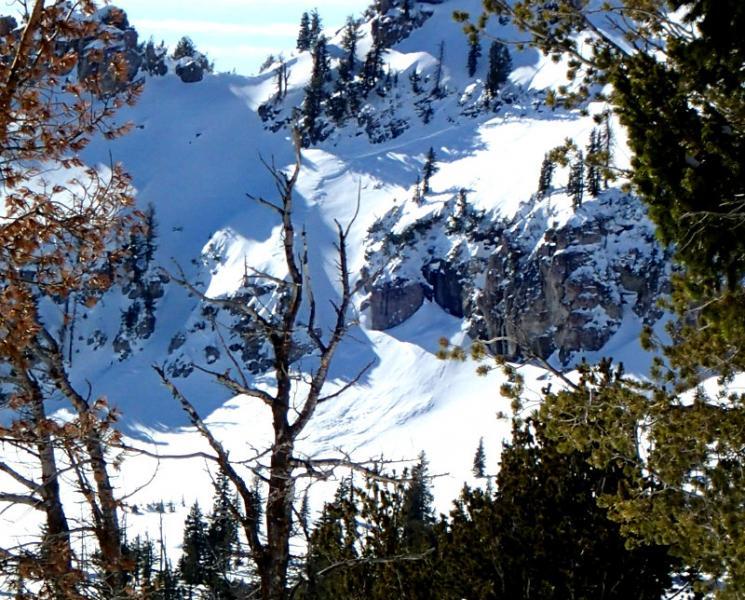
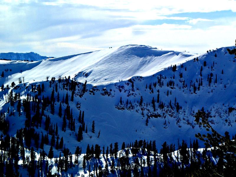
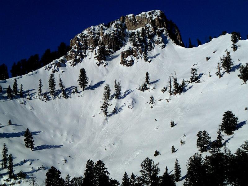
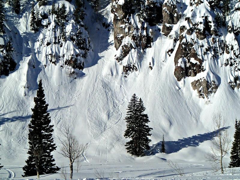
People have been testing many slopes and there were multiple skier/sled triggered avalanches. I was surprised to see several recent slabs on North facing slopes under Castle Rock and at the South end of the Lake. There were many older slab avalanches on East facing slopes near Magog, Cornice Ridge, South of Naomi, and West of the lake. All the slabs we saw were around 1 foot deep and the widest was around 50 feet wide. Nothing too serious unless they carried you over a cliff or funneled you into a gully.