Get Your Ticket to the 32nd Annual Backcountry Benefit on September 11th! Support Forecasting, Awareness, and Education

Observation Date
1/19/2016
Observer Name
Ted Scroggin
Region
Uintas » Bear River Ranger District » Whitney Basin » Double Hill
Location Name or Route
Whitney Basin-Double Hill
Weather
Sky
Few
Wind Direction
Southeast
Wind Speed
Moderate
Weather Comments
Cool single digit temperatures at the trailhead this morning with just a few high clouds and winds were still a bit windy even in the lower terrain. High thin clouds moved in around mid-day and winds stayed light to moderate along the ridge lines and from the south and southeast.
Snow Characteristics
New Snow Depth
6"
New Snow Density
Medium
Snow Surface Conditions
Powder
Wind Crust
Snow Characteristics Comments
A nice little refresher out in the Whitney area, but not quite enough to cover the old tracks. The 6'' of new medium desity snow was nice and spongy and easy to ride and turn in out of the windy areas.
Red Flags
Red Flags
Wind Loading
Red Flags Comments
I was expecting to see a little more natural avalanche activity along the higher ridge lines with the new snow and gusty winds overnight. The only slide I observed was a very small wind slab that released on the north end of Double Hill on an east facing slope. The few places I poked around and stomped on the recent wind drifts did not react a whole lot. These were up to a foot deep and only cracked out a several feet ahead of a persons sled and skis.
Avalanche Problem #1
Problem
Wind Drifted Snow
Trend
Increasing Danger
Problem #1 Comments
With so much wind textured snow all around the Whitney Basin, I was expecting to see a little more natural avalanche activity, but things were fairly quiet and manageable in my travels. With the approaching storm this evening, I think this will still be the main concern for tomorrow.
Avalanche Problem #2
Problem
Persistent Weak Layer
Trend
Same
Problem #2 Comments
Thinking slopes like the sled triggered slide from 12/26 on Double Hill, will still be a concern as more snow and wind pile snow onto the weak sugary snow that did not get cleaned-out when the avalanche released.
Comments
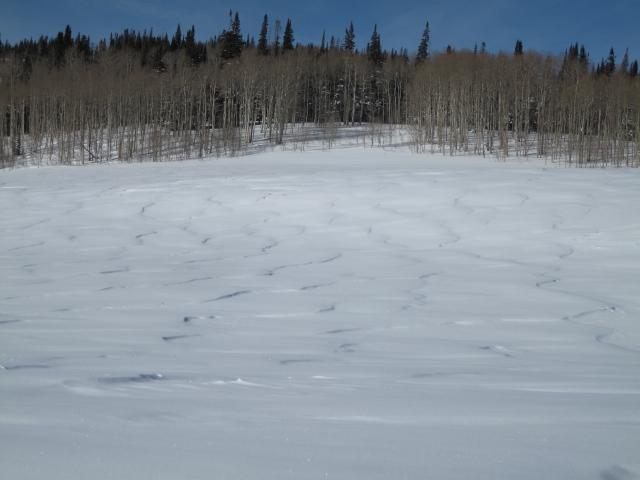
You know the wind has been blowing when you see this much textured snow down in the flats and wonder what the winds were doing up higher?
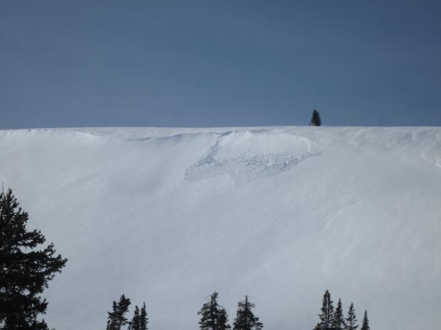
This was the only natural avalanche activity I oberserved from last nights storm. This small wind slab released on the east face of Double Hill.
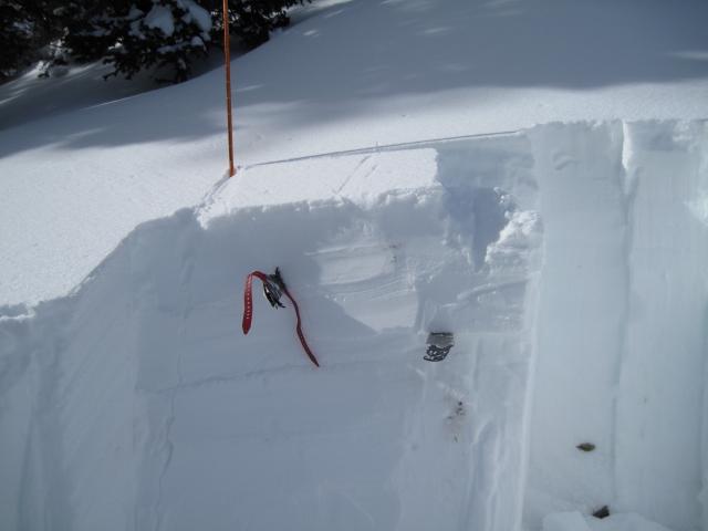
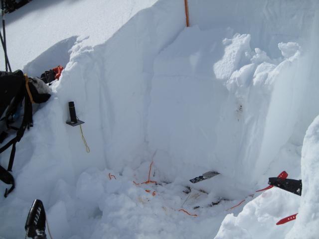
1. The weak layer that might be active with more load on top of it, is the faceted snow that developed during the high pressure and right before last weeks series of storms. This was a ECTP 14, but the fracture did not propagate across the whole column. 2. The weak sugary snow near the bottom of the snowpack has gained some strength, but in my stability test I can still get a fracture to propagate across the whole column, but it does lack the energy of earlier in the winter.
Video
Today's Observed Danger Rating
Moderate
Tomorrows Estimated Danger Rating
Considerable