

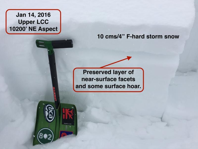
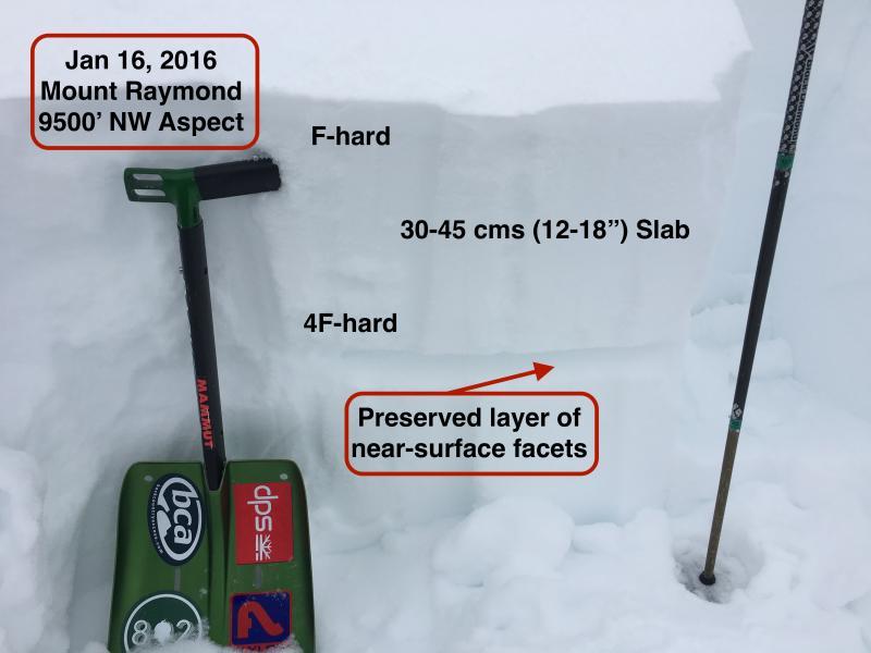
Will keep the message simple. Am finding the current avalanche problem to be the slab forming on top of the layer of near-surface facets that formed early this past week. This layer is somewhat thick (3-5 cms) (1-2") and in Millcreek Canyon there is now 30-45 cm slab sitting on top. (Given spatial variability wouldn't be surprised to find thicker slab in areas that received more snow and/or wind (i.e. upper LCC)
On Thursday morning I was finding the storm snow to be sensitive and very easy to get sluffs running at this NSF layer. Today conditions were much less sensitive - moderate to hard Q3 shears at this layer, ECTN20 as well as ECTX. The slab on top of the buried layer of NSF was fairly soft (mostly F-hard) and lacking energy.
Am thinking current snowpack structure is teetering on a fulcrum, and today it was balanced towards stability. But a bump in wind speeds and/or new snow may quickly ch-ch-ch-change things (sorry, had to get a Bowie mention in there) and conditions would shift to poor stability, with this layer of NSF being the biggest concern.
I did look at the faceted crystals under a scope and they do not look especially week, so I am hopeful this layer will heal quickly, but it is worth obviously paying attention to as we go forward. (Also curious how others are thinking about the weakness of this layer.) Was looking for preserved surface hoar today as I often find it can be preserved at mid-elevations on Millcreek, but did not notice any today and dug numerous quick hand pits looking for it.
Photos comparing upper snowpack from Thursday to today, with the biggest difference being we now have a more substantial slab from most recent storm.
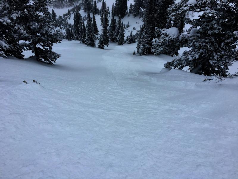
Did ski a few steeper pitches today, and ski cuts still quite effective at mitigating hazard. This sluff ran approximately 75 meters (250')' from a ski cut on a fresh wind drift.