Am submitting a composite observation from what I have been seeing while touring in upper LCC and BCC the past few days. Overall the snowpack in upper Cottonwoods is looking as strong as I have seen all season. Deep snowpack (> 1meter) and basal facets are continuing to strengthen with mostly 4F hardness. Triggering a deep slab avalanche seems increasingly unlikely - really would have to be poor luck and sweet spot would be in a thinner snowpack area.
Evelyn nailed the forecast the past 2 days identifying wind as the primary possible avalanche concern, and there are obviously pockets out there (i.e. Meadow Chutes on Thursday). On Friday's forecast Evelyn mentioned any uptick in winds would bump the avalanche hazard. Apart from a few small drifts and cornices, I have not seen any wind loading in upper elevations of the Cottonwoods the past 2 days, and Friday afternoon was windless.
The light density snow that fell overnight sluffed very easily on steeper slopes and sluffs were running a fair distance. Also still seeing poor bonding with the old snow surface now buried 20-30 cms (8-12") down.
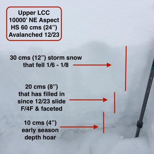
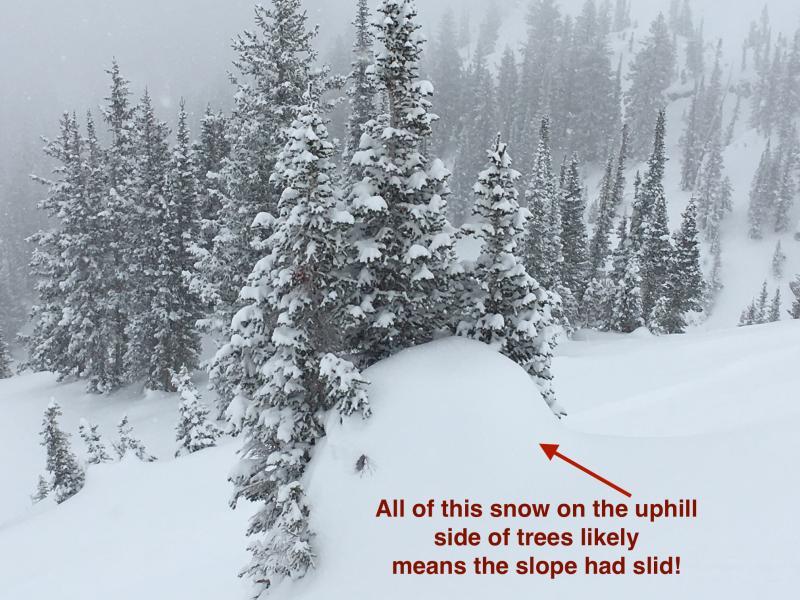
What I have been focusing on the past few days are the slopes that slid earlier in December, many of which slid on Wednesday 12/23. As others have been noting, these paths have slowly been filling in the past few weeks with additional snowfall and some wind loading. Overall I am finding the depths slopes to now be 45-60 cms (18-24") with the base of the thin snowpack consisting of weak, faceted snow. These slopes look much more like an early November snowpack - thin and faceted.
Water totals in the Cottonwoods from the past few days are now about 1", and this may be enough to trigger soft slabs that fail on this weak layer. Additionally, any wind loading may also be enough to overload this weak layer. I don't believe these slides would be large and not very well connected, but the snowpack is thin and rocky.
From what I have observed the past few days, generally a Moderate hazard with the primary concern being storm snow avalanches on slopes that have previously avalanched. I also don't think this is a widespread issue. Most terrain is stable with sluffing likely on steeper slopes.
Photos of thin snowpack area that is being described, as well as other visible clues a slope had previously avalanched.


Ski and travel conditions are brilliant.


