31st Annual Backcountry Benefit - September 12th - Tickets Available Here!

Observation: Burch Creek

Observation Date
1/16/2015
Observer Name
Bill Brandt, Lee Fortin, BC
Region
Ogden » Snowbasin Backcountry » Burch Creek
Location Name or Route
Birch Creek
Weather
Sky
Overcast
Wind Direction
Southwest
Wind Speed
Moderate
Weather Comments
Light snow at the end of the day. Strong ridge line wind gusts transporting snow and scouring slopes to the crust. It was rather calm just a bit downslope.
Snow Characteristics
Snow Surface Conditions
Dense Loose
Wind Crust
Melt-Freeze Crust
Rain-Rime Crust
Snow Characteristics Comments
Variable snow surfaces. Powder was dense on the surface and a bit inverted with low density snow on top of the crust. Ski crampons would have been useful on the steep wind scoured slopes on the way back into the resort.
Red Flags
Red Flags
Wind Loading
Cracking
Red Flags Comments
The wind was moving snow all day and cross loading many sub ridges near the main ridgeline.
Avalanche Problem #1
Problem
Persistent Weak Layer
Trend
Increasing Danger
Problem #1 Comments
We easily released a wind slab just stepping on the edge of it. NWN slope of 36-38 degrees. It pulled out 20-25 yards across and ran about 50-60 yards down slope with moderate energy until it piled into some trees and the slope angle lessened where it stopped. This event changed our planned route. The snow pack is solid below the crust
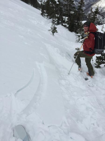
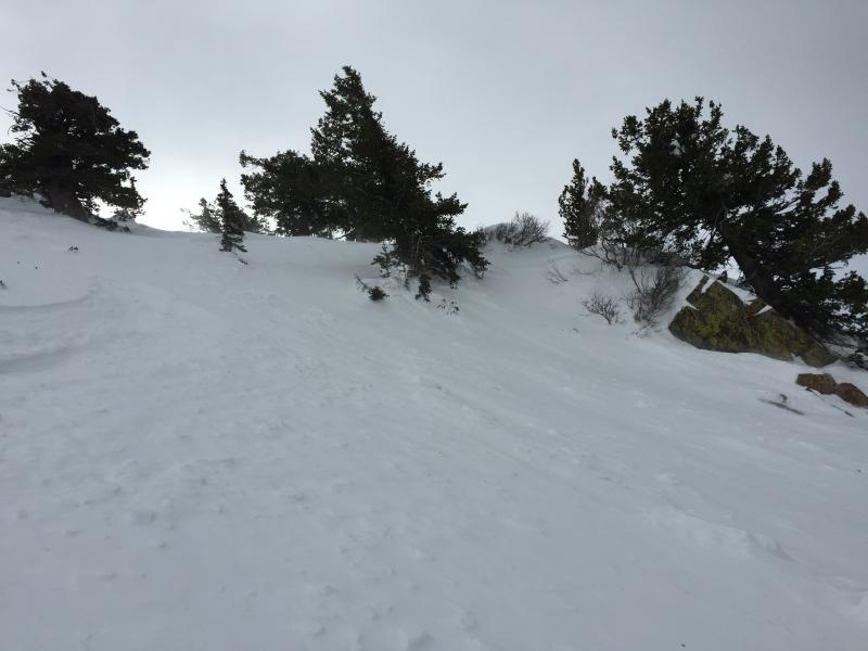
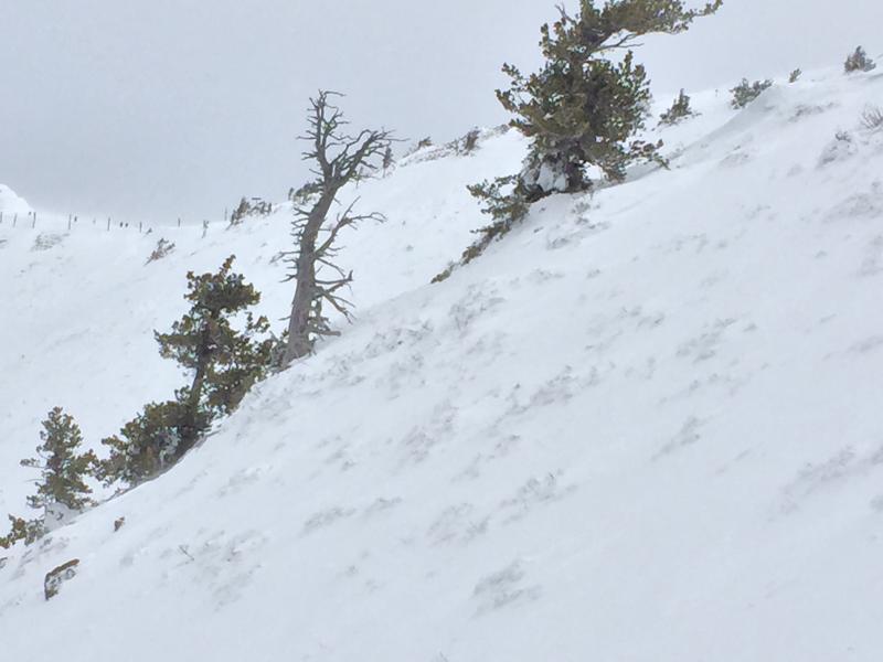
First photo shows the slab stacked up against the trees. The second photo shows where the slab released from the tree on the left to the rock on the right. There is a crown up along the skyline. Hard to see. Third photo shows how wind scoured the snow is in places. Danger mostly moderate to low you just have to avoid these wind slabs which maybe harder to see with new snow on top. Our observation was different than Bruce's from Cutler Ridge with slabs that were very sensitive to ski cuts. Also noted control work the SB patrol was doing in the sister chutes was productive with slides running 1/4- 1/2 slope in several areas.
Today's Observed Danger Rating
Moderate
Tomorrows Estimated Danger Rating
Considerable