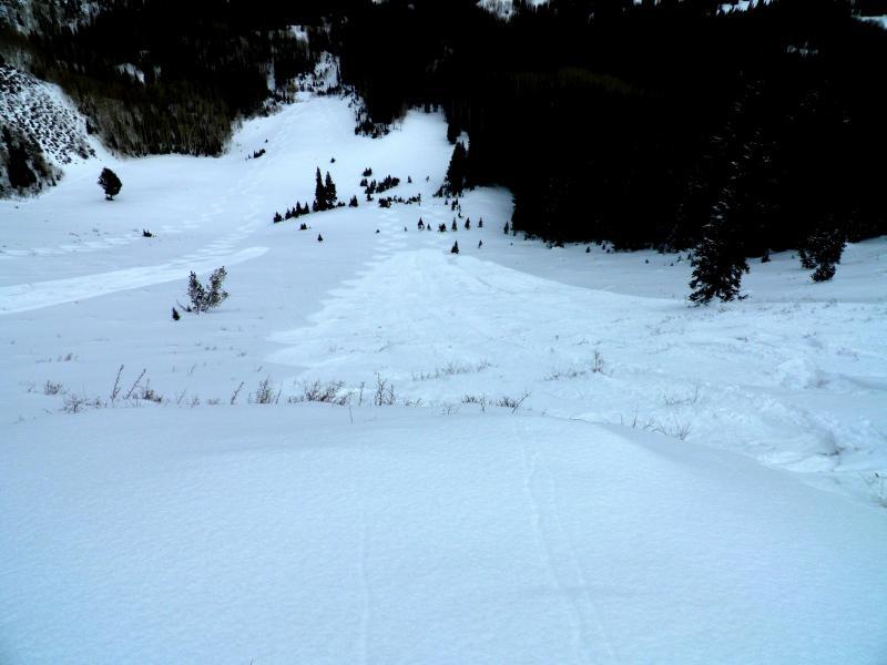
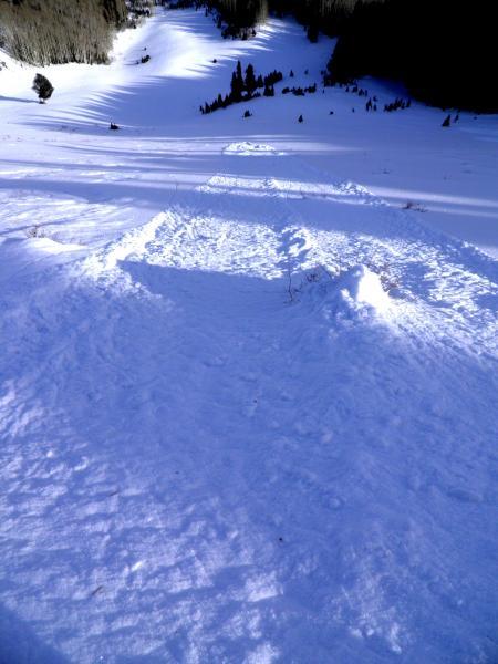
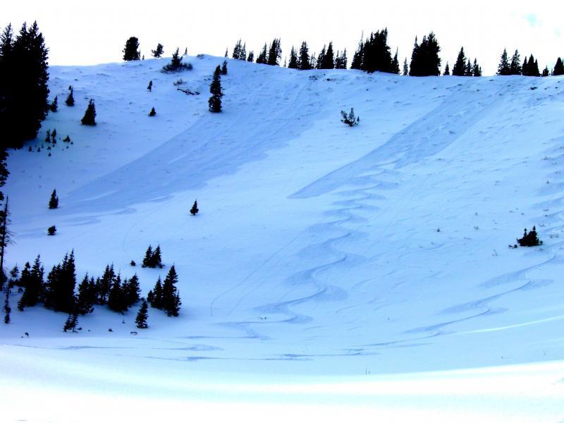
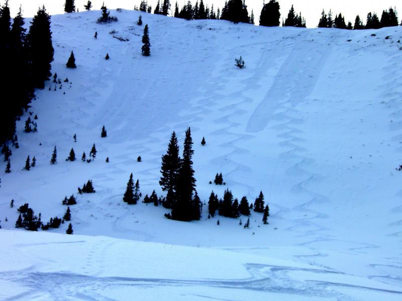
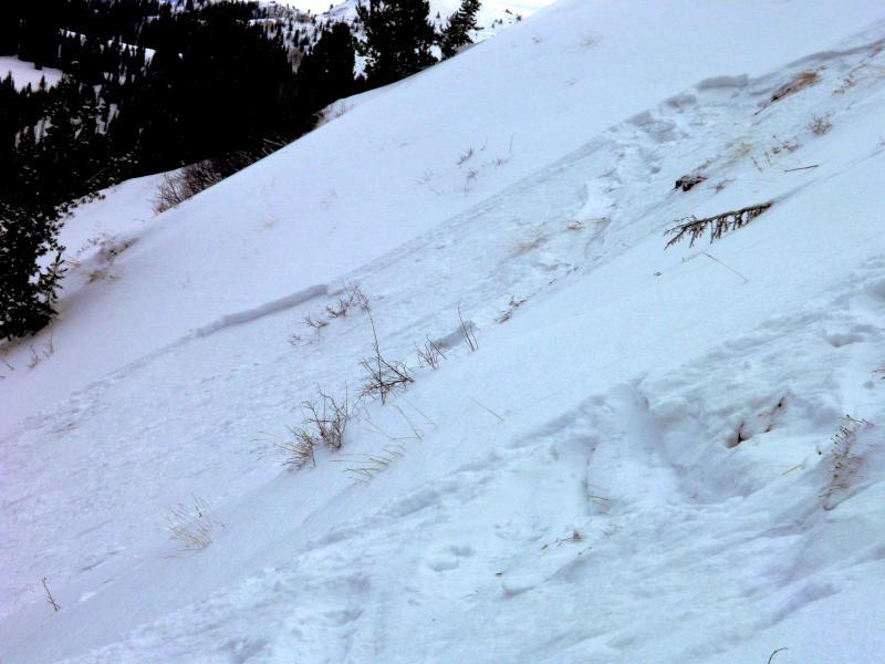
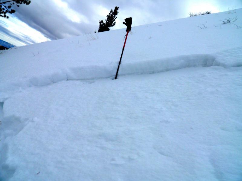
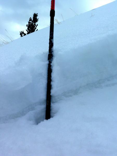
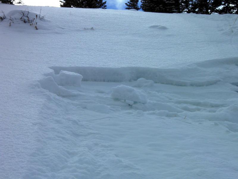
Wanted to get out and see how loose the surface was before this weekends storm. Surface conditions were a quite a bit looser than was noted on Wednesday. Long running sluffs in steeper terrain entraining quite a bit of snow. and running well out on to flatter terrain. Also of note was a decaying wind slab that cracked out and propagated in the top of No Name Bowl. Took out the new snow and the wind slab that was resting on the layer of facets from our dry spell before last weekends storm. When you look at the crown its pretty obvious where things are going to be active on the PC Ridgeline. South, West Monitor, and No Name all have the same set up, new snow resting on a heat crust or a decaying wind slab, Not a trustworthy bridge with any kind of snow load. The wind slab crust layer might make for more connected avalanches if we get the load, they may hold some weight but when they go they might tend to go larger than if the snow was just sliding on near surface facets. Photos, lots of new snow sluffing, the first shot is where the windslab cracked out on buried facets. Other photos are of the little crown that resulted from the wind slab failing on facets, in the close up it is easy to see the weak facet layer under the wind slab, large grain facets
Low now with increasing hazard with wind and new snow.


