Observation Date
3/28/2014
Observer Name
Ted Scroggin
Region
Uintas » Bear River Ranger District » Whitney Basin
Location Name or Route
Whitney Basin-Double Hill
Weather
Sky
Broken
Precipitation
Light Snowfall
Wind Direction
Southwest
Wind Speed
Moderate
Weather Comments
A brief return to winter this morning with cooler temperatures and some cold new snow. Mostly cloudy for the first half of the day with some light snow and moderate southwest winds on the ridge tops. The afternoon was partly cloudy with sunshine and diminshing winds.
Snow Characteristics
New Snow Depth
10"
New Snow Density
Low
Snow Surface Conditions
Powder
Wind Crust
Damp
Snow Characteristics Comments
Just a few new inches of snow at the trailhead with a nice 8-10" of snow from the last two days in the Whitney Basin. Pretty light density snow this morning and the snow conditions stayed fairly good for most of the day before the strong sun started to impact the snow quality in the mid and lower elevations. Along the ridgelines there was just enough wind to keep the snow a little cooler and keep the snow conditions decent.
Red Flags
Red Flags
Wind Loading
Cracking
Red Flags Comments
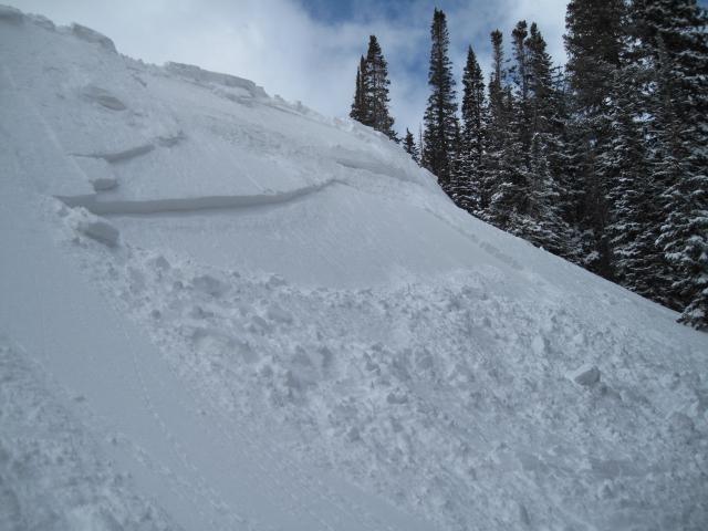
Steady winds and new light density snow was being blown around quite easily, forming sensitive soft wind slabs this morning. These seemed to have calmed down as the day went on with warmer temps and lighter winds.
Avalanche Problem #1
Problem
Persistent Weak Layer
Trend
Decreasing Danger
Problem #1 Comments
Today's soft wind slabs were a little touchy early this morning while the winds were still gusty. As the afternoon went on and winds calmed down and the skies cleared these wind slabs seemed to be less of an issue. I would think in the higher windy terrain there are still some lingering wind slabs that would be reactive to the weight of a rider.
Avalanche Problem #2
Problem
Persistent Weak Layer
Trend
Same
Problem #2 Comments
Struggling with still thinking the deep slab problem is out there, but given the large amount of terrain and plenty of areas where the snow pack remains thin, rocky and weak, I think this avalanche problem is still possible.
Comments
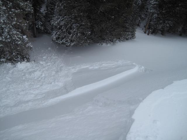
Sensitve soft wind slabs were found along the exposed ridgelines. These were up to 12-16" deep and breaking on the old slick snow surface on east and northeast facing slopes. It looked like the slabs were sitting on top of some lighter density snow that fell early in the storm. Some of these wind slabs might still be touchy in the higher windy terrain.
Today's Observed Danger Rating
Moderate
Tomorrows Estimated Danger Rating
Moderate