Observation: Reids Peak

Observation Date
3/31/2025
Observer Name
Manship/Nassetta
Region
Uintas » Reids Peak
Location Name or Route
Mirror Lake Highway
Weather
Sky
Overcast
Precipitation
Light Snowfall
Wind Direction
South
Wind Speed
Moderate
Weather Comments
A moody day on the Mirror Lake Highway. Trailheads were above freezing with a light breeze. At mid upper elevations it was breezy, but the alpine peaks took the cake for notable weather with sustained strong winds moving snow and forming fresh wind drifts. Around 1200 weather started to move in up high accompanied by light snowfall and winds penetrating into the mid elevations.
Snow Characteristics
New Snow Depth
5"
New Snow Density
Medium
Snow Surface Conditions
Powder
Wind Crust
Melt-Freeze Crust
Snow Characteristics Comments
There was an even coat of 4-6" of medium density snow from the last little storm. Underneath the new snow was a stiff melt freeze crusts on all aspects we traveled on. Travel is good and supportable, riding is utilitarian.
Red Flags
Red Flags
Wind Loading
Red Flags Comments
As I mentioned strong winds were moving snow up high and in exposed areas at mid elevations.
Avalanche Problem #1
Problem
Wind Drifted Snow
Trend
Increasing Danger
Problem #1 Comments
With snow available for transport and winds to move it, this was our number one concern. We noted evidence of some small crowns in steep terrain that look to have released naturally during this wind event. Throw new snow in the mix, and the danger for this problem will continue to rise.
Avalanche Problem #2
Problem
Persistent Weak Layer
Trend
Same
Problem #2 Comments
Although the PWL problem is trending towards dormancy, we are still keeping it on our radar with an increased load from wind loading and new snow. Steep, thin, rocky, norttherly terrain at upper elevations is where this problem may still lie.
Comments
In our travels we noted low elevation trailhead melting out, but still an acceptably deep snowpack as we gained elevation.
In sheltered terrain there is an even coating of snow from the last storm, but it is firm underneath. The snow seems like it has bonded well to this firm crust, but with a substantial load it may act as a slick, connected bed surface for avalanches failing within the new snow.
The wind is doing its worst, blowing from the S and SW, with new snow moving in, I would expect touchy avalanche conditions in areas with wind drifted snow.
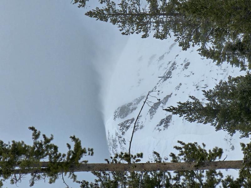
Winds cranking off of Mt. Watson.
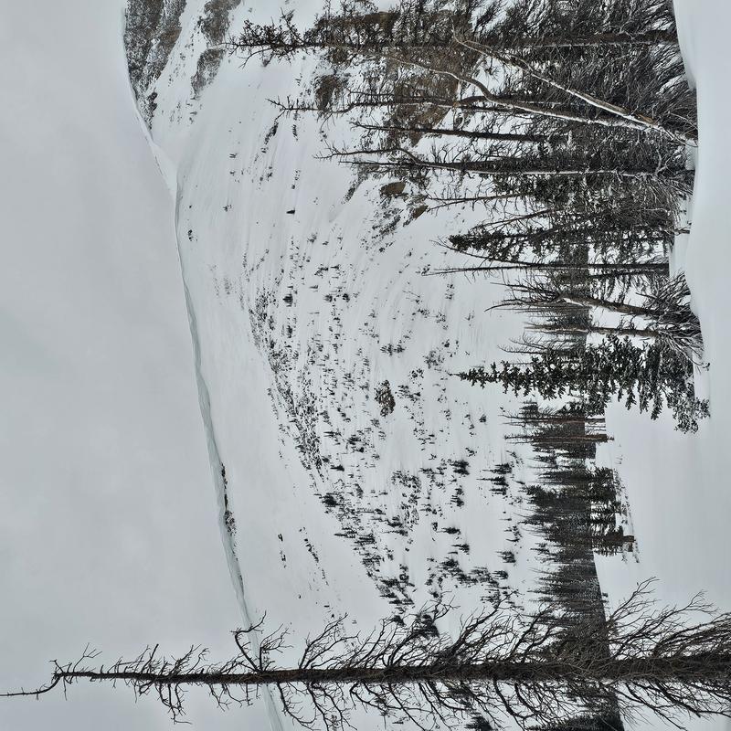
Wind scouring on Bald Moutain.
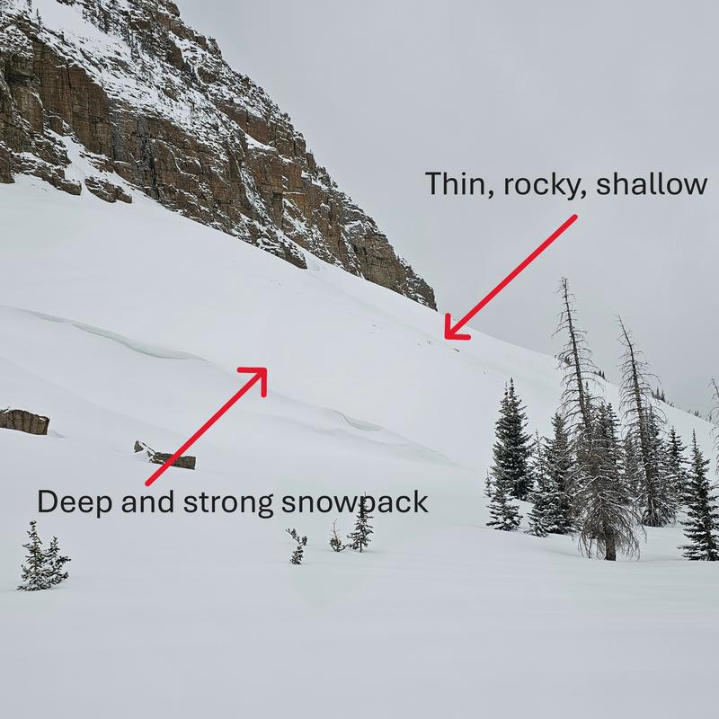
The photo above shows how in the alpine, a relatively planer slope can have thin weak points, right next to deep, strong areas. These are the areas that you might find the trigger point of a PWL avalanche.
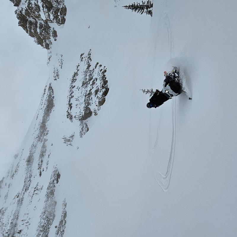
Andy making the best of our shallow cream.
Video
The montain pass roads and trailheads are getting thin, but a little patience and a few pulls to cool the machines down are all ya need!
Today's Observed Danger Rating
Moderate
Tomorrows Estimated Danger Rating
None
Coordinates